An impactful winter storm remains on track to hit the Miami Valley this weekend.
>>RELATED: Road crews treating roads ahead of this weekend’s potential winter weather
A bulk of this storm system will miss our area. However, accumulating snow will fall throughout the region Saturday.
Storm Center 7 Chief Meteorologist Austin Chaney has been tracking this system all week and will have the latest on News Center 7 at 5 p.m., 5:30 p.m., and 6:00 p.m.
Here’s a breakdown of what you can expect.
>> TRACK THE LATEST CONDITIONS: Live Doppler 7 Radar
>>PREVIOUS COVERAGE: Road crews treating roads ahead of this weekend’s potential winter weather
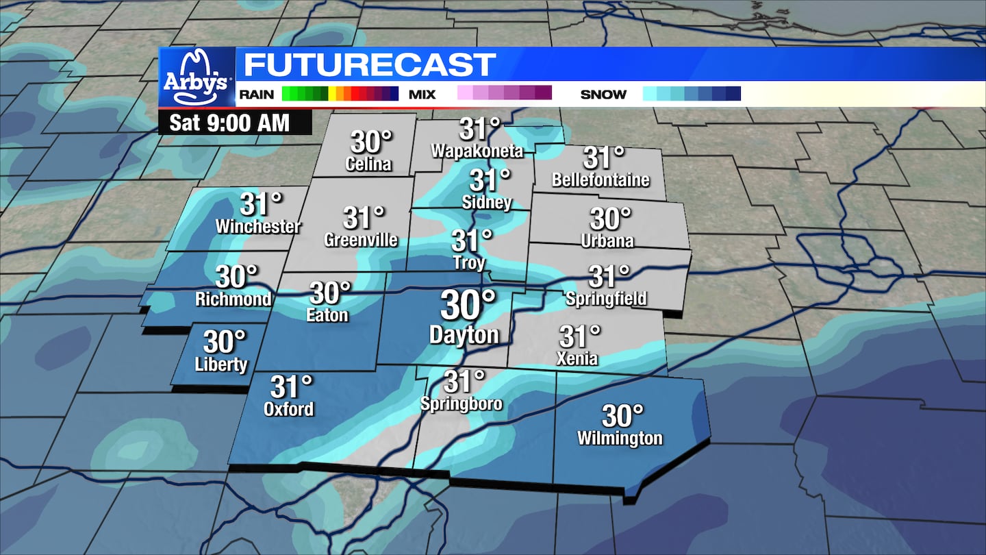
Timing:
The forecast remains on track for some light snow this weekend, Storm Center 7 Chief Meteorologist Austin Chaney reported on News Center 7 at 5:00.
Snow showers may begin around 3 a.m., and last through midday Saturday.
Precipitation will taper off Saturday afternoon, but some passing rain/snow mixed showers remain possible into Sunday.
Road issues are most likely early Saturday morning before the sun comes up. Snow may stick to untreated roads.
After the sun rises, temperatures will begin to come above freezing and any road issues should subside.

Another storm system will move through the region on Tuesday. You should expect rain and wind.
Precipitation on Tuesday may start as snow before completely turning into rain.
Snow showers are possible on Wednesday.
Location:
Counties in the southern portions of the Miami Valley will see better chances for some accumulation, Storm Center 7 Chief Meteorologist Austin Chaney reported on News Center 7 at 5:00.
Southern stretches of the Miami Valley can expect 1.5 inches or less, while Northern stretches may only see a few tenths of an inch.
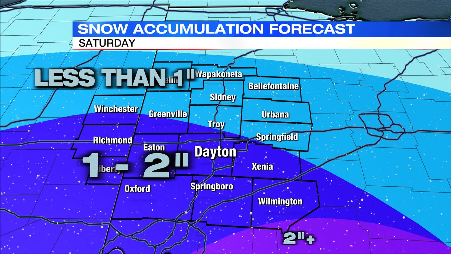
Those south of Dayton may see about 2 inches of snow.
We will continue to follow this story.
©2024 Cox Media Group


