QUICK-LOOK FORECAST:
- Dry for much of Monday
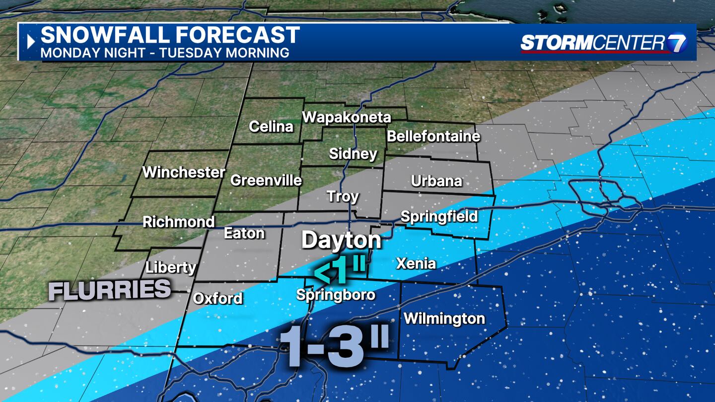
- Big snow misses us to the southeast Monday night
- Some snow locally still possible
>> TRACK THE LATEST CONDITIONS: Live Doppler 7 Radar
DETAILED FORECAST:
SUNDAY: Mostly clear skies early give way to some high clouds as we go through the night. Cold. Lows on either side of 30 degrees.
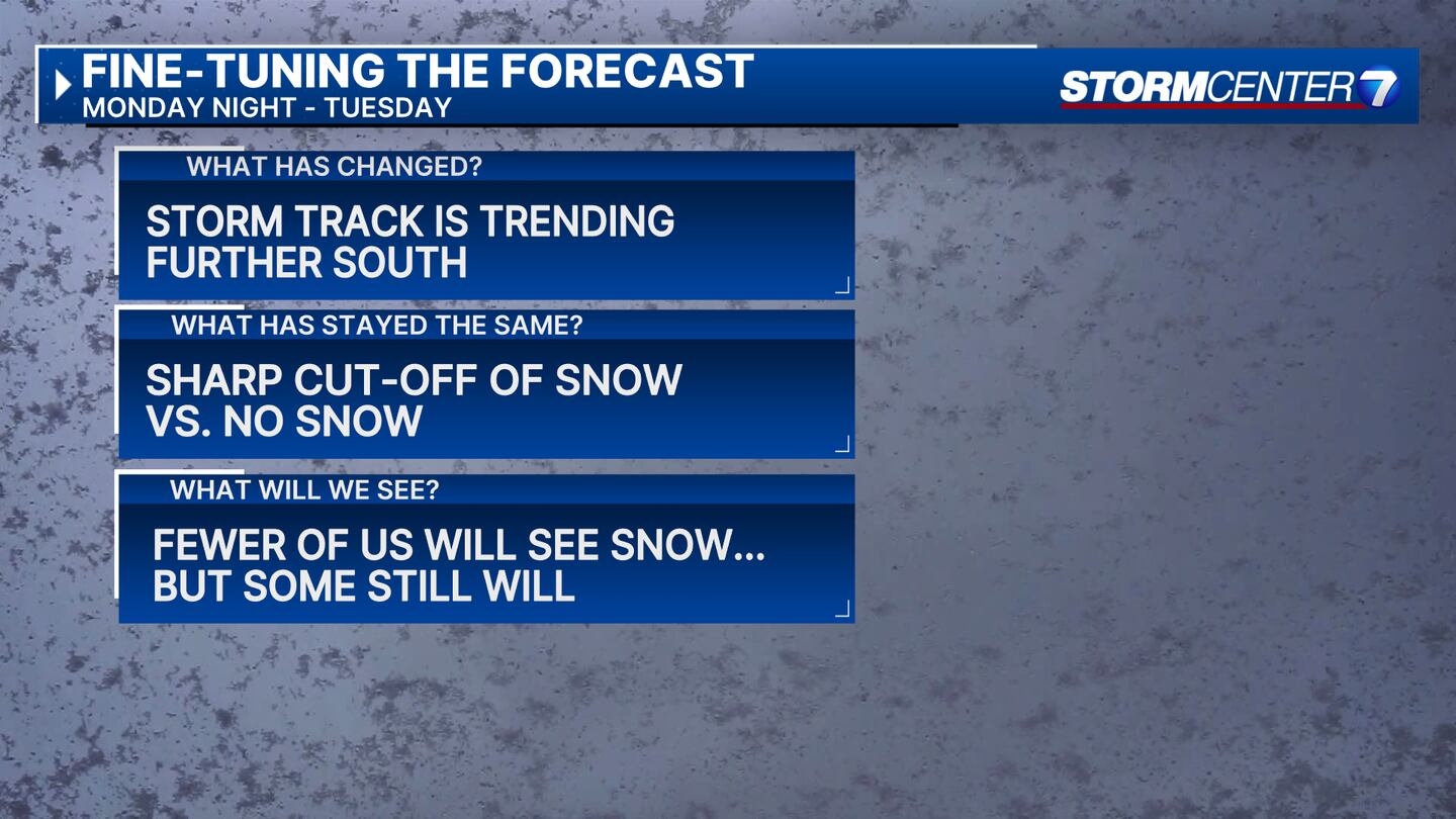
MONDAY: Clouds are increasing with a chance for rain showers mainly southeast of Dayton arriving around sunset. Highs in the mid to upper 40s. Overnight, a storm system tracks to our southeast. Southeastern portions of the Miami Valley may get clipped with snow, but it looks less likely that folks north of an Oxford, to Dayton, to Springfield line see much of anything. South of that line, some accumulation is possible mainly on grassy surfaces. Lows in the upper 20s to lower 30s.
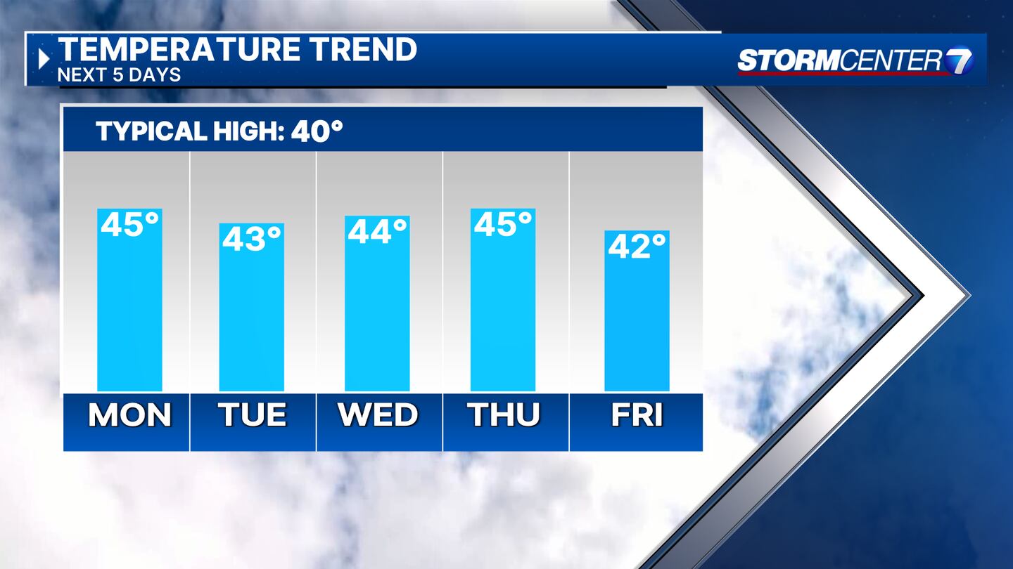

TUESDAY: Partly cloudy on Tuesday. Some lake-effect snow flurries are possible. No accumulation is expected. Highs in the upper 30s to near 40.
WEDNESDAY: Partly cloudy. Seasonable with a high in the low to middle 40s. Clouds are increasing Wednesday night, most likely to stay dry.
THURSDAY: Chance of a rain shower. Partly to mostly cloudy with highs in the upper 40s.
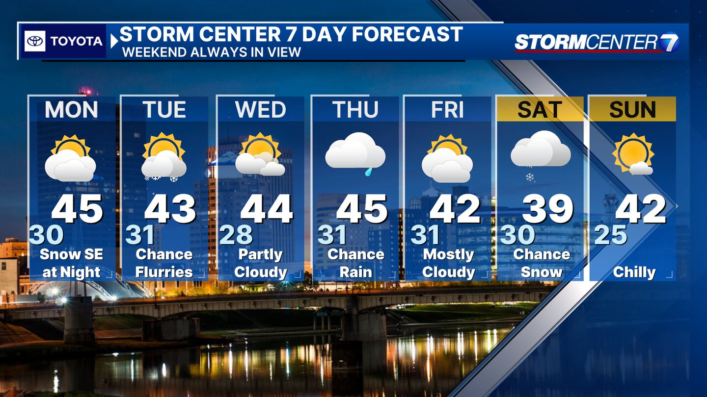
FRIDAY: Cooler and mostly cloudy with highs in the lower 40s.
SATURDAY: Chance for snow showers with highs in the upper 30s.
SUNDAY: Mostly sunny and chilly with highs in the upper 30s.
©2024 Cox Media Group


