QUICK-LOOK FORECAST:
- Light accumulating snow tonight
- Quite cold for Saturday
- Warmer with chances for rain and storms next week
>> TRACK THE LATEST CONDITIONS: Live Doppler 7 Radar
DETAILED FORECAST:
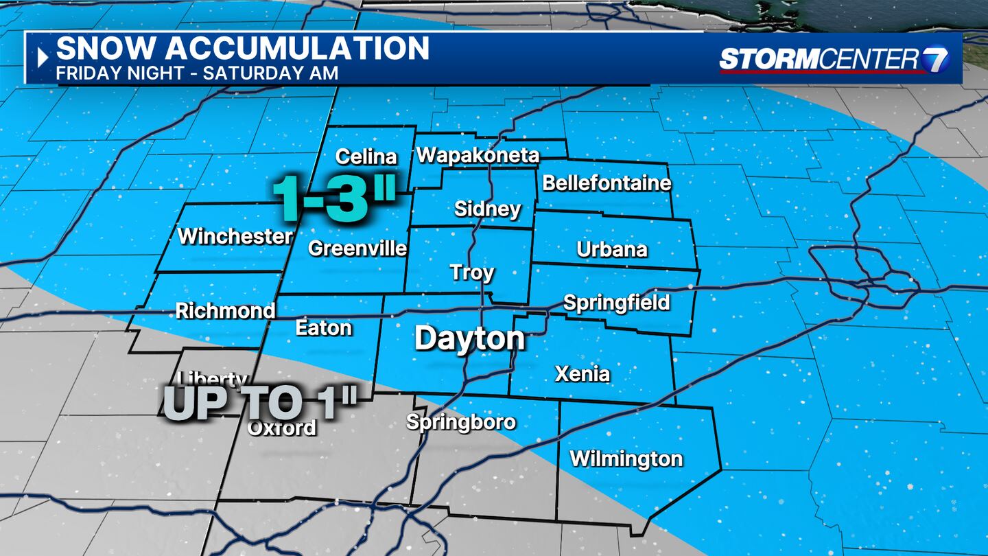
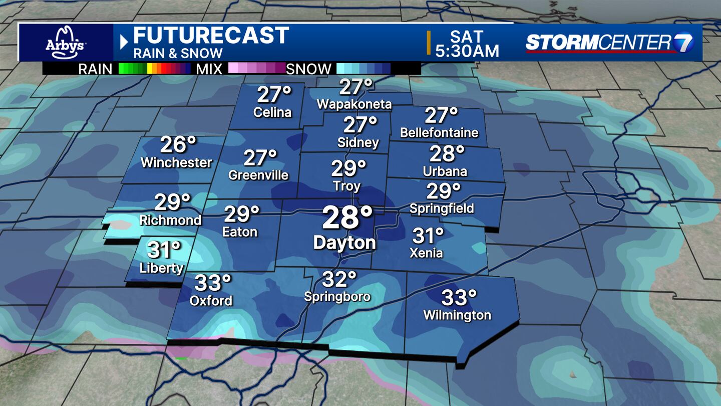
FRIDAY: Clouds increase this evening followed by snow late tonight into Saturday morning. Light accumulations of 1-3 inches are possible with most of this on the grassy surfaces. It will get cold—lows in the low to mid-20s tonight. Wind chills will drop into the teens tomorrow morning.
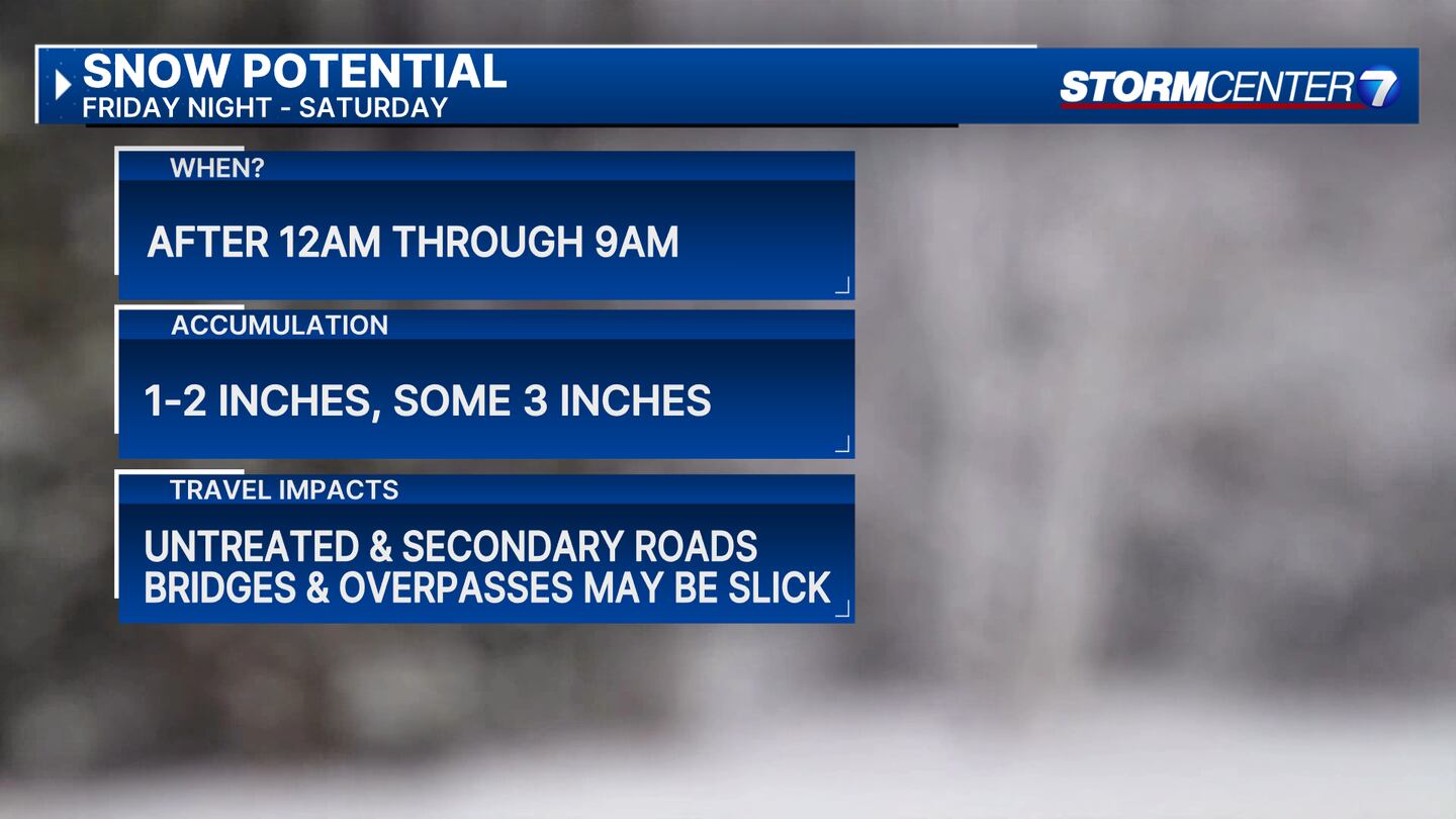
SATURDAY: Snow showers end Saturday morning. A gradual clearing into the afternoon. Staying cold with highs only around freezing. Windy, especially early in the day which will make for some cold wind chills
SUNDAY: Sunshine and rather mild again with highs quickly rebounding to the mid-50s.
MONDAY: Even milder with a mix of clouds and sunshine. Highs in the low 60s.
TUESDAY: Cloudy with a chance for showers and thunderstorms. Very warm for this time of year with highs in the mid-60s.
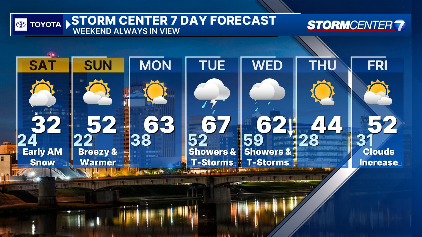
WEDNESDAY: Cloudy with a chance for showers and storms. Breezy. Mild again with highs in the low 60s early in the day. Quickly falling temperatures Wednesday afternoon.
THURSDAY: Gradual clearing behind the Wednesday cold front. Cooler with highs in the mid-40s.
FRIDAY: Increasing clouds with rain possible Friday night. High temperatures in the low 50s.
©2024 Cox Media Group


