QUICK-LOOK FORECAST:
- Patchy fog possible overnight
- Coolest temperatures thus far since June
- Overall dry pattern resumes
>> TRACK THE LATEST CONDITIONS: Live Doppler 7 Radar
DETAILED FORECAST:
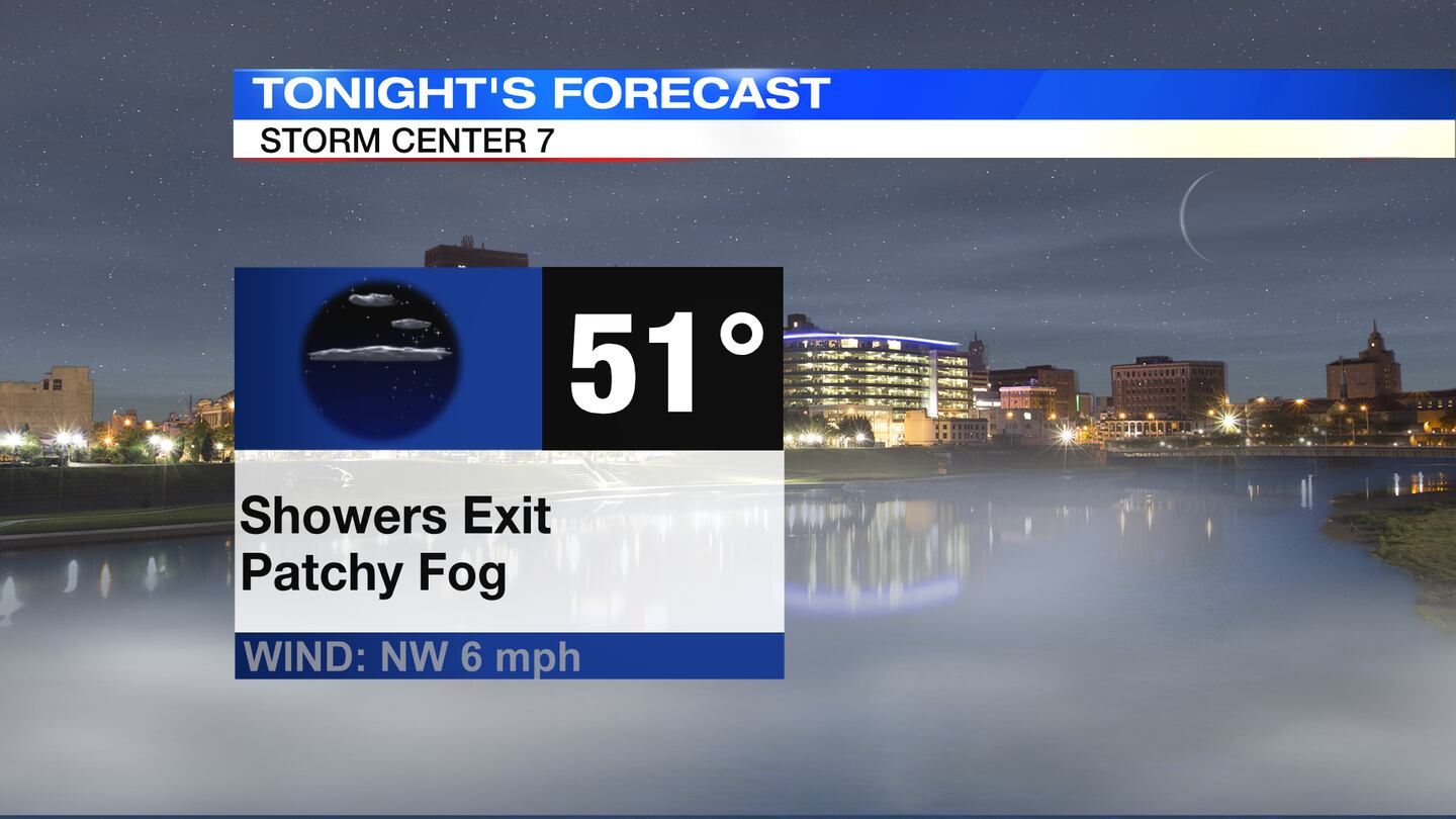
TUESDAY: Isolated showers exit and skies begin to clear, according to Storm Center 7 Chief Meteorologist Austin Chaney. Areas that clear out may see some patchy fog overnight. Cool with lows falling into the lower 50s by Wednesday morning.
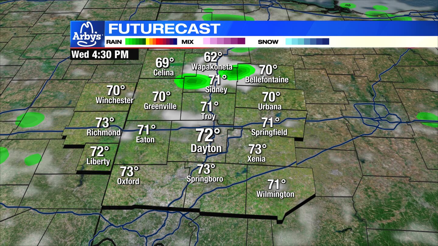
WEDNESDAY: Patchy morning fog, then a mix of sun and clouds for the afternoon. A stray shower can’t be ruled out, but most areas stay dry. Highs around 70 degrees.
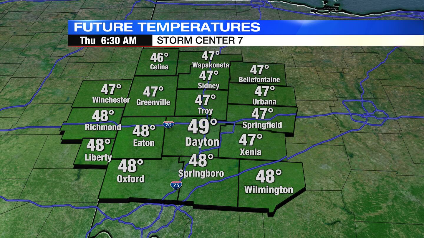
THURSDAY: A crisp start with lows in the upper 40s. These 40s will be the first in Dayton since the end of May. Partly cloudy skies. Another afternoon with highs in the upper 60s to lower 70s.
FRIDAY: Another chilly morning with morning lows in the upper 40s. Nice during the afternoon with mostly sunny skies and highs in the mid to lower 70s.
SATURDAY: Mainly clear and comfortable with high temperatures in the mid to upper 70s, nearing 80 degrees.
SUNDAY: Partly to mostly cloudy with a few showers possible. Highs in the low to mid-70s.
MONDAY: Clearing out with sunshine returning. Highs in the low to mid 70s.
TUESDAY: Partly cloudy and a little warmer with highs in the upper 70s.
©2023 Cox Media Group


