
DAYTON — Who’s ready for fall to come back and for all the snow to melt?! It should almost all be gone by Wednesday afternoon and we will forget it snowed by Saturday with temperatures almost 10 degrees above average! Hey its Stormcenter 7 Meteorologist Ryan Marando.
High pressure is going to work back into the Miami Valley and as that system moves east, that means we get the southerly return flow winds. It will push temperatures to be in the 50s and 60s by the weekend!

[DOWNLOAD: Free Storm Center 7 Weather app for alerts as news breaks]
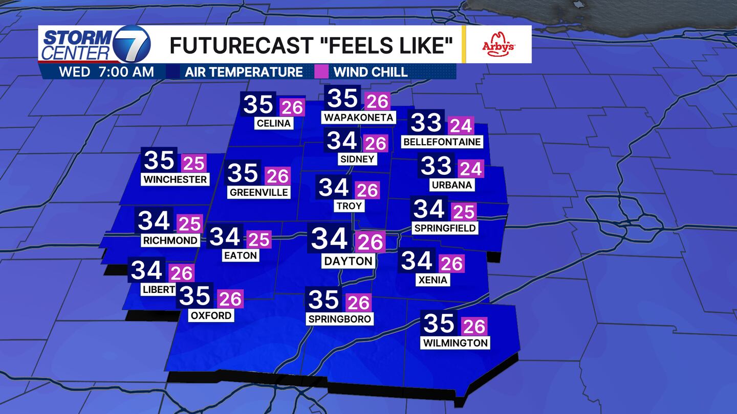
Now we will still have chilly, seasonable mornings in the mid 30s. Winds overnight Tuesday into Wednesday will keep temperatures “warmer.” That wind helps mix up the atmosphere. So instead of air temperatures in the low 20s like Tuesday morning, they will be right near freezing Wednesday morning. Wind chills will be in the 20s though.
[WATCH Storm Center 7 Weather on the following devices]
The next big burst of cool air looks to arrive with our next system. Since temperatures will be so warm ahead of it, the system will only bring rain likely overnight Saturday into Sunday. Temperatures look to mostly fall during the day on Sunday behind that system.


