WIND CHILL ADVISORY: All counties until 10 a.m. Wednesday for wind chills down to -15.
QUICK-LOOK FORECAST:
- Bitterly cold again tonight
- Accumulating snow likely Thursday into Friday
- Warmup arrives starting Monday
>> TRACK THE LATEST CONDITIONS: Live Doppler 7 Radar
DETAILED FORECAST:
OVERNIGHT: Mostly clear skies overnight, according to Storm Center 7 Chief Meteorologist Austin Chaney. Very cold air in place yet again. Lows in the lower single digits with wind chills as low as -15. Dress in layers and limit time outside.
WEDNESDAY: Yet another morning of single-digit low temperatures. Mostly sunny skies will help us get back to the mid-20s for the afternoon. Some clouds filter in late in the day.
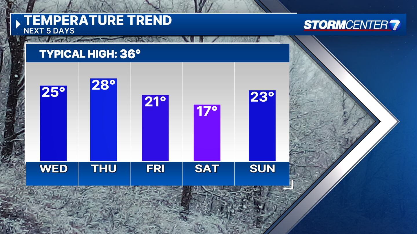
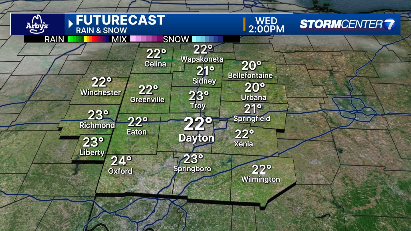
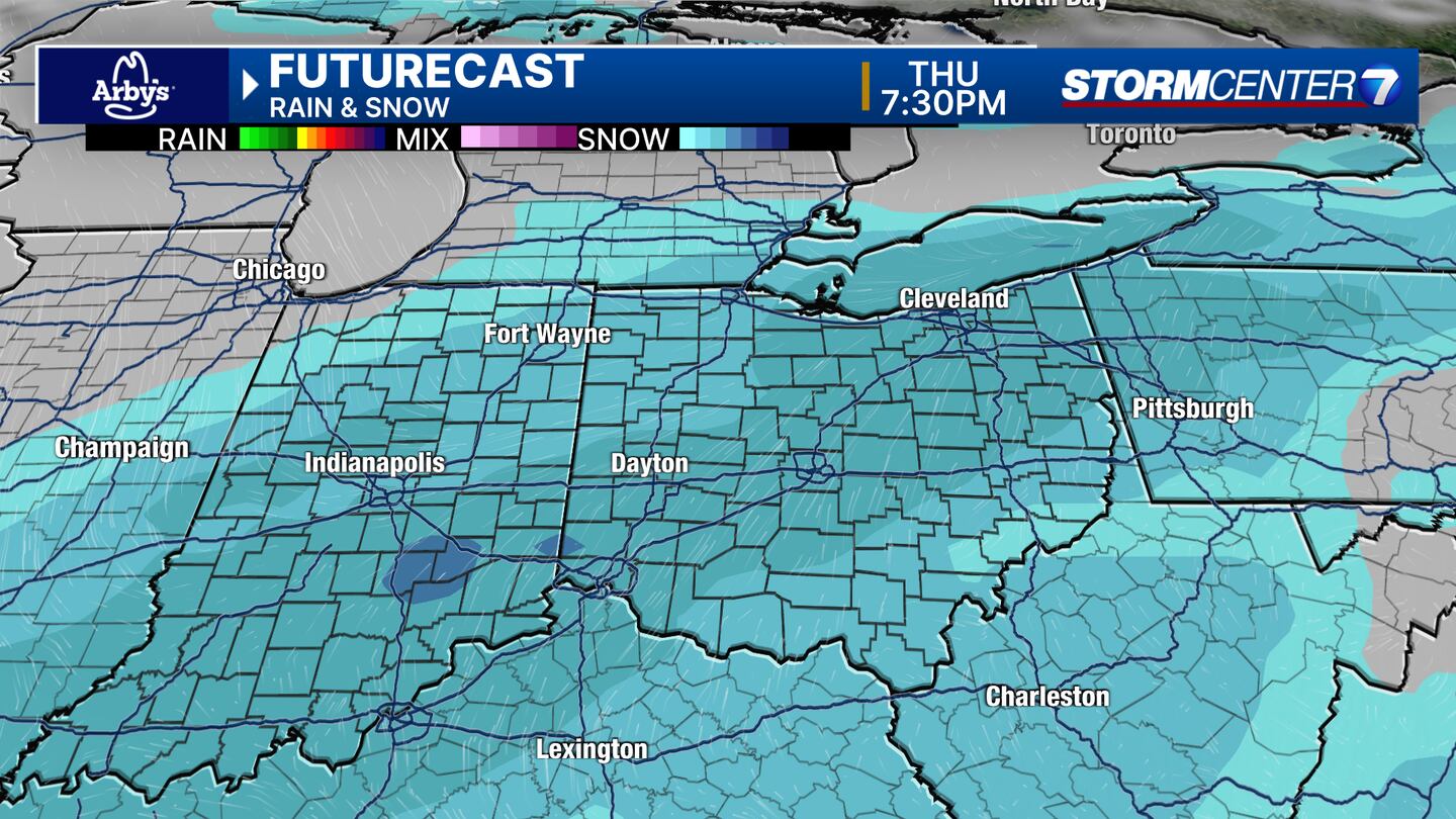
THURSDAY: Clouds increase with a chance for snow arriving during the afternoon. Highs in the upper 20s. Snow becomes more widespread overnight with accumulating likely by then.
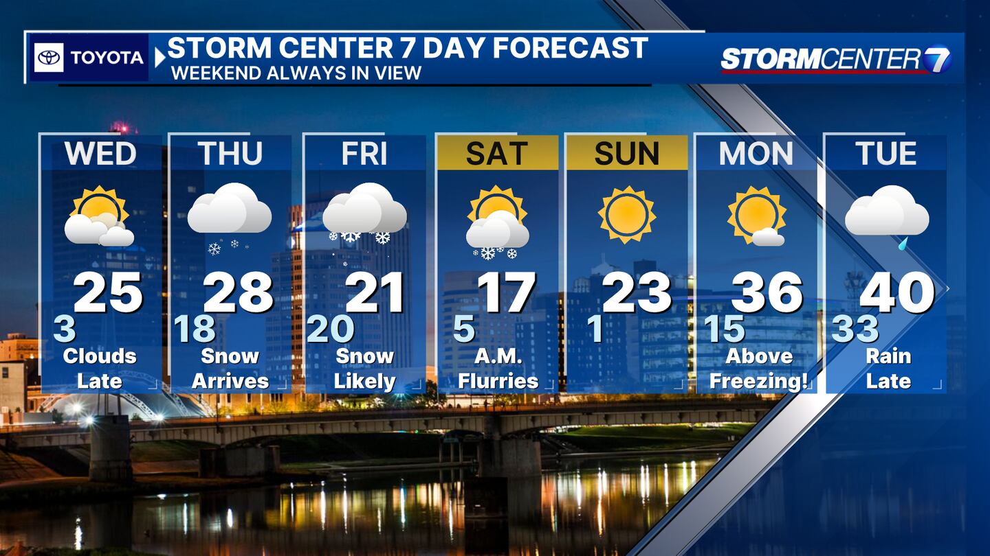
FRIDAY: Cold with snow showers likely. Highs in the lower 20s. Snow would not have any problem accumulating with cold temperatures and cold ground temperatures Thursday and Friday. Early snowfall estimates look to be in the 2-4 inch range through Friday.
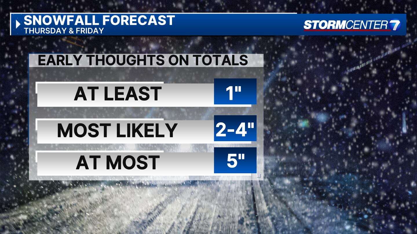
SATURDAY: Cold with snow showers likely. Highs in the lower 20s. Snow would not have any problem accumulating with cold temperatures and cold ground temperatures Thursday and Friday. Early snowfall estimates look to be in the 2-4 inch range through Friday.
SUNDAY: Mostly sunny. Frigid morning and cold afternoon. Daytime highs climb to the mid 20s.
MONDAY: Cloudy with rain arriving late in the day. Milder with highs near 40 degrees.
©2024 Cox Media Group


