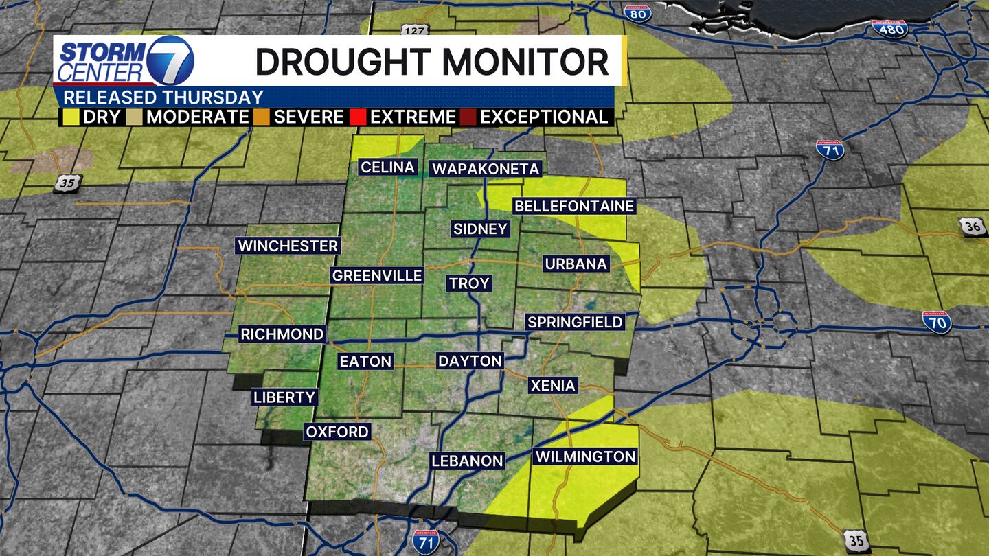
DAYTON — Good Thursday morning, Miami Valley! If you watched us this morning, you know that some showers will pass through today. While this will not be heavy, we certainly could use some rainfall. Our cooler and drier than normal pattern is starting to show in the latest drought monitor released at 8:30 AM this morning.
Much of the Miami Valley is more than inch below normal on rainfall for the month. At the Dayton International Airport, the observations show the deficit is at -1.22″ for the month of August. However, if we look at the summer season, we still have a surplus of 1.07″ at the airport.
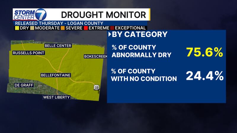
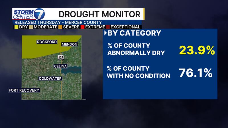
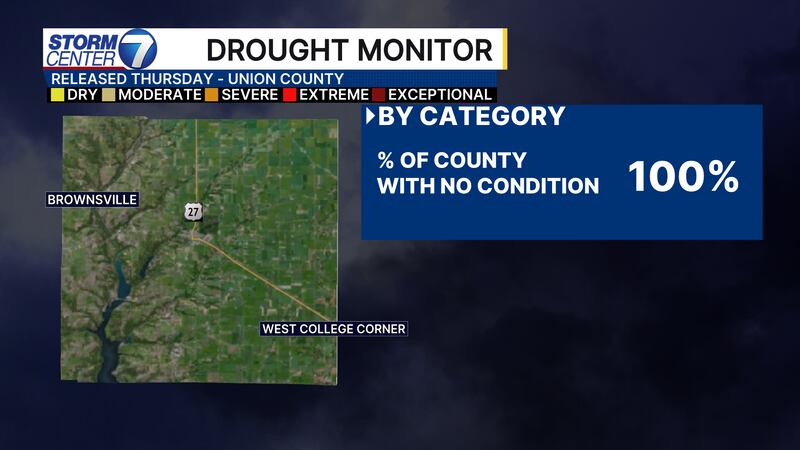
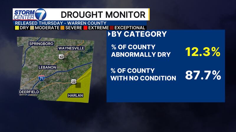
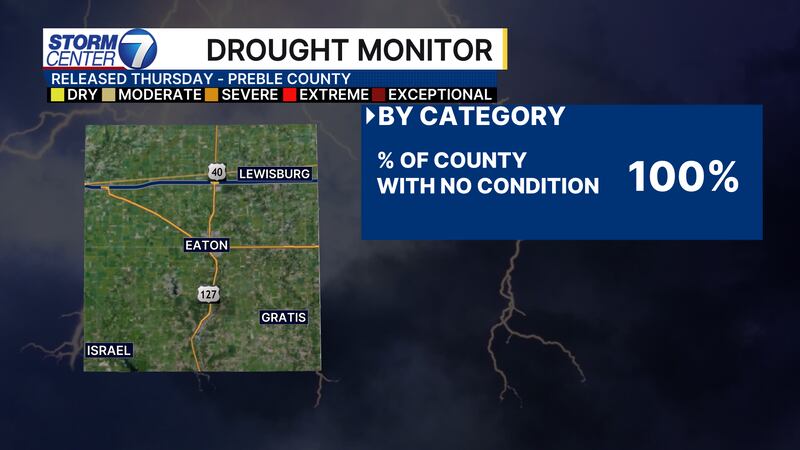
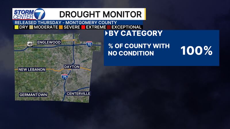
County-By-County Breakdown:
0 of 20


[DOWNLOAD: Free Storm Center 7 Weather app for alerts as news breaks]
The last substantial rainfall for most of the area took place back on August 12th into August 13th. Since then, we have seen very few showers and the overall pattern suggests we are going to keep similar conditions around into the start of September. There are a few small rain chances just after Labor Day that may bring us some rain to catch up a bit on the deficit.

[WATCH Storm Center 7 Weather on the following devices]
As of right now, the biggest impacts you will find are lawns turning brown or dormant, rivers and creeks running a little lower than you may typically be used to, and a few spotty areas where trees may change color. The wetter start to summer has helped us avoid intense drought for now, but let’s hope beneficial rains come soon! The longer we stay too dry I do get concerned for fall foliage to not be as vibrant.


