QUICK-LOOK FORECAST:
- Showers to pass through this evening
- Cooler weather coming this weekend
- Next chance for rain arrives Saturday
>> TRACK THE LATEST CONDITIONS: Live Doppler 7 Radar
DETAILED FORECAST:
TONIGHT: Cloudy this evening with the next round of rain arriving. Showers will be possible from around 5 p.m. until midnight, according to Storm Center Chief Meteorologist Austin Chaney. Any lingering fog should clear as rain moves through.
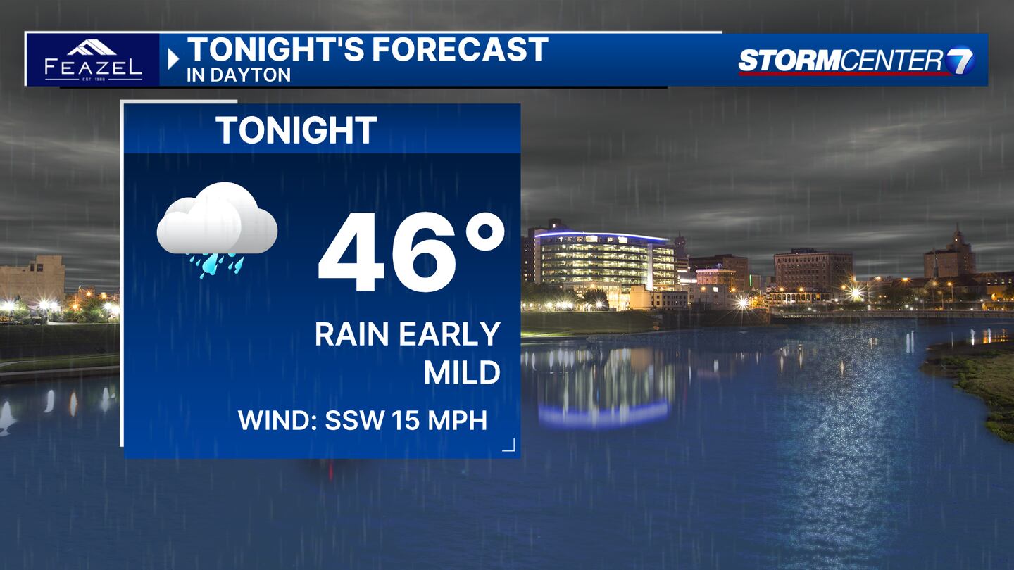
Temperatures drop to the mid 40s by daybreak on Friday.

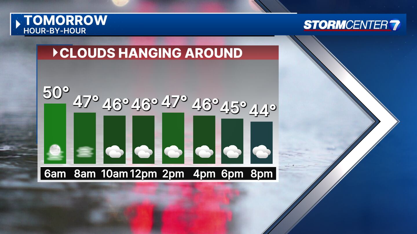
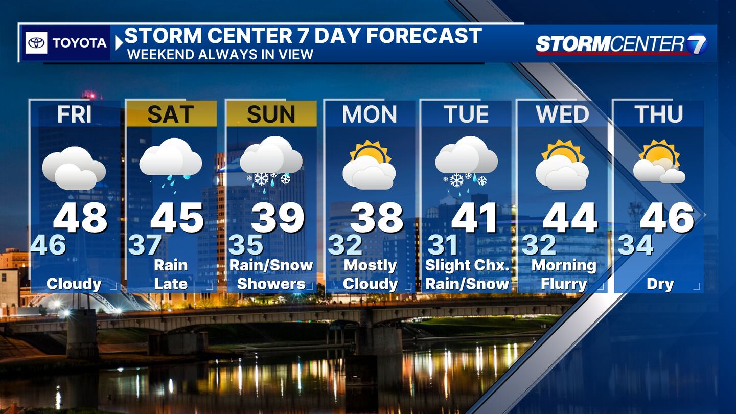
FRIDAY: Mostly cloudy, light drizzle. The high for the day in the 50s likely occurs while everyone is sleeping. We’ll drop to the mid-40s this morning, then rebound to the upper 40s by the afternoon.
SATURDAY: Cloudy and mostly dry during the day. A chance for showers by late afternoon, continuing through Saturday night. As weather cools Saturday night, rain may mix with snow. Lows in the mid-30s.
SUNDAY: A chance for rain showers. Snow may mix in at times early. Drying out in the afternoon. Daytime highs climb to the upper 30s.
MONDAY: Mostly cloudy and a bit colder. Highs in the upper 30s.
TUESDAY: A slight chance for rain or snow showers. Highs in the mid-30s.
WEDNESDAY: A morning sprinkle or flurry possible. Partly cloudy. Cool with highs in the lower 40s.
THURSDAY: Partly cloudy and cool. Highs in the mid-40s.
©2024 Cox Media Group


