
QUICK-LOOK FORECAST:
- Cold tonight, milder Sunday
- Dry weather setting in for several days
- Spring-like temperatures next week
>> RELATED: Accumulating snow expected today; Timing, how much, what to expect
DETAILED FORECAST:
>> TRACK THE LATEST CONDITIONS: Live Doppler 7 Radar
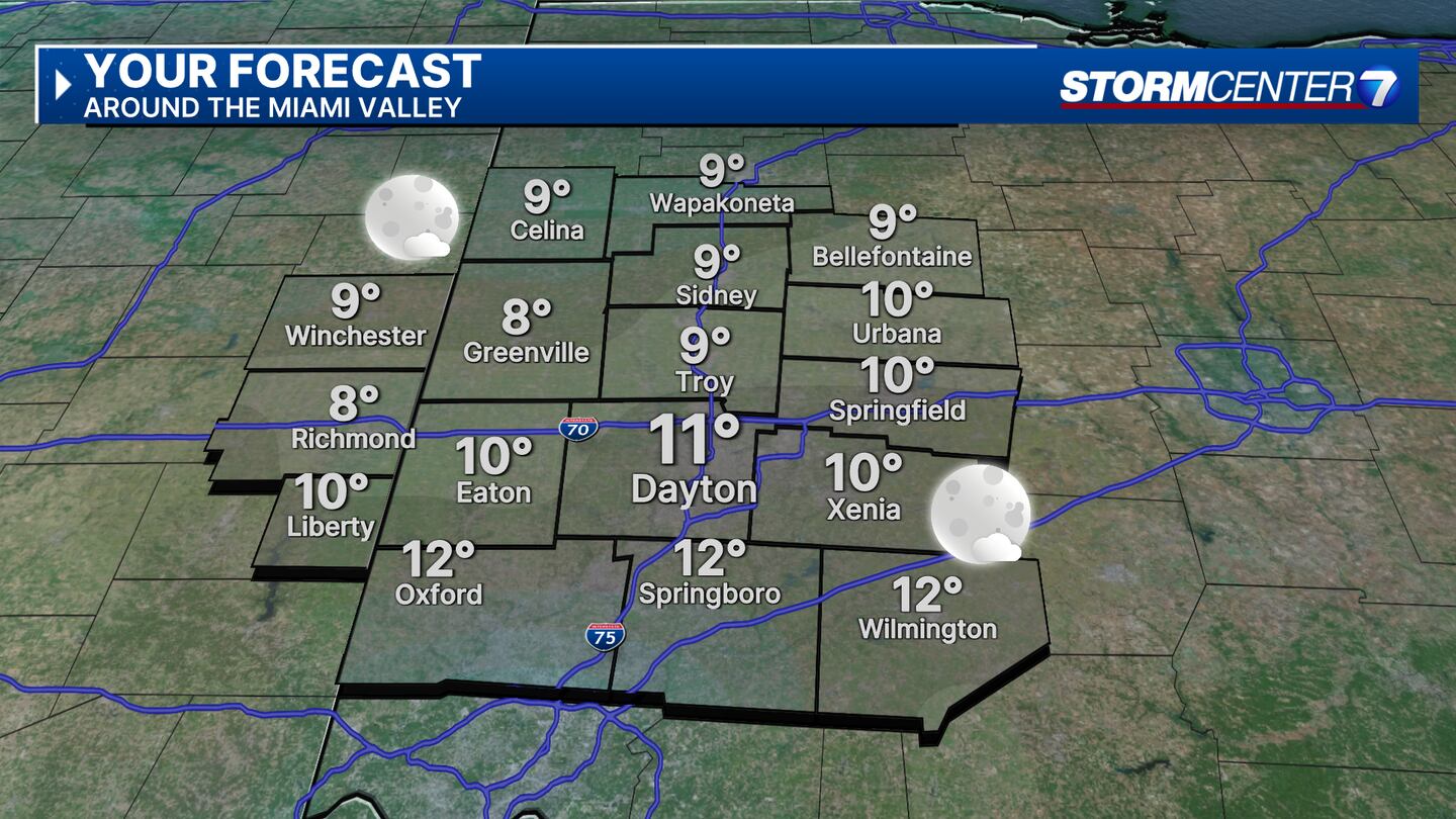
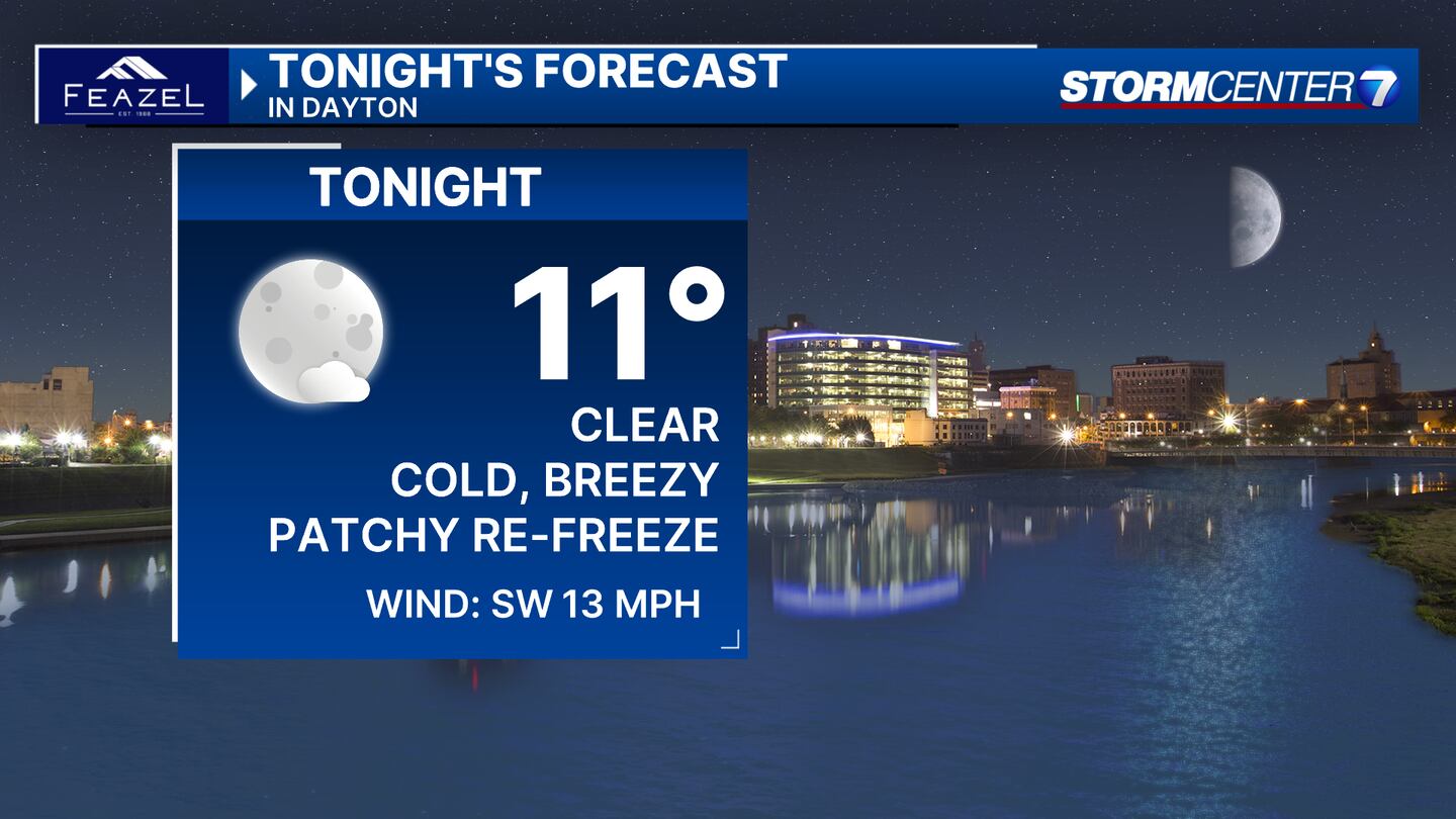
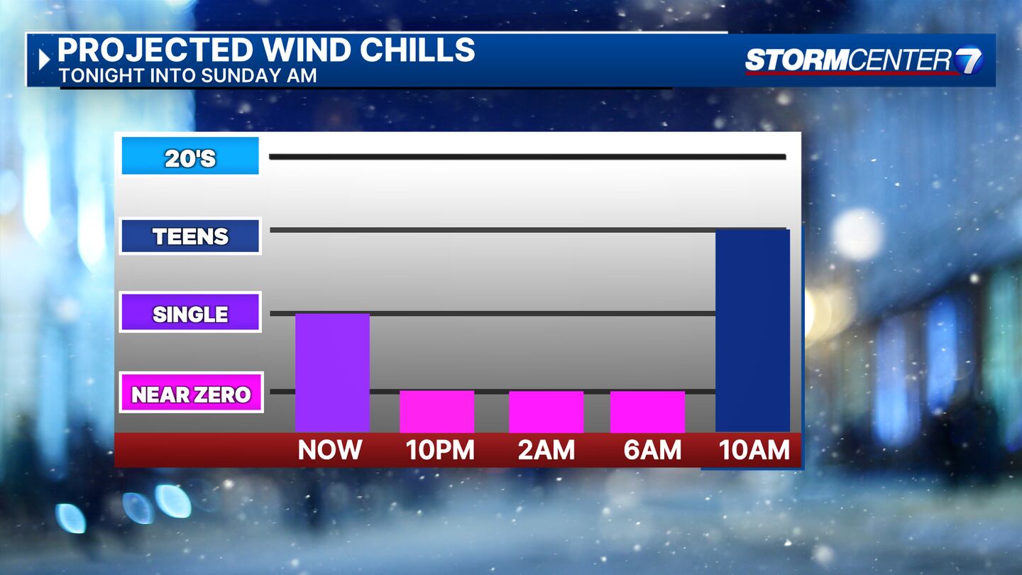
SATURDAY (COLD): Clear skies and breezy. Wind chills near zero at times, and occasionally dipping below zero in stronger gusts. Lows in the upper single digits to lower teens.
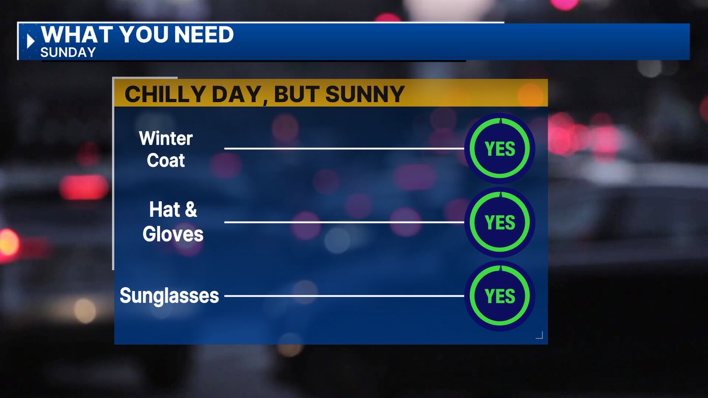
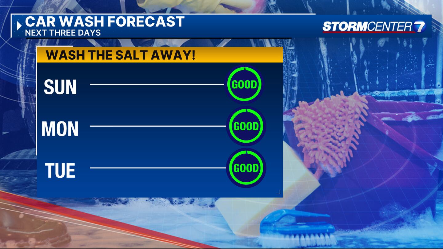
SUNDAY: Another cold start with single-digit wind chills before 10 a.m. Snow will start to melt. Mostly sunny and chilly with highs in the upper 30s.
MONDAY: Increased clouds but a dry forecast continuing and turning milder. Warming it up with highs in the mid to upper 40s.
TUESDAY: Partly sunny and dry. Highs in the lower 50s.
WEDNESDAY: Mostly cloudy with very mild temperatures. Mild with highs in the middle 50s.
THURSDAY: Mostly cloudy with a few showers possible. Remaining mild with highs in the lower 50s.
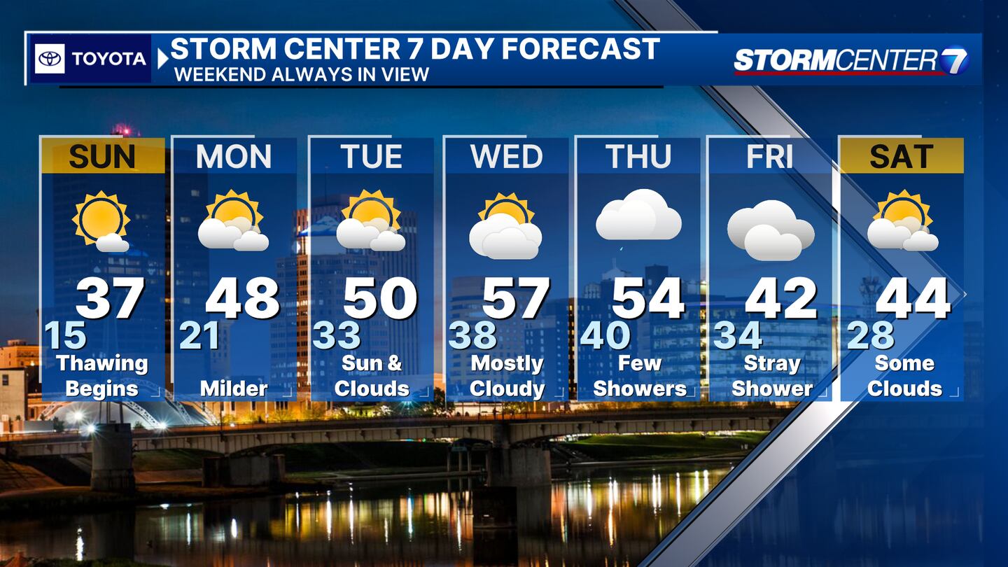
FRIDAY: Cloudy, cool with a shower possible. Lower confidence in the forecast at this juncture. Highs in the lower 40s.
SATURDAY: Some clouds and sun and cool. Highs in the middle 40s.
©2024 Cox Media Group


