QUICK-LOOK FORECAST:
- Chilly, snow showers Monday
- Windy week ahead
- Seasonable temperatures
>> TRACK THE LATEST CONDITIONS: Live Doppler 7 Radar
SUNDAY: Cold temperatures with a few sprinkles/flurries. No accumulations are expected. Lows in the middle to upper 20s.

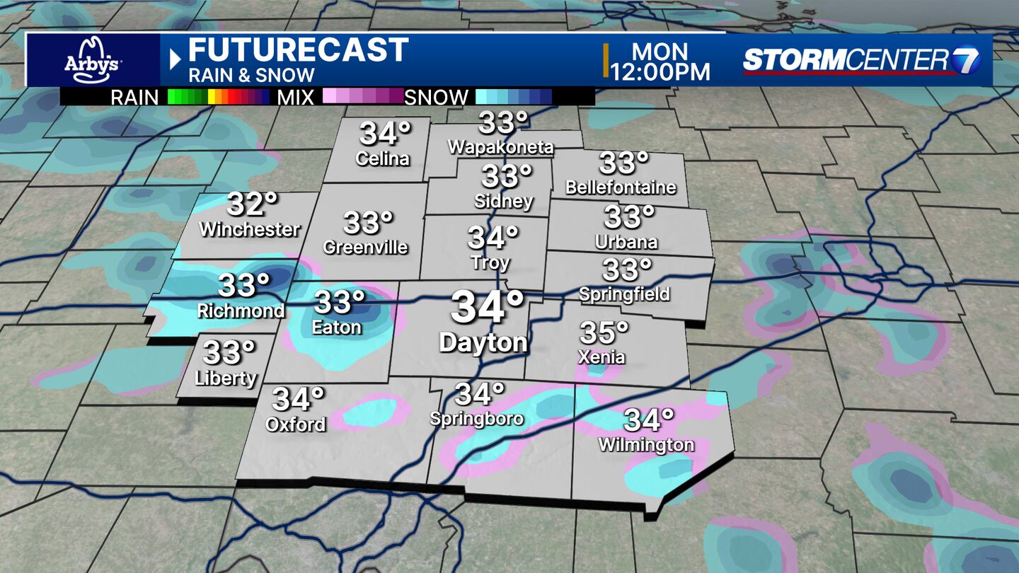
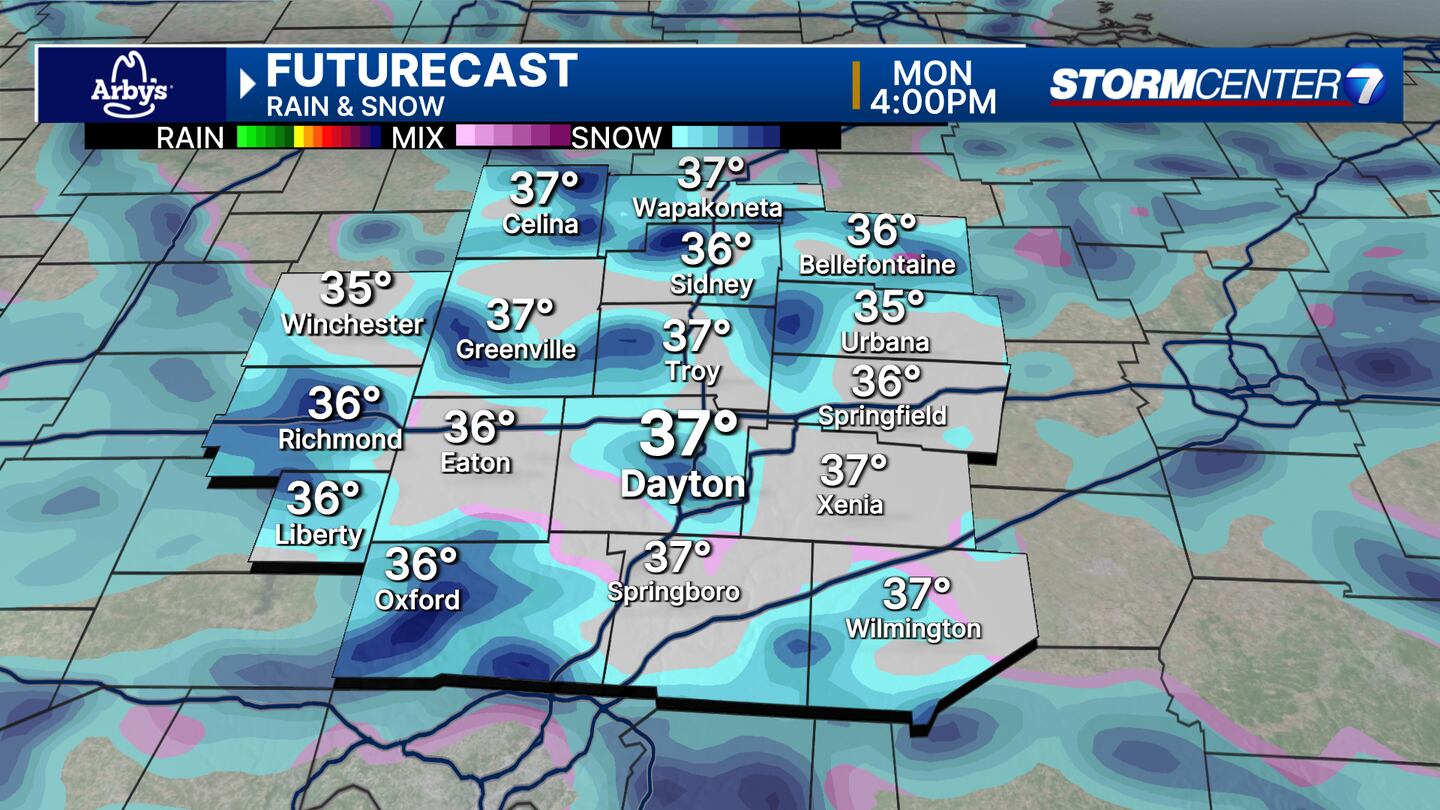
MONDAY: Scattered snow showers looking more likely. A light dusting is possible, but no travel impacts expected. Highs in the middle to upper 30s.
TUESDAY: Partly cloudy & windy with gusts of 30+ MPH possible. Cool again with highs in the lower 50s.
WEDNESDAY: Partly cloudy. Staying cool and breezy with highs in the upper 40s. Sub-freezing temperatures overnight could impact early season blooms and lead to another freeze.
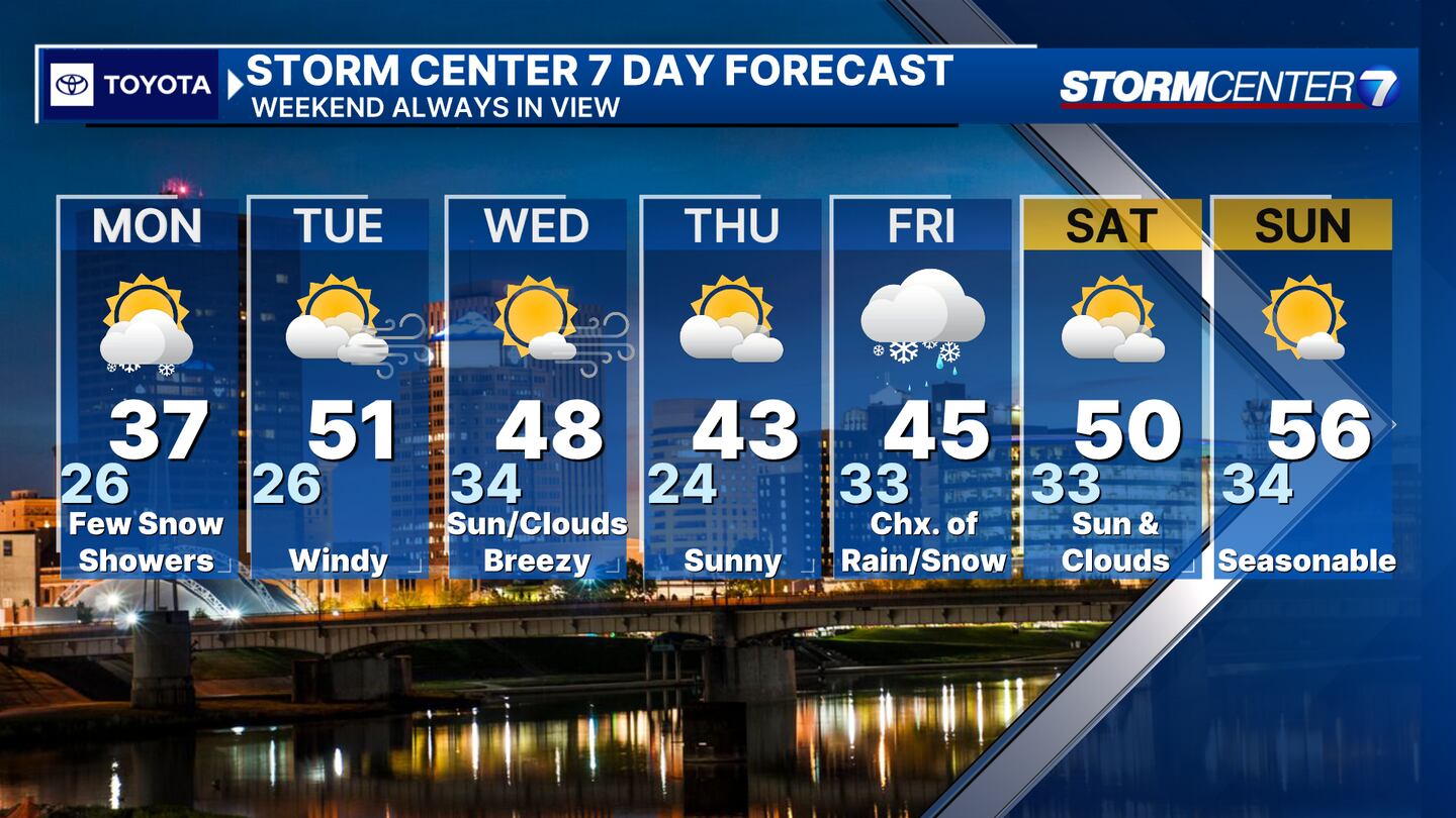
THURSDAY: Mostly cloudy and the forecast has trended much cooler today here. Cool with highs in the middle 40s. Some rain and snow showers may arrive late in the day into the overnight.
FRIDAY: Chance of rain and snow showers, but the confidence here is low. Cool with highs in the middle 40s.
SATURDAY: Some sunshine and seasonable. Highs around 50.
SUNDAY: Sunshine and a bit milder with highs in the middle 50s.
©2024 Cox Media Group


