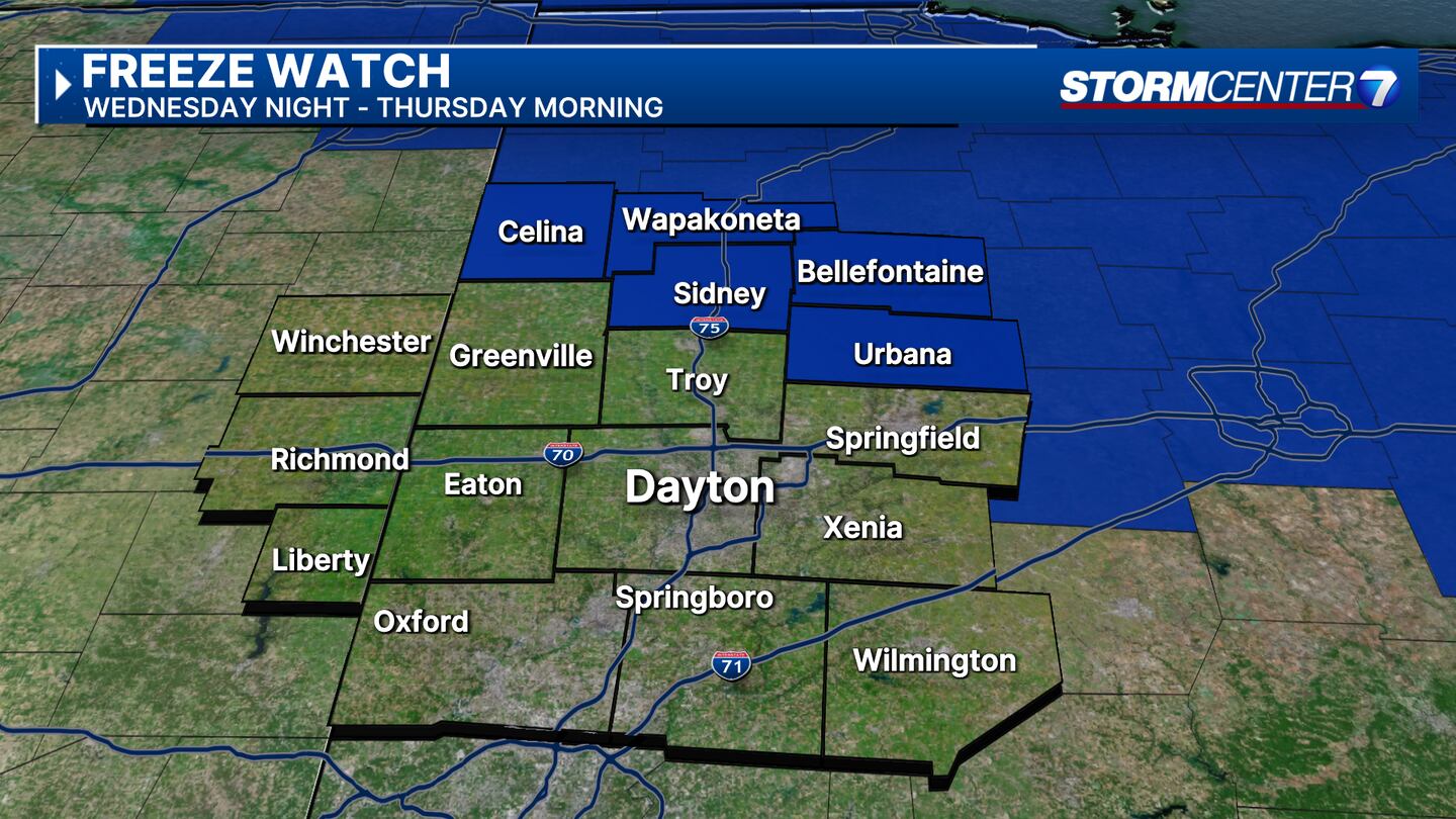
Freeze Watch is in effect from Wednesday night until 9 a.m. Thursday morning for Mercer, Auglaize, Logan, Shelby, and Champaign counties.
QUICK-LOOK FORECAST:
- Rain moves through this evening
- Freeze watch Wednesday night
- Warmer with storms this weekend
>>TRACK THE LATEST CONDITIONS: Live Doppler 7 Radar
DETAILED FORECAST:
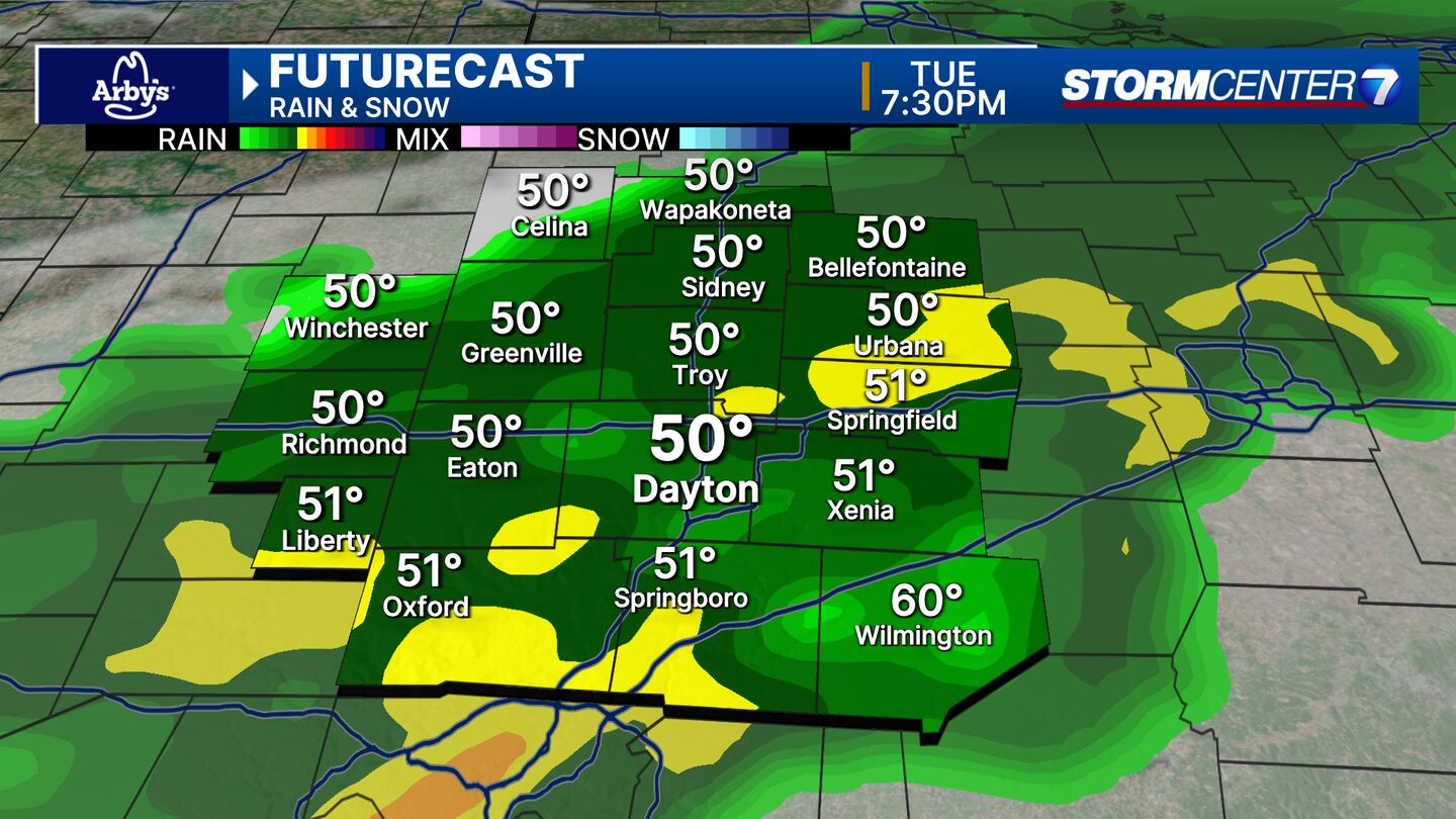
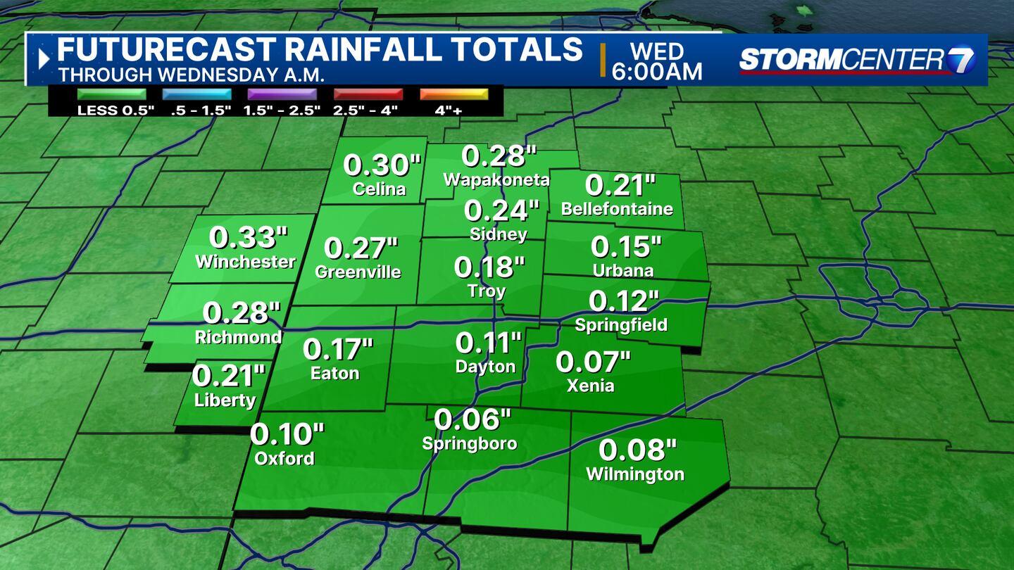
TUESDAY: Cloudy with rain arriving this evening, persisting into the first part of tonight. By 10-11PM most of the activity will have exited to the south east. Rainfall totals around .25 to .5″. Breezy. Cool with 50s this evening, down to the lower 40s overnight.
WEDNESDAY: Rain is gone by Wednesday morning, but clouds may be stubborn to clear especially further east and northeast. More sun late in the day. Cool with afternoon high temperatures struggling to get past the low 50s. North wind sustained around 10MPH will make it feel cooler. Overnight, temperatures will fall close to freeze. Obviously, if it gets below.
THURSDAY: Mostly sunny mild with highs in the lower 60s.
FRIDAY: A chance for showers and thunderstorms. Much warmer with highs in the mid to upper 70s.
SATURDAY: A chance for showers and thunderstorms. Much warmer with highs in the mid to upper 70s.
SUNDAY: Another chance for showers and thunderstorms. Keeping eyes on the potential for strong storms.Warm again with highs in the upper 70s to around 80.
MONDAY: Partly cloudy with another chance for storms. Highs in the upper 70s.
©2024 Cox Media Group


