A Freeze Watch is in effect for the Miami Valley from midnight Friday until 10 a.m. Saturday.
A Flood Warning continues for the Great Miami River in Sidney.
A Flood Warning continues for the Great Miami River in Taylorsville.
QUICK-LOOK FORECAST:
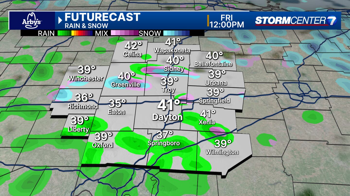
- Few more rain/snow/graupel showers Friday
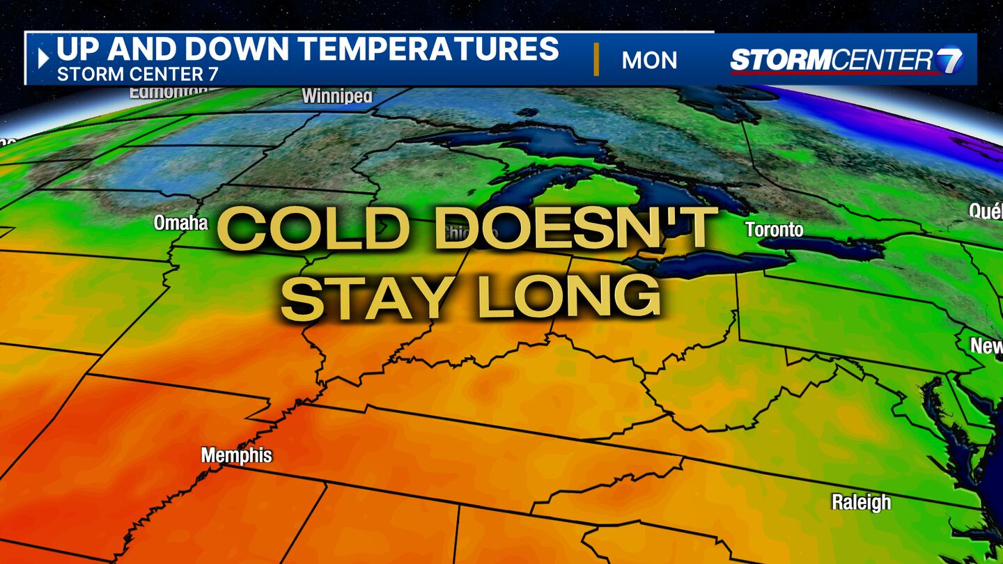
- Cold hanging around through Saturday
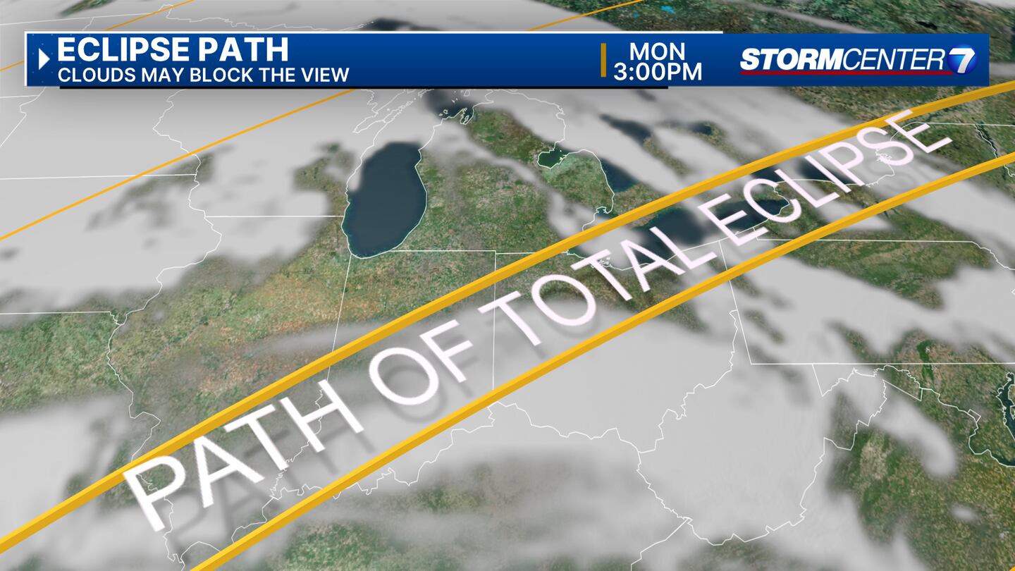
- Eclipse Day not the best, not the worst either
>> TRACK THE LATEST CONDITIONS: Live Doppler 7 Radar
DETAILED FORECAST:
TONIGHT: Rain and graupel showers from this afternoon and evening start to decrease in coverage overnight, Storm Center 7 Chief Meteorologist Austin Chaney says.
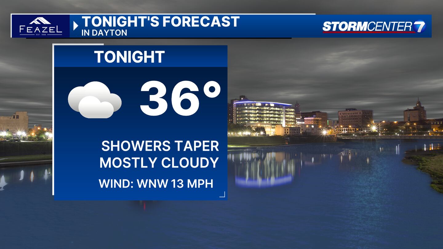
We’ll keep the clouds around. Chilly tonight with lows in the middle 30s.
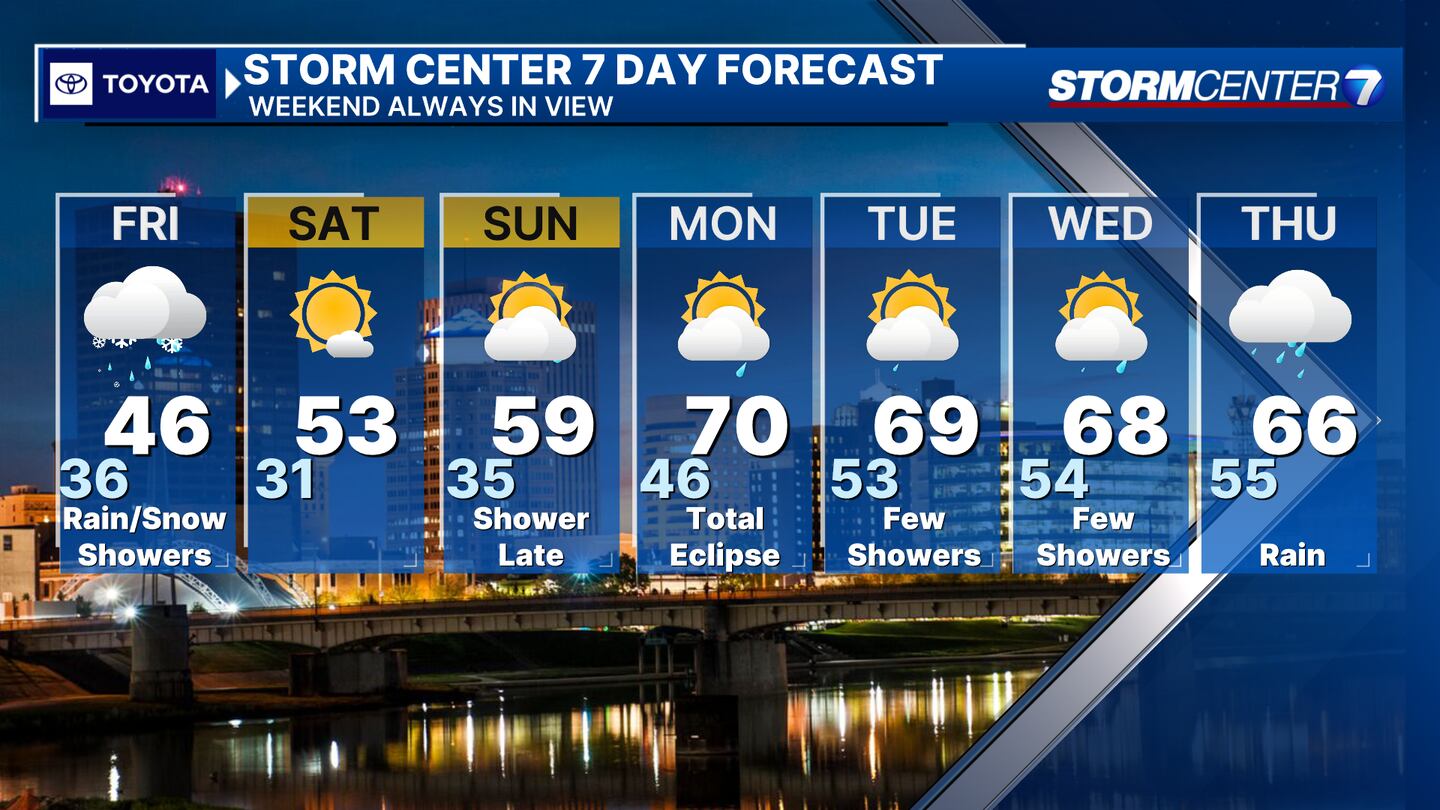
FRIDAY: Our pesky area of low pressure looks a little slow to depart. As a result, we’re going to keep the chance for a few more rain/snow/graupel showers in the forecast for today. The coverage shouldn’t be as widespread as Thursday. Otherwise, mostly cloudy skies. High temperatures climb to the middle 40s. Breezy.
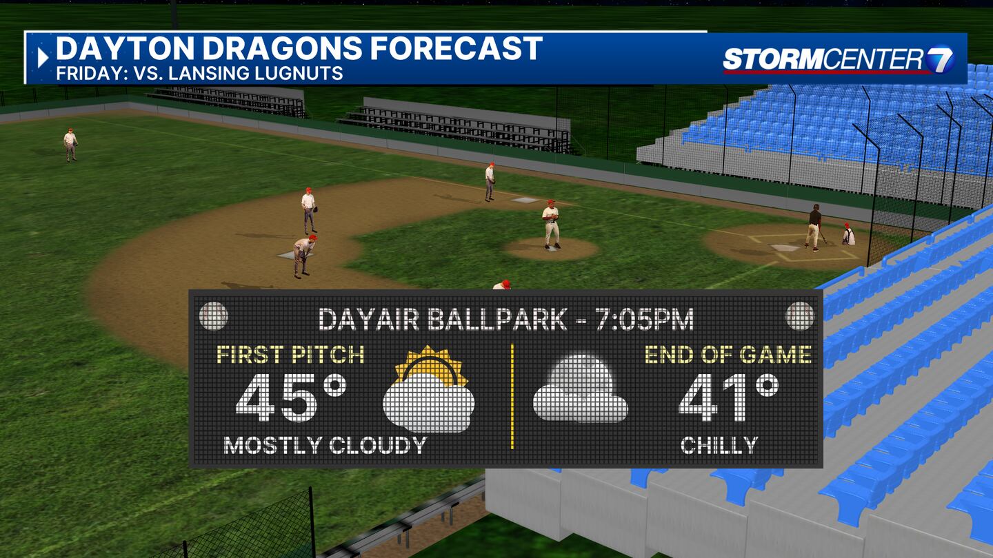
Opening Day for the Dragons looks dry but chilly. Dress warm!
SATURDAY: Cold with frost possible for the morning. Mostly sunny in the afternoon with highs in the lower 50s.
SUNDAY: Frost is possible early. Clouds return during the day giving way to a chance for rain showers by late evening or overnight. High temperatures will be warmer in the upper 50s.
MONDAY: (TOTAL SOLAR ECLIPSE) A chance for morning clouds and showers. There may be some clearing into the afternoon, but high uncertainty still exist regarding cloud cover. High temperatures will be warmer in the upper 60s.
TUESDAY: Partly cloudy and mild with highs in the upper 60s to 70 degrees. There will be a chance for showers.
WEDNESDAY: Partly cloudy with a slight chance for showers. Warm with highs in the upper 60s to near 70.
THURSDAY: Cloudy with rain likely. Highs in the mid to upper 60s.
©2024 Cox Media Group


