Accumulating snow is looking more likely for many across the area Friday.
Storm Center 7 Chief Meteorologist Austin Chaney has been tracking this system all week. Get the latest before you go to bed on what this system will bring and where it’ll hit LIVE on News Center 7 at 11.
>>TRACK THE CONDITIONS: Live Doppler 7 Radar
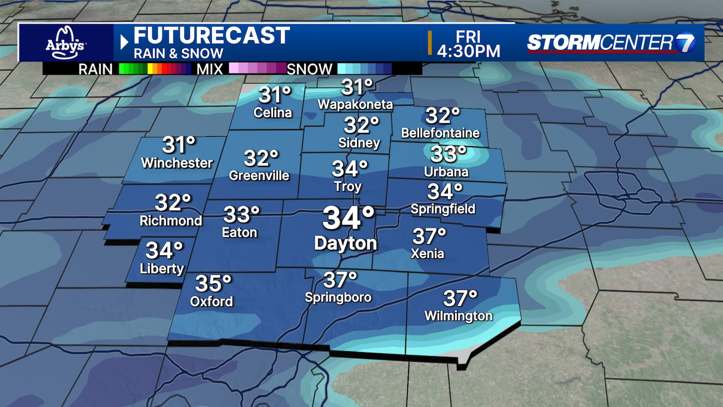
The latest data is trending for good news for fans of snow. And with temperatures looking a little colder Friday, snow totals could be a bit higher.
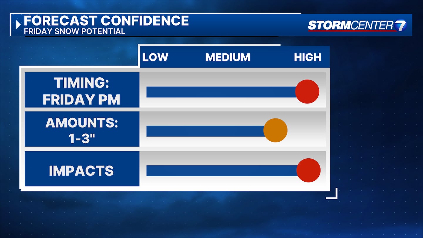
TIMING: Snow flurries or light snow showers will be possible north of I-70 as early as 8 a.m. But the main event arrives as we go into the afternoon hours. By mid-afternoon, all of the Miami Valley is seeing snow. Snowfall tapers Friday night.
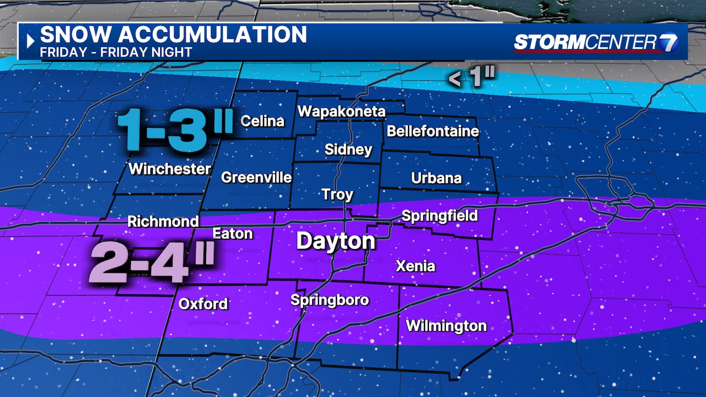
HOW MUCH?: Most areas will see 1 to 3 inches and a strip of 2 to 4 inches along and south of I-70. A lot of it will be on the grass, but some slick spots could develop on roadways after sunset on Friday.
>>FULL FORECAST from Storm Center 7′s team of meteorologists
ALERTS: As of now, there are no winter advisories or storm warnings in effect. The National Weather Service may issue alerts tonight or Friday morning.
IMPACTS: The main concern will be the possibility of slick roads Friday evening and night. By then, temperatures will be dropping. If snow is still falling, it may then stick to streets and roads. Any remaining moisture could also freeze on untreated streets and roads as temperatures drop to the low 20s overnight.
©2024 Cox Media Group


