
QUICK-LOOK FORECAST:
- Dry and mild tonight
- More storms return Wednesday
- Isolated severe storms Wednesday night
>>TRACK THE CONDITIONS: Live Doppler 7 Radar
DETAILED FORECAST:
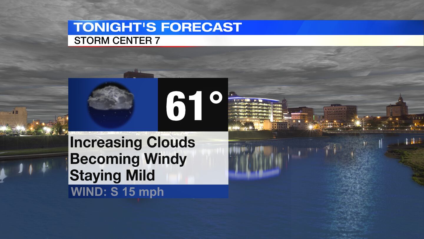
TODAY: Mostly cloudy to cloudy skies tonight. Winds increase, too. Temperatures will be falling only to a low near 60 degrees by morning.
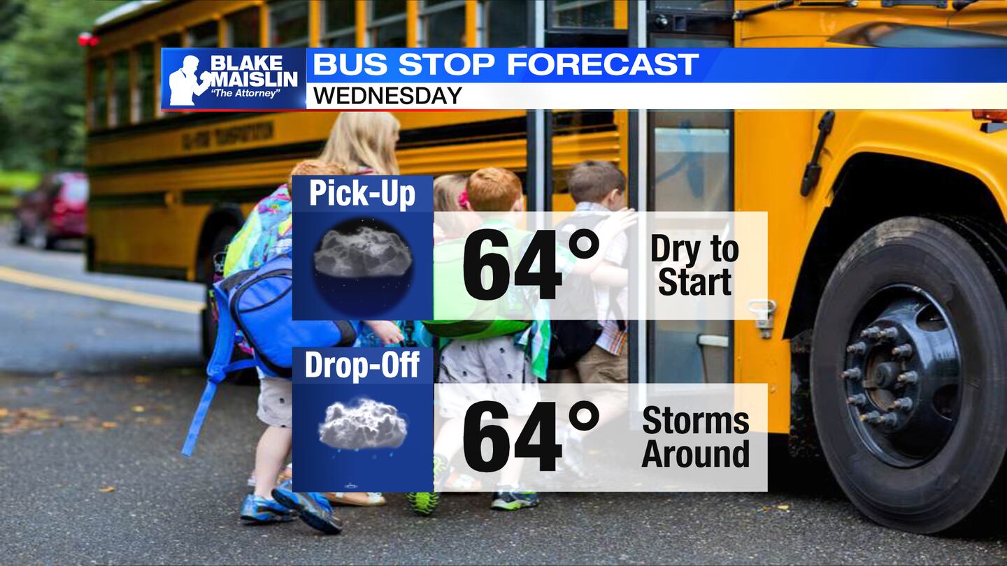
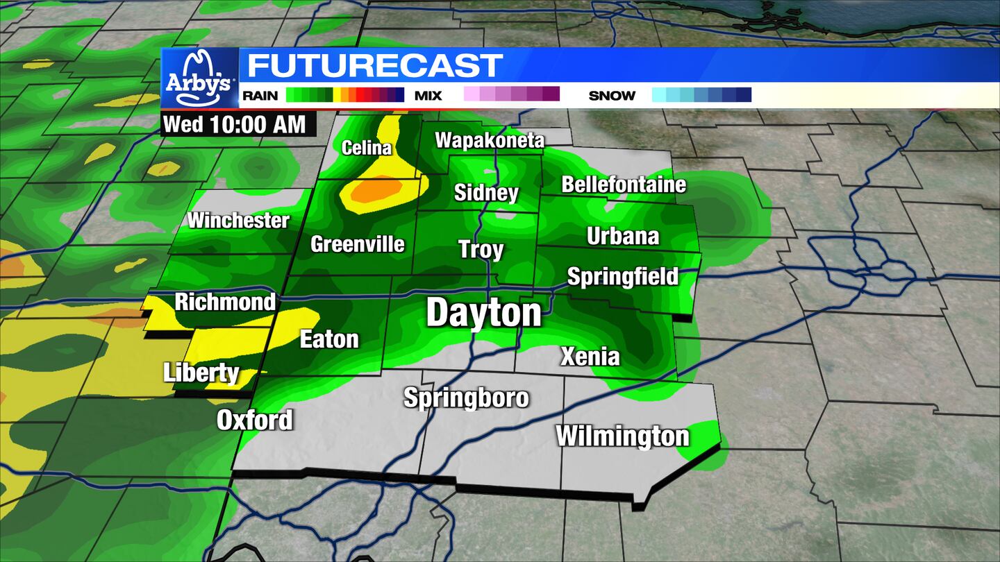
WEDNESDAY: Cloudy and warm with scattered showers and thunderstorms arriving by mid-morning through early afternoon. Winds will also increase. Some gusts up to 35 mph possible. Highs in the lower 70s .
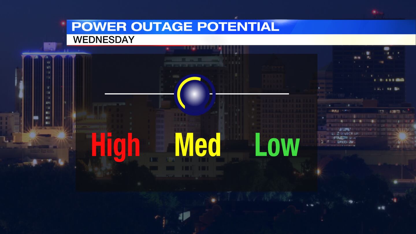
>>Severe weather potential: Here’s what we know about Wednesday night
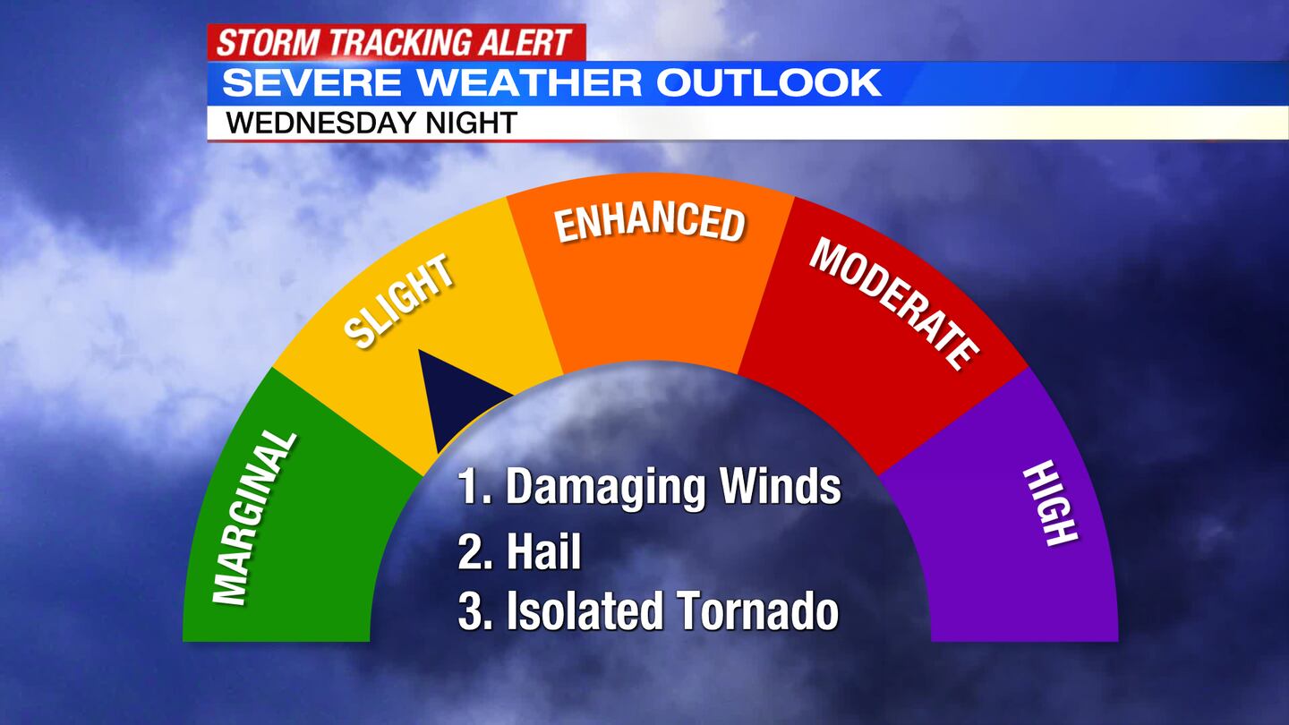
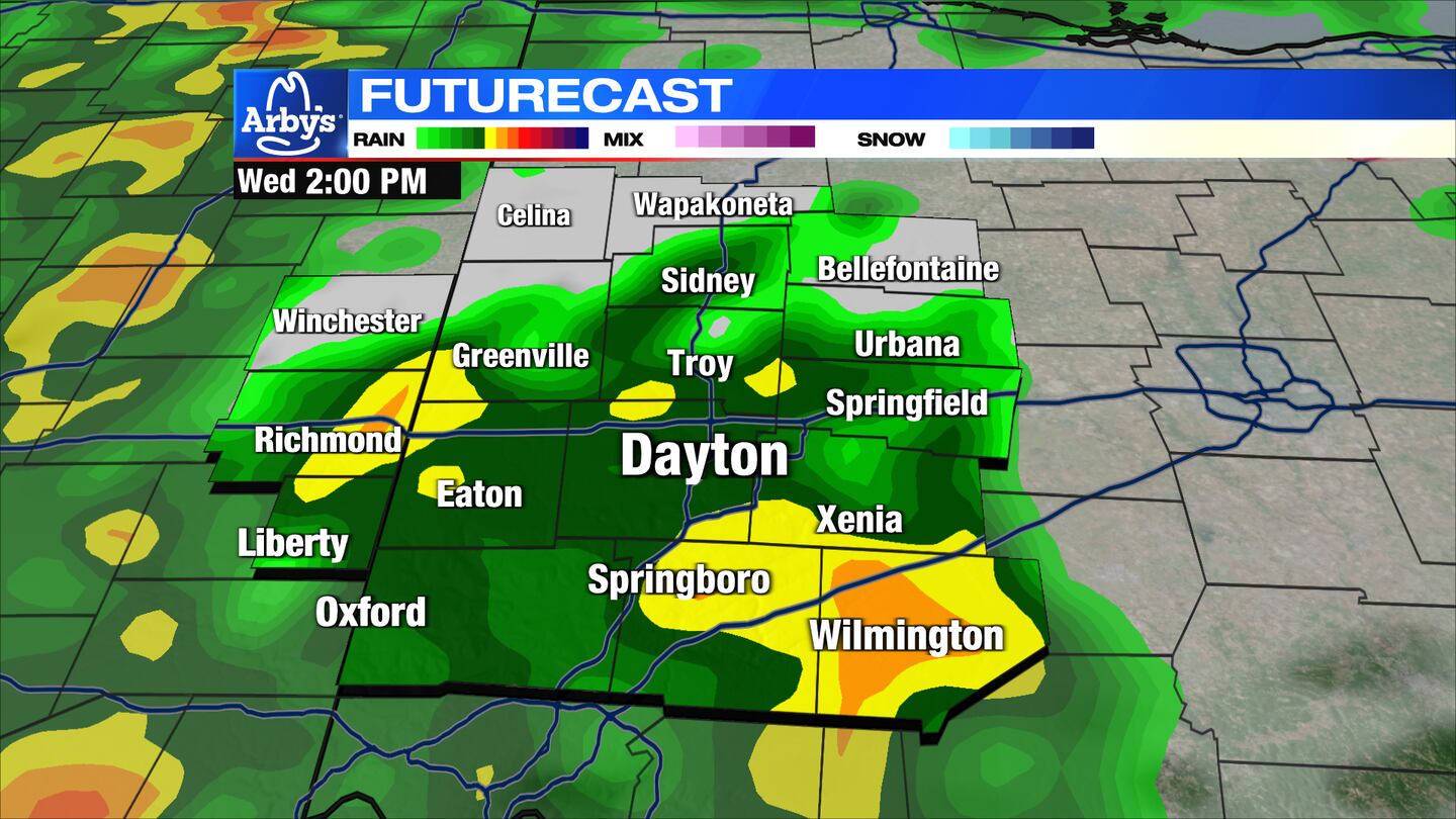
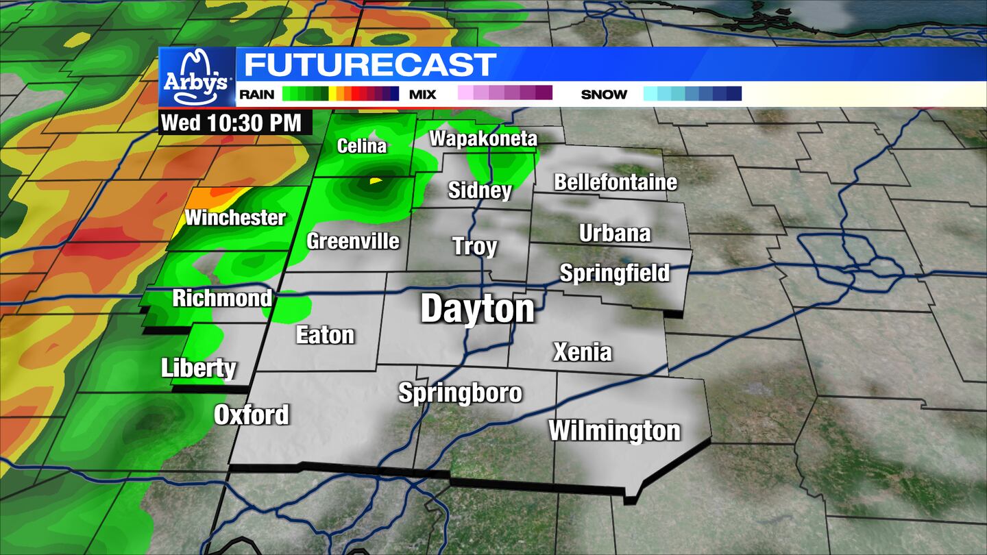
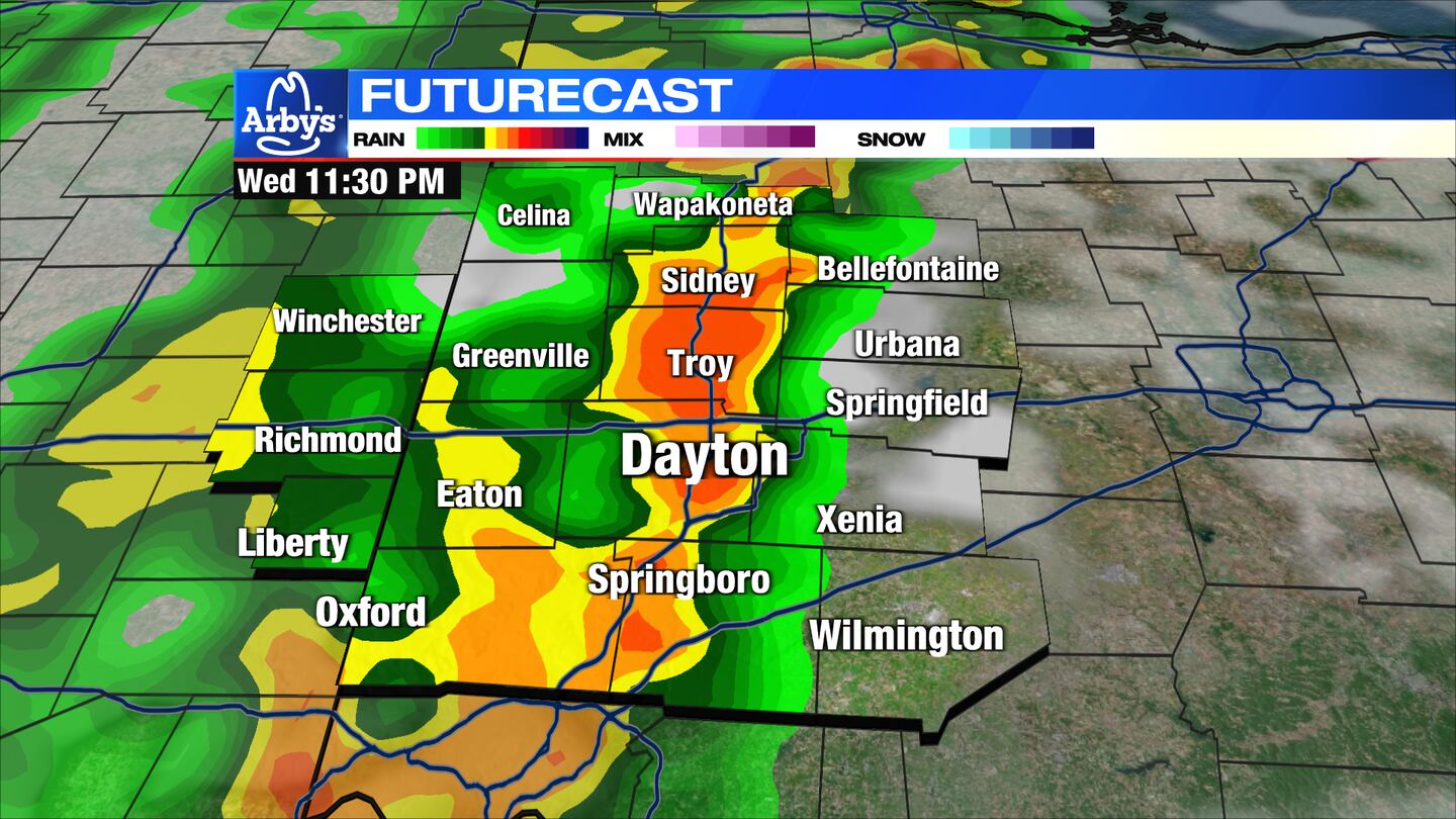
A break in the storms are expected late afternoon into the early evening then a second line of strong to severe storms move in from the west before midnight.
An isolated strong to severe storm possible with damaging winds the primary threat, along with hail, heavy rain, and a few tornadoes possible. Storms will exit to the east by daybreak on Thursday.
THURSDAY: A windy day with a mix of sun and clouds for Thursday. Also, slightly cooler with highs in the lower 60s.
FRIDAY: Sunny and pleasant with highs in the lower 60s. Clouds increase late Friday with a shower is possible overnight Friday.
SATURDAY: A passing shower possible in the morning then partly cloudy and seasonable. Highs in the upper 50s.
EASTER SUNDAY: Clouds increase with most of the day dry. Chance of a few showers Sunday night. Highs in the lower 50s.
MONDAY: Mostly cloudy with the chance of a few showers on Monday. Highs around 50 degrees.
TUESDAY: Mostly cloudy with a few more showers possible. Highs in the lower 50s
©2022 Cox Media Group