QUICK-LOOK FORECAST
- Mild afternoon with a few showers
- Cooler weekend, but dry
- Temps into the 70s next week
>> Live Doppler 7 Interactive Radar
DETAILED FORECAST
Today: Some clouds will build this afternoon ahead of some passing showers and isolated storms this evening, according to Storm Center 7 Meteorologist McCall Vrydaghs.
Highs will reach the upper 60, but temperatures will cool into the 50s tonight.
Most of the evening will be dry as the first round of activity moves east. More clouds and a few showers develop later tonight, mostly after midnight.
Areas north of Interstate 70 are in the best position to see the second round of showers.
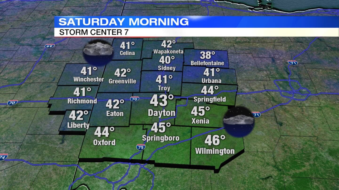
Overnight lows will fall into the lower 40s by morning.
- WHIO On-Demand page: http://bit.ly/2GxtQWg
- iTunes: https://apple.co/2Gxu4g4
- Stitcher: http://bit.ly/2sJ4CCt
Saturday: It will be mostly cloudy with a few sprinkles to the north. The afternoon will be cooler by about 10 degrees as highs climb to the mid-50s. Clouds will break for some sun late day.
>> How to spot the full ‘pink’ moon and Jupiter
Sunday: It will be a great end to the weekend, although the morning will start with some areas of frost. We'll see sunshine for the afternoon with highs in the upper 50s to around 60.
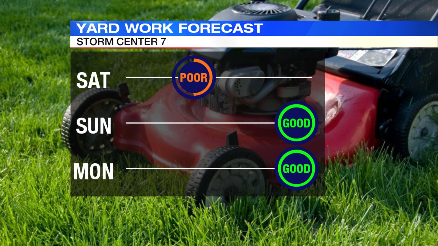
Monday: Spotty frost will be possible in the morning. Highs will reach around 70. It will be warmer than normal.
Tuesday: Highs will reach the mid-70s, which is about 10 degrees above normal. It will stay quiet and dry.


