>> Storm Center 7 Chief Meterologist McCall Vrydaghs honored as ‘storm hero’
QUICK-LOOK FORECAST
- Showers with a few storms this evening
- Summer-like pattern arrives
- Hot and humid to end the week
DETAILED FORECAST
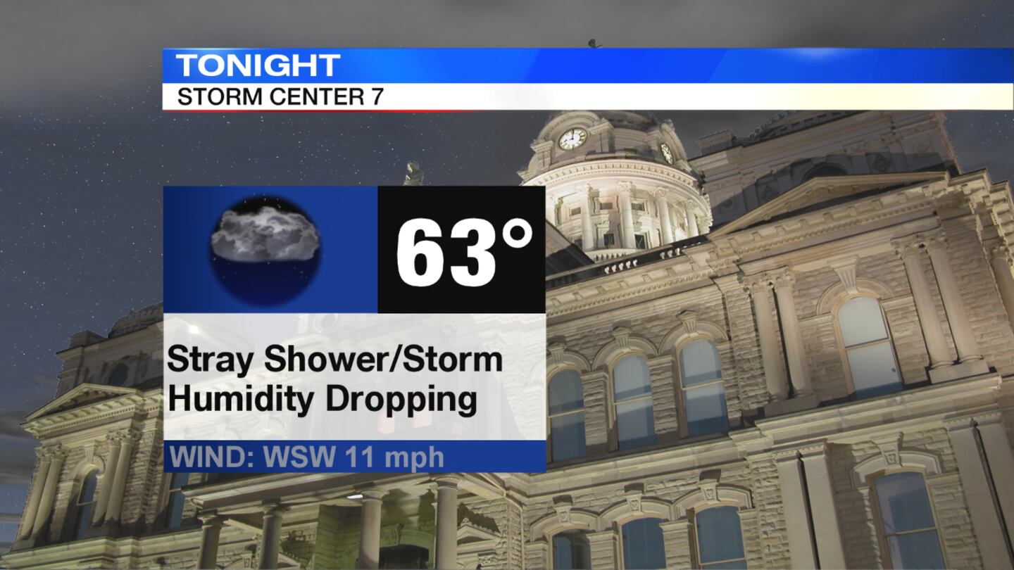
THIS EVENING/OVERNIGHT: There will be some scattered showers around this evening with a few embedded thunderstorms possible, but severe weather is not expected, said Storm Center 7 Chief Meteorologist McCall Vrydaghs. Isolated downpours and some gusty winds with any storms that move through would be the primary threat. Showers will taper late evening before a few isolated passing showers move through overnight. It will be mostly cloudy through the night with temperatures falling into the lower 60s, and the humidity will drop slightly by morning.
>> TRACK THE CONDITIONS: Live Doppler 7 HD Interactive Radar
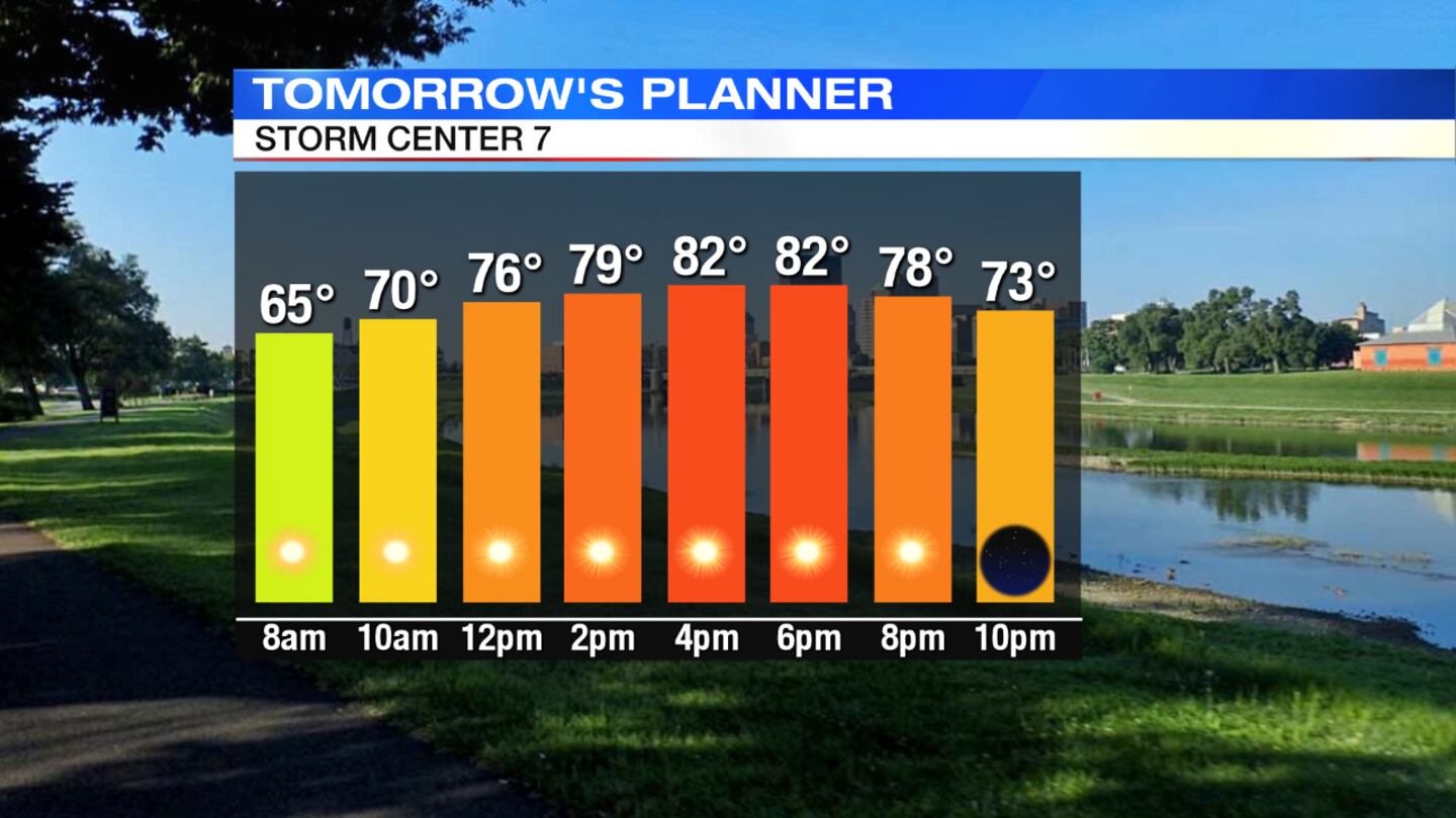
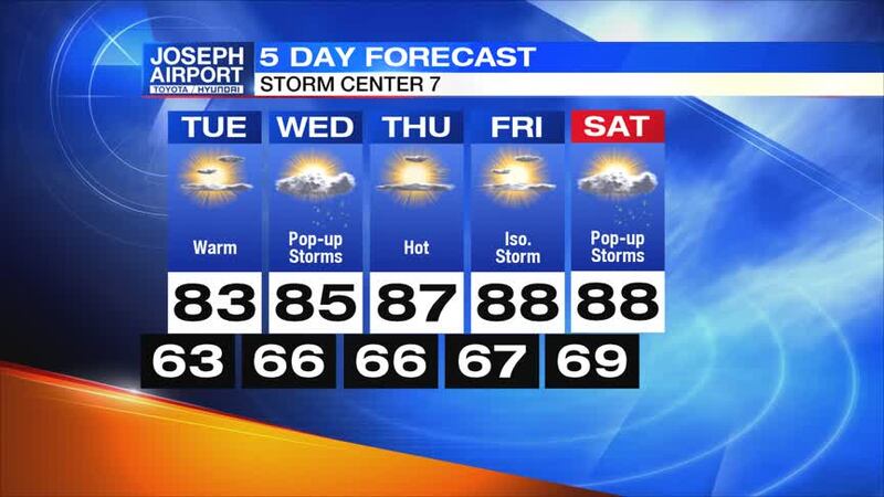
TUESDAY: It'll be mostly sunny and warm with highs climbing into the lower 80s. It will also stay quiet into the day with partly cloudy skies and lows in the middle 60s.
WEDNESDAY: Expect the day to be partly cloudy, warm and muggy with a slight chance of an isolated shower or storm with highs in the middle 80s.
>> LISTEN: Cloudy with a Chance of Podcast: A podcast for weather fans
THURSDAY: There will be sunshine, a few clouds and warmer with highs in the upper 80s, but the humidity will make it feel more like 90 degrees during the afternoon.
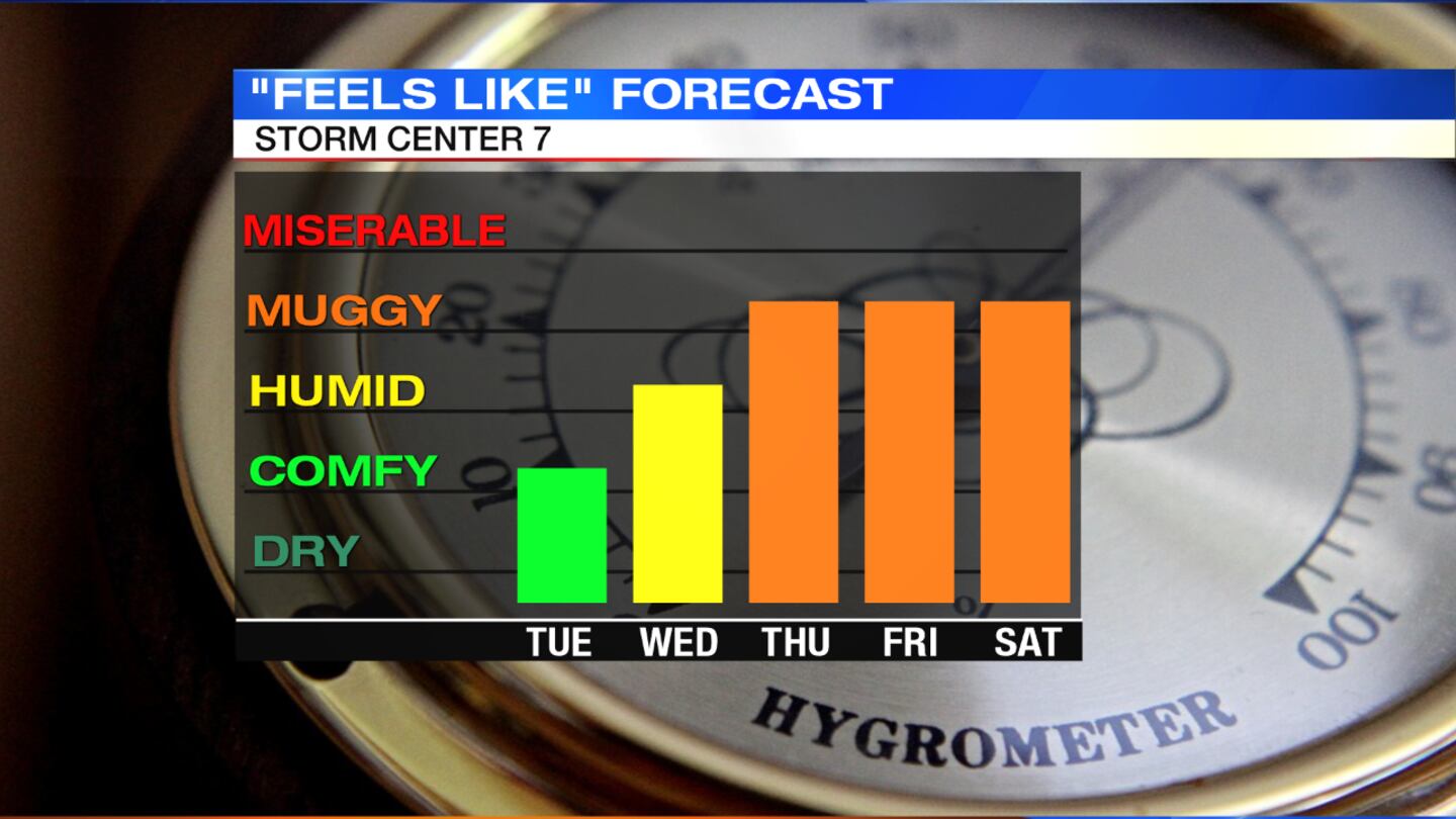
FRIDAY: Expect another sunny, hot and humid day with possibly a few pop-up showers or storms during the peak heating of the day with highs in the upper 80s, but feeling like the lower 90s.
>> YOU NEED THIS: Download the WHIO Weather App
SATURDAY: It'll be hot and humid again with a few pop-up storms during the afternoon as temperatures climb to the upper 80s with head index values in the lower 90s.


