A Flood Advisory has been issued for Logan County until 3:45 a.m.
A Flood Advisory has been issued for Darke and Shelby counties until 3:30 a.m.
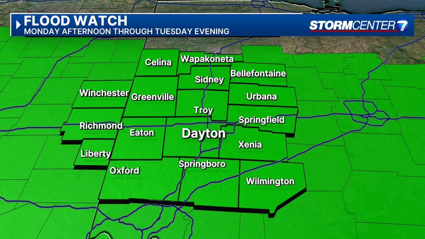
A Flood Watch for the entire region until 8 p.m. Tuesday night.
QUICK-LOOK FORECAST:
- Severe weather outbreak possible Tuesday
- Flooding risk remains through Tuesday night.
- Colder air returns to the Valley
>> TRACK THE LATEST CONDITIONS: Live Doppler 7 Radar
FULL DETAILS:
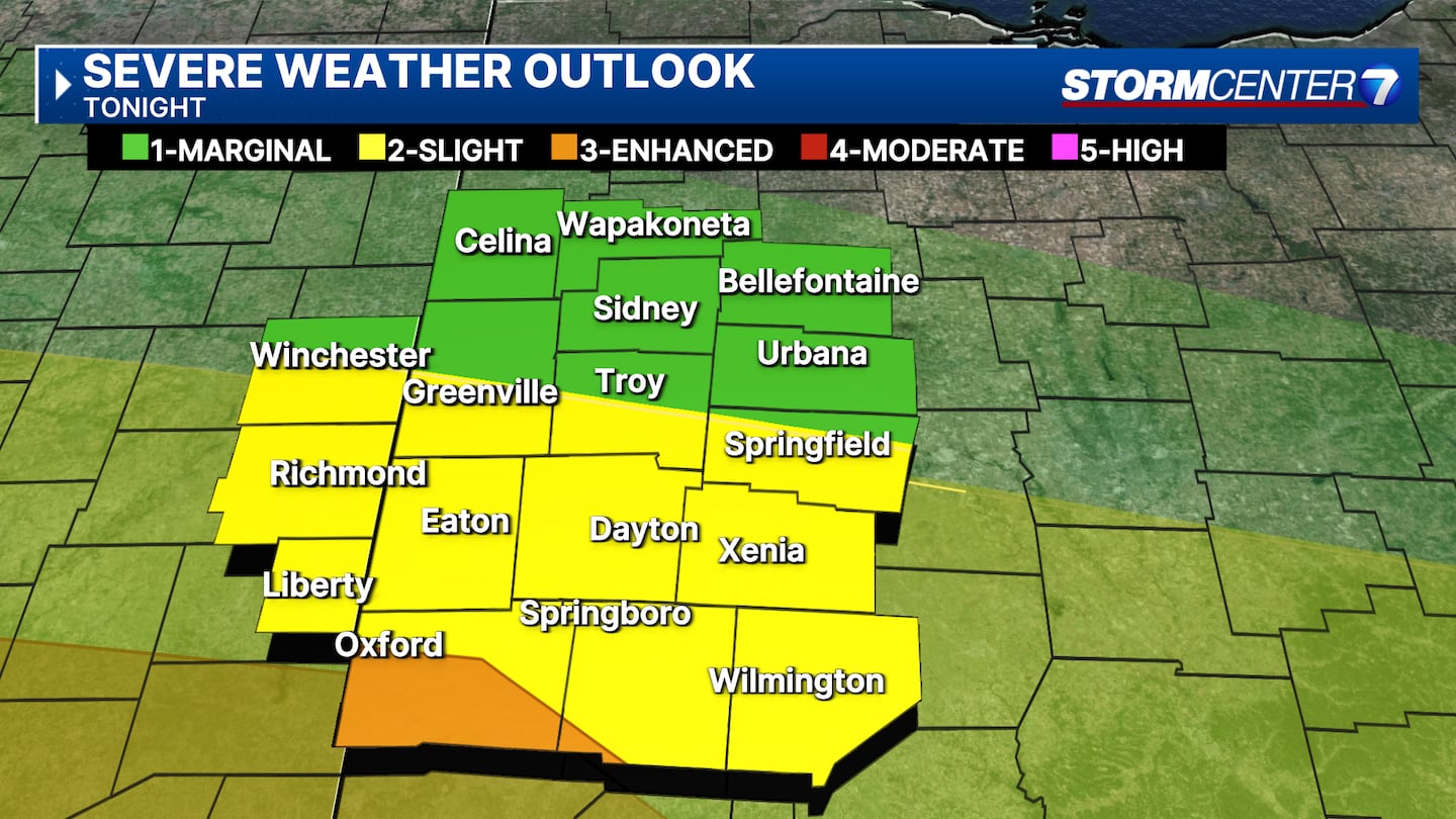
OVERNIGHT: Rain and thunderstorms return to the region. A few storms are possible, and heavy rain will be a big issue overnight. Heavy rain on top of already saturated ground may lead to localized flooding, and a flood watch remains in effect.
Rain and storms should exit around daybreak. Overnight lows only fall to the upper 50s.
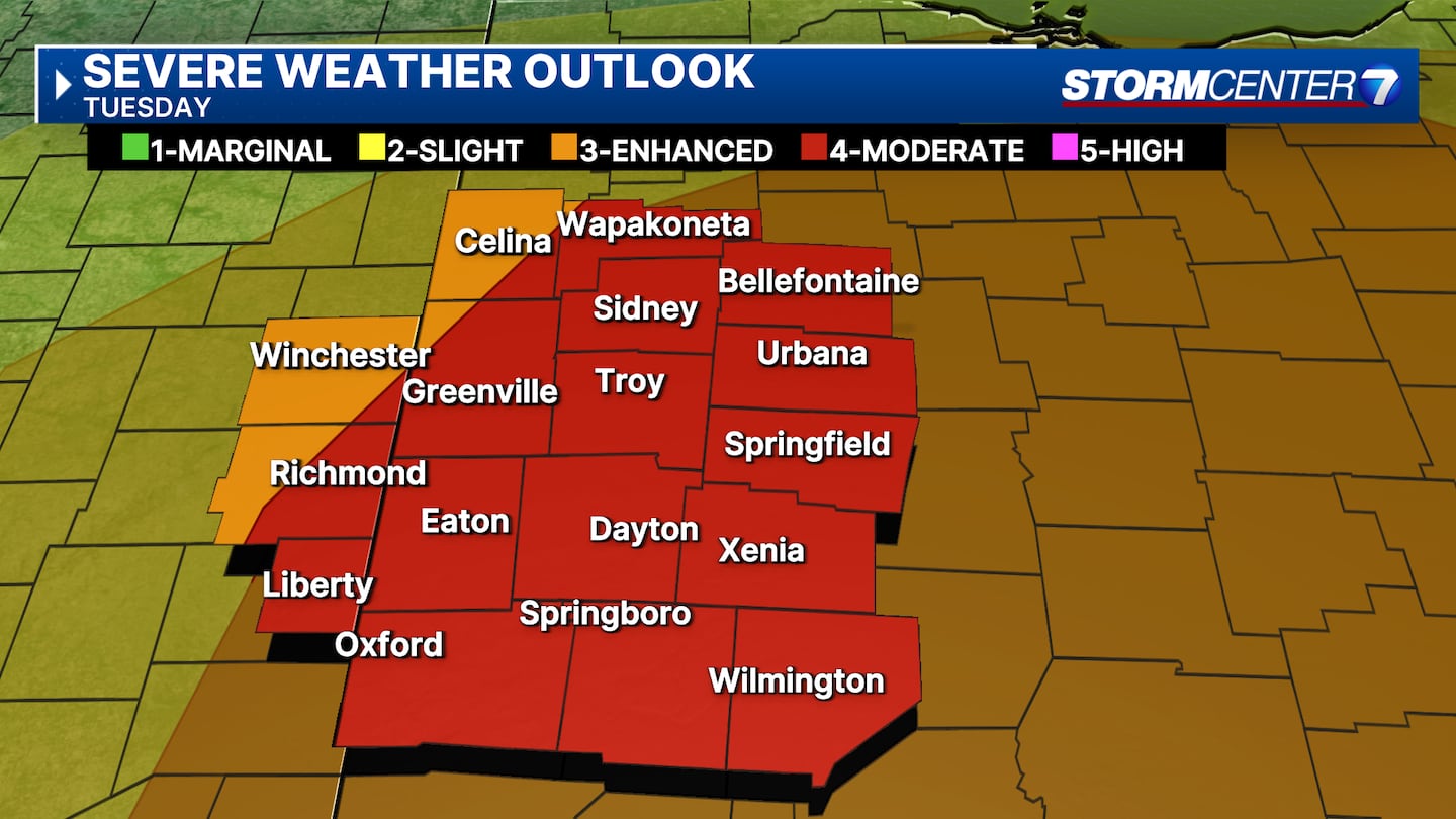
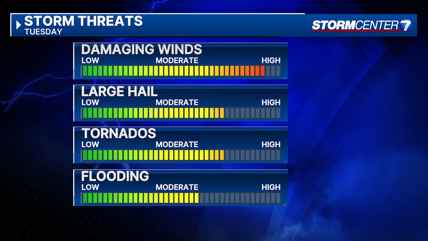
TUESDAY: A substantial severe weather risk exists for the Miami Valley on Tuesday. The Storm Prediction Center is including nearly all of the region in a level 4/5, Moderate, risk for severe storms. After morning rain exits, there will be a break in activity until Tuesday afternoon. Between 4-10 PM on Tuesday,
WEDNESDAY: Windy and much colder with rain showers mixing with snow showers by afternoon. Highs in the middle 40s.
THURSDAY: Lingering rain or snow showers, mainly early. Staying cloudy. Cool with highs in the low 40s
FRIDAY:Mostly cloudy with a sprinkle possible. Still cool with highs near 50.
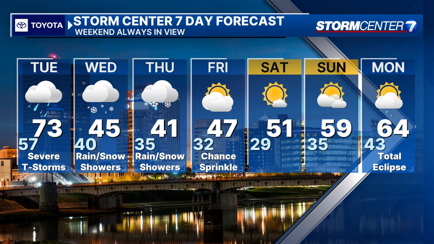
SATURDAY: Sunshine and a bit milder with higher in the middle 50s.
SUNDAY: (ECLIPSE EVE!) Partly cloudy and milder with highs in the upper 50s.
MONDAY: Some morning showers and clouds. Some clearing into the afternoon
©2024 Cox Media Group


