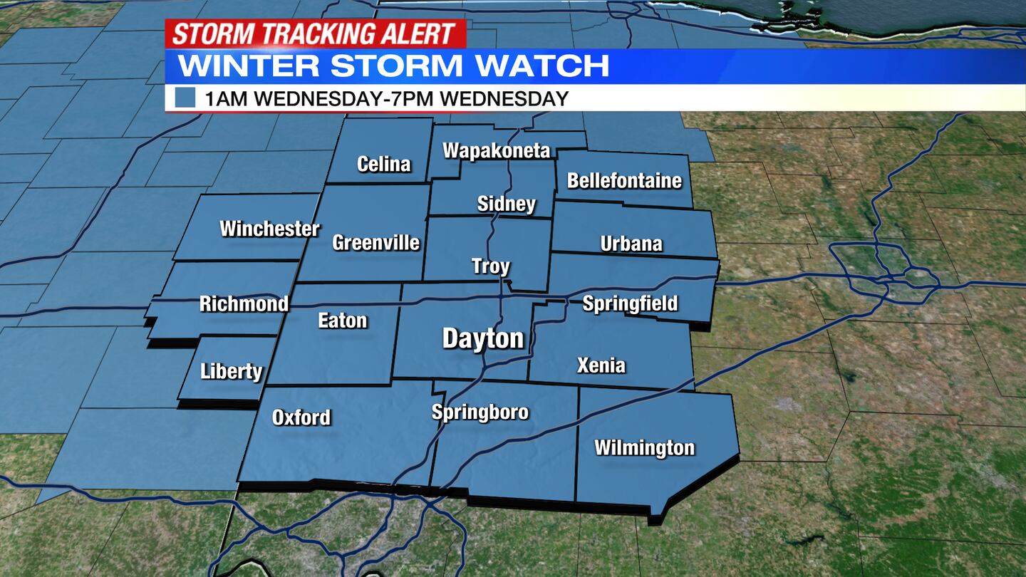
Winter Storm Watch is issued for the region from 1:00 a.m. Wednesday until 7:00 p.m. that evening.
QUICK-LOOK FORECAST:
- Quiet, some sun Tuesday
- More snow & rain Wednesday
- Snow showers at times Thursday
>> TRACK THE CONDITIONS WITH LIVE DOPPLER 7
DETAILED FORECAST:
TONIGHT: Storm Center 7 Chief Meteorologist McCall Vrydaghs says it will be mostly cloudy and chilly overnight with lows in the upper 20s.
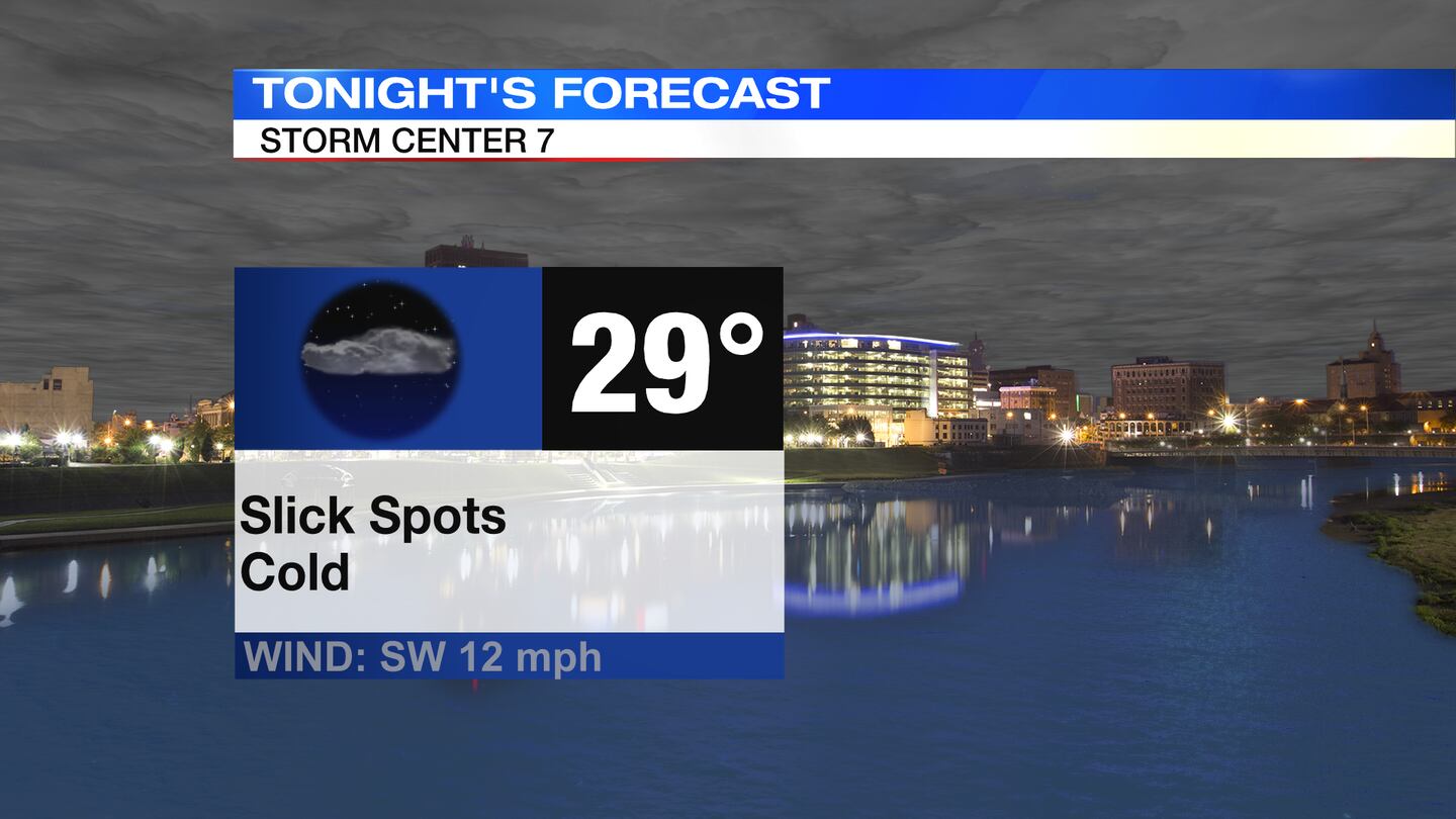
Isolated slick spots will be possible.
TOMORROW: A cold morning again with temperatures in the upper 20s.
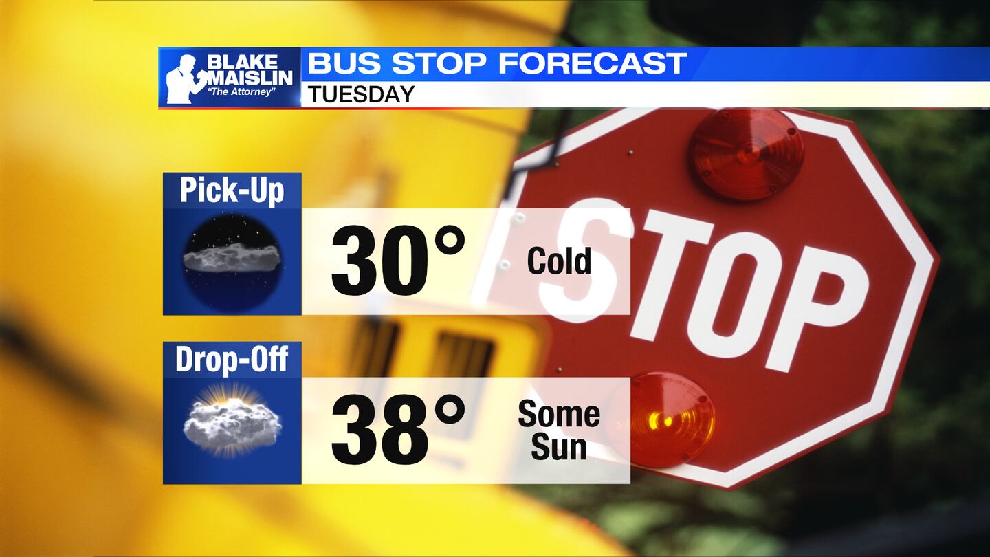
A mix of sun and clouds. Highs in the upper 30s. Clouds increase, and snow showers will overspread through the night.
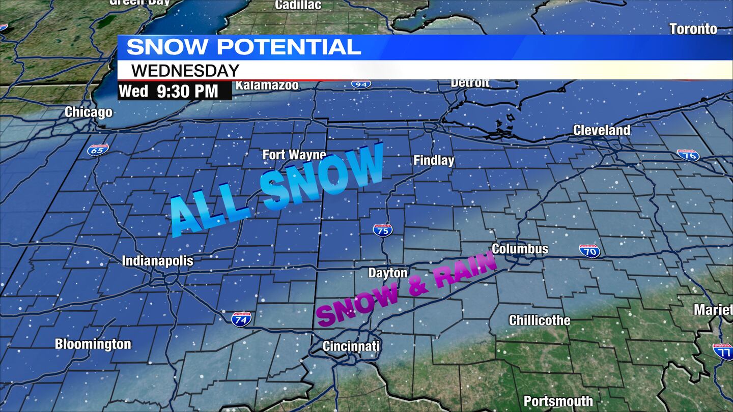
WEDNESDAY: Snow moving through, light accumulation by morning.
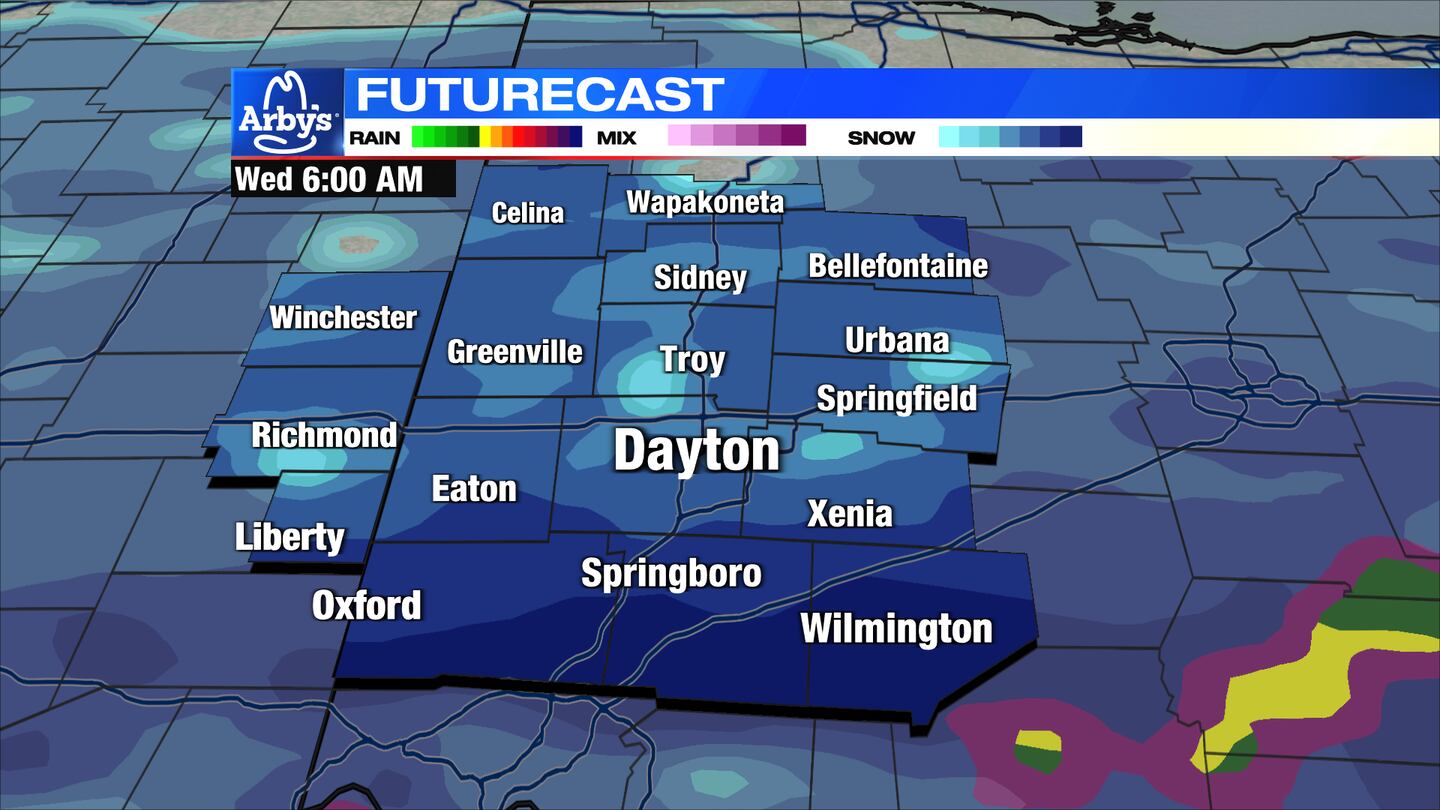
Snow will switch to rain Dayton and southeast for the afternoon; Northwest of Dayton will stay snow. Roads will be messy for the morning drive and likely schools will be canceled.
Road condition should improve for the afternoon as temperatures rise to the upper 30s and rain moves in.
All precipitation will taper and switch back to snow in the evening. Roads will become slick once again.
THURSDAY: Slick spots and some snow-covered roads may linger. Scattered snow showers are possible at any point during the day. Temperatures hold steady in the lower 30s.
FRIDAY: Slick spots early. Highs in the middle 30s. Some dry time during the day with mostly cloudy skies. More light snow showers in the evening and at night.
SATURDAY: A cold and dry day in the middle 30s. Broken clouds.
SUNDAY: More rain and snow showers possible. Highs in the upper 30s.
MONDAY: Clouds give way to sunshine and a bit colder with highs in the lower 30s.

©2023 Cox Media Group


