MIAMI VALLEY — Several rounds of severe weather are possible over the next two days.
[DOWNLOAD: Free WHIO-TV News app for alerts as news breaks]
TRENDING STORIES:
- People heartbroken, angry after 2 killed in 2 separate shootings in Springfield
- ‘You can be trooper today;’ OSHP finds new recruit on interstate
- Child flown to hospital after truck overturns in Darke County crash
The first round of storms may develop to our west around 9 p.m. tonight. Britley Ritz says if they do, they could be severe with damaging winds, large hail, and even a small risk for a tornado.
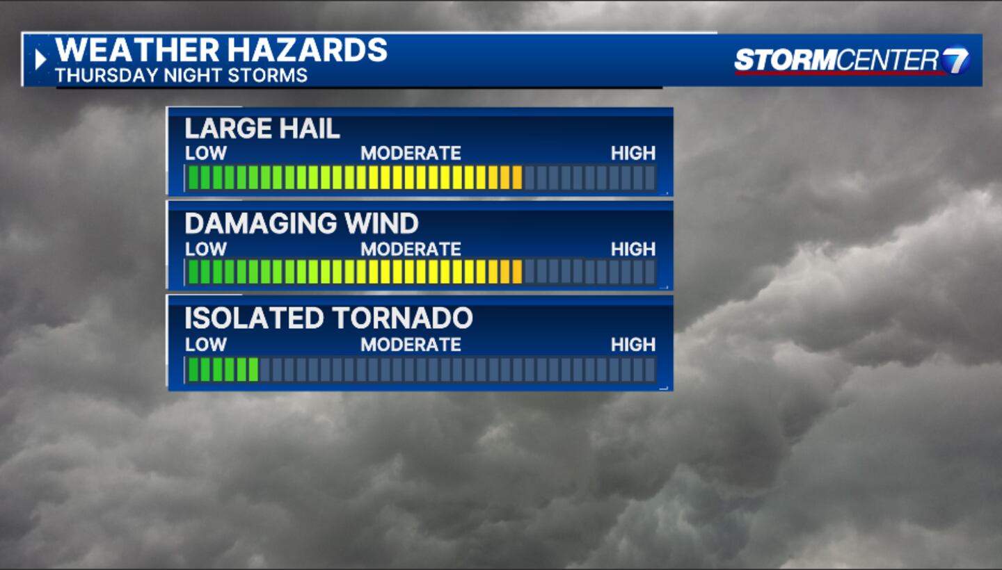

However, a capping inversion is keeping us from certainty. Ritz says this acts like a lid keeping storms from firing.
“This acts like a lid keeping storms from firing,” she said. “If the cap breaks, we get storms. If it doesn’t, we will stay quiet and calm.”
The next chance for storms is Friday night.
Ritz says there is less of a cap in the atmosphere and even more instability to work with. The only question is, does this line of storms sweep through here, or does it just miss us?

We could see damaging winds, large hail, and a few tornadoes on Friday. Parts of the area are under an enhanced risk for severe storms, Level 3 of 5.
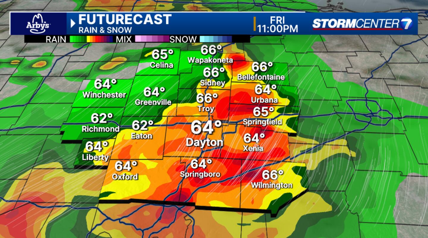
The key message is to be weather aware, but don’t be surprised or disappointed if they don’t occur.
Storm Center 7 will continue to update this developing story.
[SIGN UP: WHIO-TV Daily Headlines Newsletter]
©2025 Cox Media Group