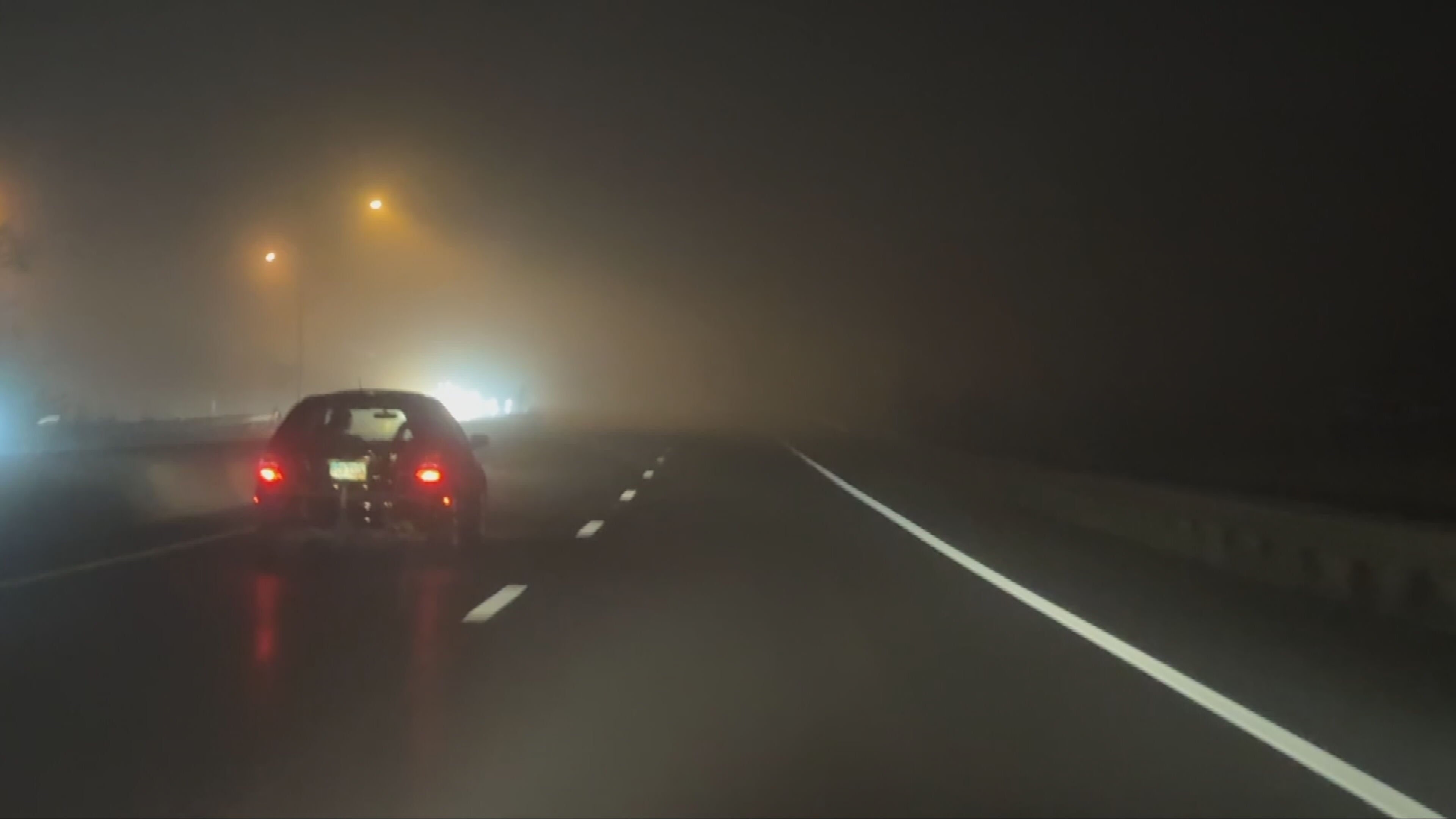
DAYTON — Good early Thursday morning, Miami Valley! Meteorologist Nick Dunn here with you. Noticing any fog out there? If so, you are not alone! We have some patchy dense fog early this morning.
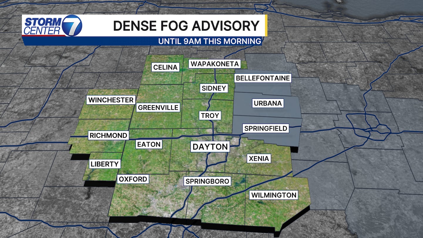
There is a Dense Fog Advisory until 9AM for Logan, Champaign, and Clark Counties. Visibility is lower east of the Miami Valley towards Columbus, but just be mindful of changing visibility in spots this morning.
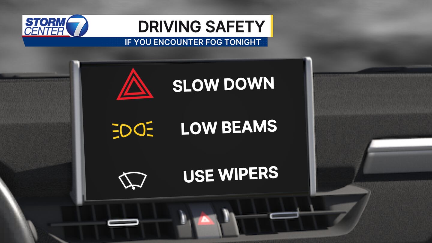
Remember to use the low beams out there! Additionally, some frost means a quick scrape of the windows might be needed as you head out the door. Just enough to be a bit of a nuisance!
[DOWNLOAD: Free Storm Center 7 Weather app for alerts as news breaks]
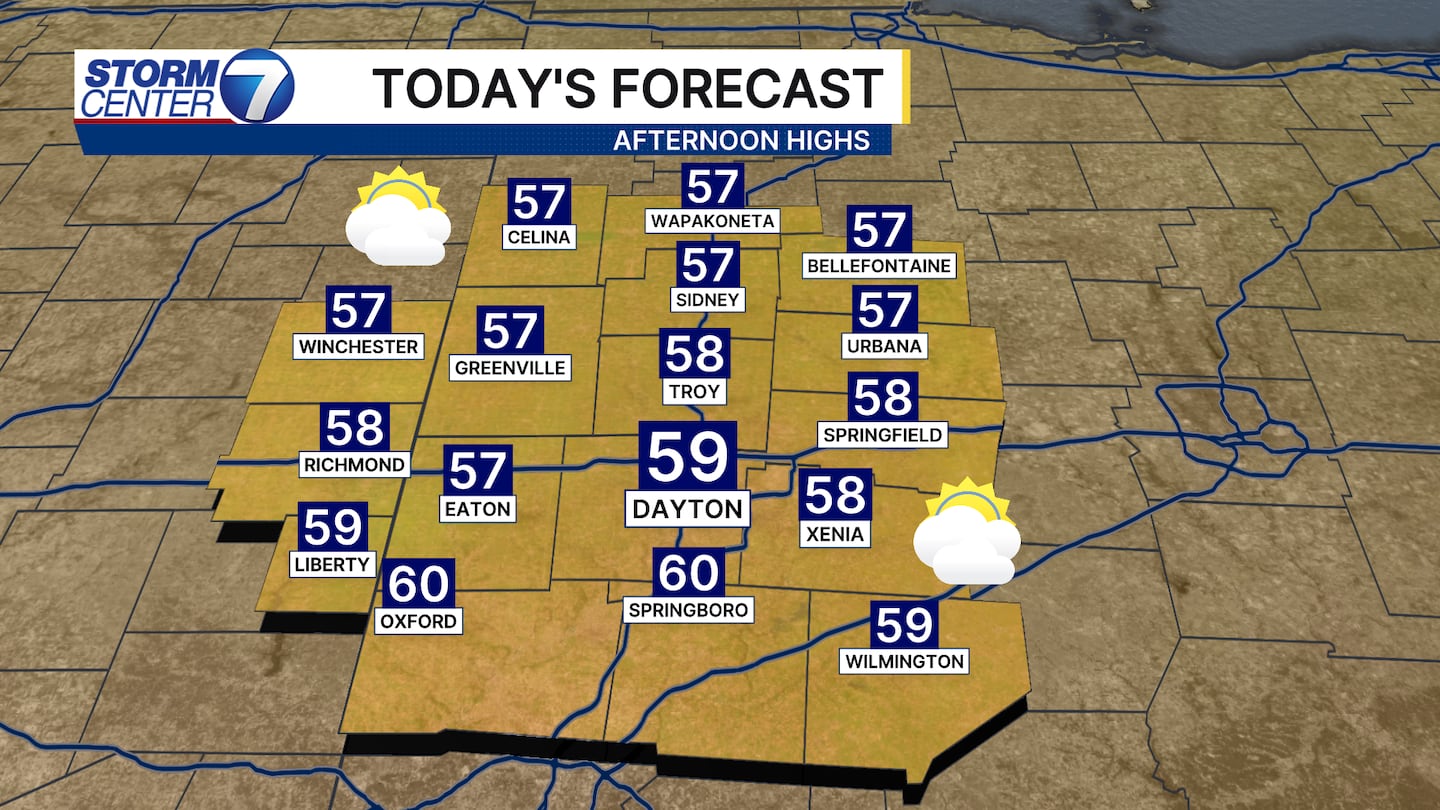
By this afternoon we are much warmer with highs in the mid to upper 50s for most! Breezes from the south increasing combined with a warm front approaching will help boost our temperatures. A spotty shower is possible around dinner time but most are dry. Better rain chances arrive into early Friday!
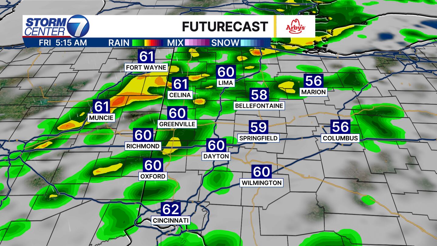
Be ready for rain and a few rumbles of thunder early Friday! This is quick moving, but wet roads and stronger gusts to 40 miles per hour will be enough to dampen the morning commute. Highs in the low 60s are likely in the morning hours before we dip back into the 50s by the afternoon.
The record high for Friday is 61 degrees set 80 years ago in 1946! I think we have a good shot to tie or break it!
[WATCH Storm Center 7 Weather on the following devices]
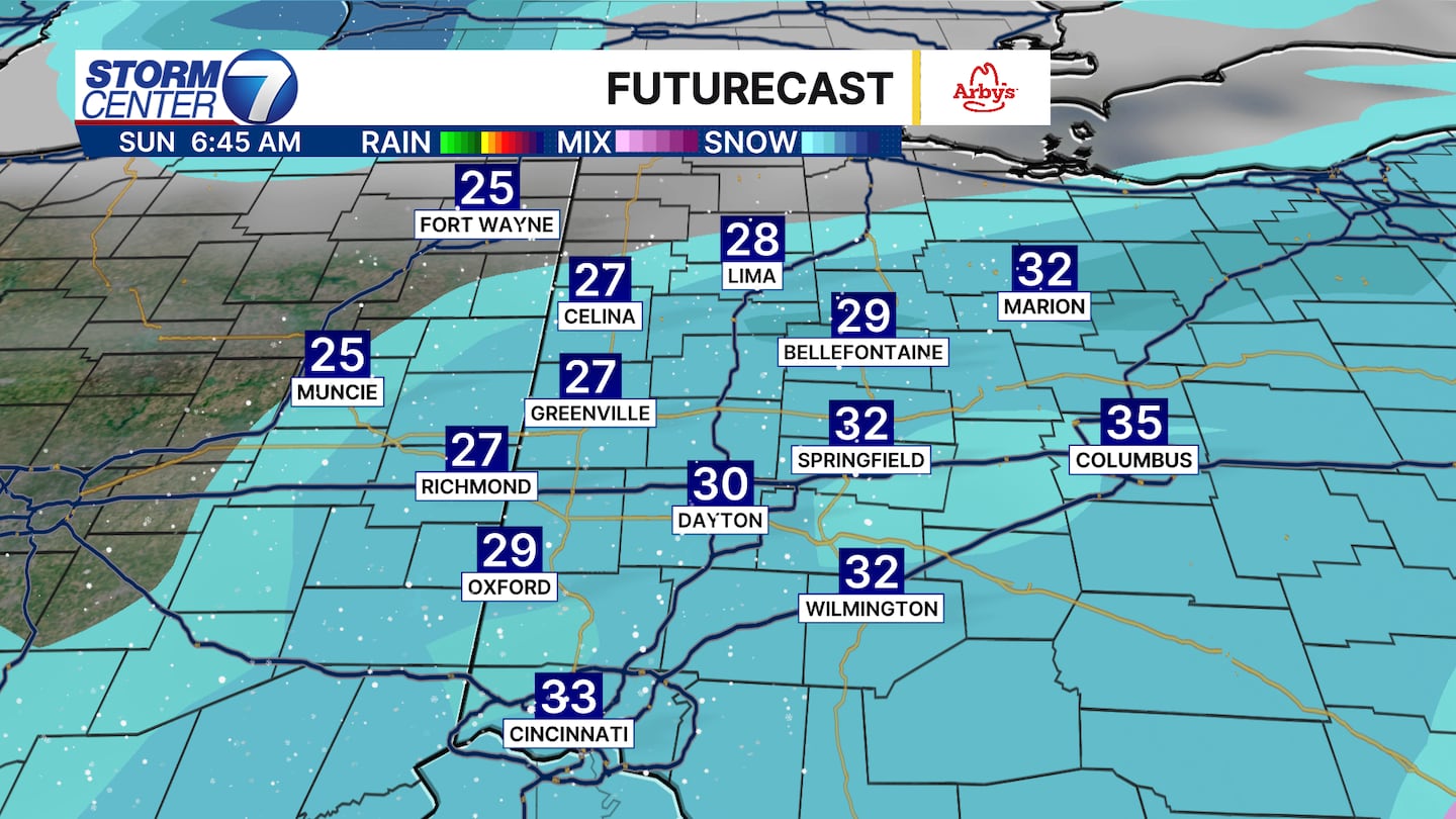
By Sunday we will have a few flurries flying around after some rain showers exit on Saturday. A big change in temperatures from the near-record highs on Friday!
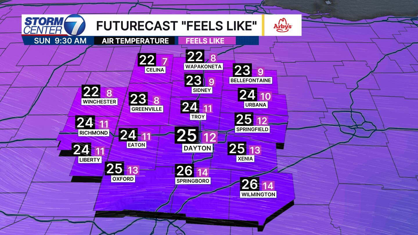
Add in some wind and we will have wind chills in the teens as you head out to church or breakfast! Brrr!
©2026 Cox Media Group


