The National Weather Service has issued a Severe Thunderstorm Watch for Butler, Warren and Clinton counties until 2 a.m.
QUICK-LOOK FORECAST:
- Few storms tonight
- Hot end to work week
- Showers and storms over the weekend
>>TRACK THE CONDITIONS: Live Doppler 7 Radar
DETAILED FORECAST:
TODAY: Sunshine returns this afternoon with some scattered clouds around. It will be a warmer day, too, with highs in the lower to middle 80s.
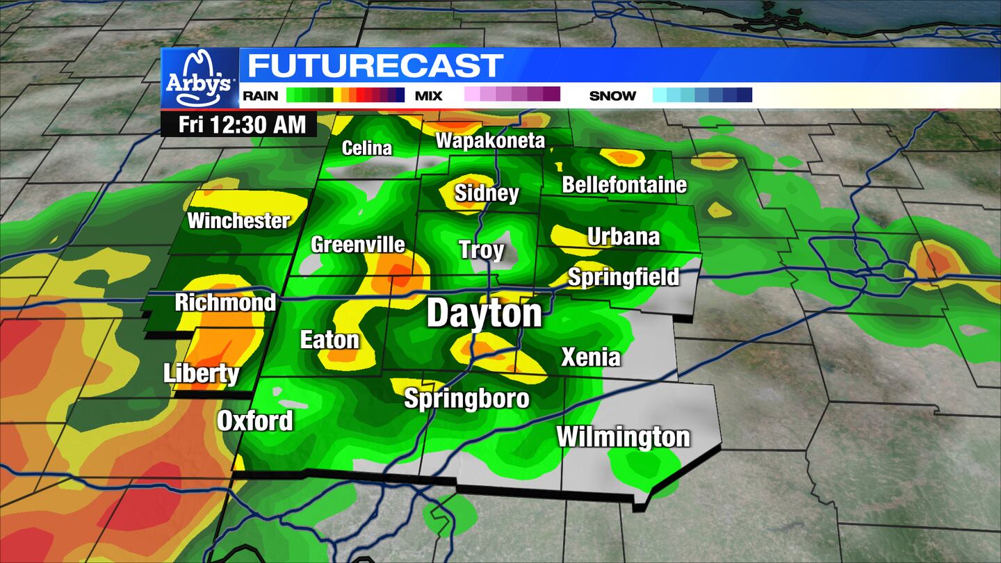
Some showers and storms passing showers and will develop late evening into the night, mainly south of I-70.
One or two storms could become severe with damaging winds the primary threat. Small hail and heavy rain is possible, too.
>> Summer-like heat to arrive on Friday
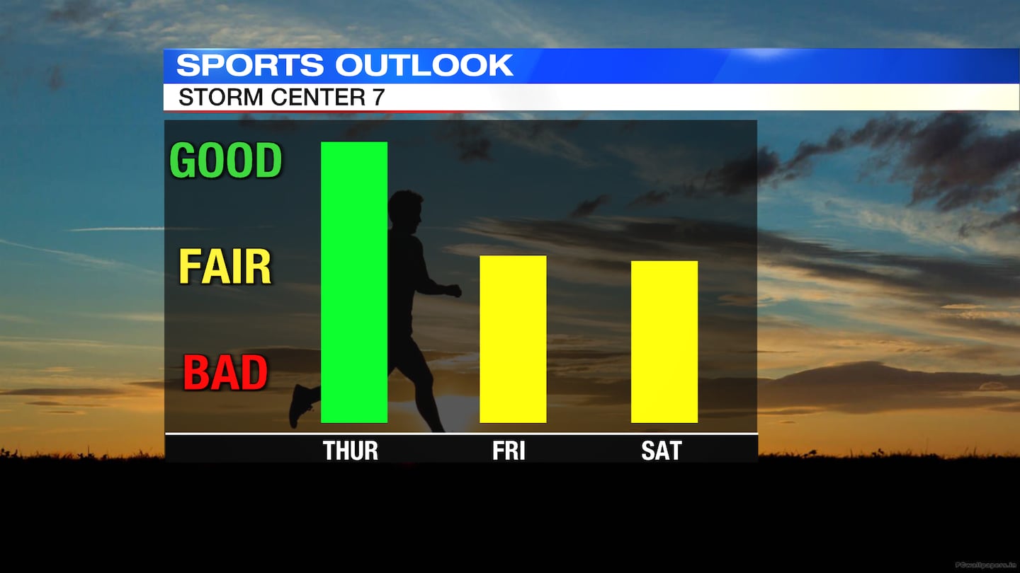
FRIDAY: Hot and windy day. Skies are clear with sunshine in the afternoon. Gusty winds up to 35mph are possible. Highs are expected around 90 with a heat index in the mid-90s.
SATURDAY: Clouds increase through the day. Highs in the middle 80s and a little muggy. Scattered showers and storms in the evening and lasting into the overnight hours. An isolated strong storm early in the night is possible.
SUNDAY: Any showers push east through the morning. Sunshine for the late afternoon. It will be a cooler day in the upper 60s.
MONDAY: A nice start to the week. Highs in the upper 60s and sunny.
TUESDAY: A dry start to the day with highs in the middle 70s. Some showers could develop at night.
WEDNESDAY: Scattered showers and storms develop. Highs around 70.
©2022 Cox Media Group


