
QUICK-LOOK FORECAST:
- Rain arrives late Tuesday
- Cooler, then a huge warm-up
- Chances for storms this weekend
>>TRACK THE LATEST CONDITIONS: Live Doppler 7 Radar
DETAILED FORECAST:
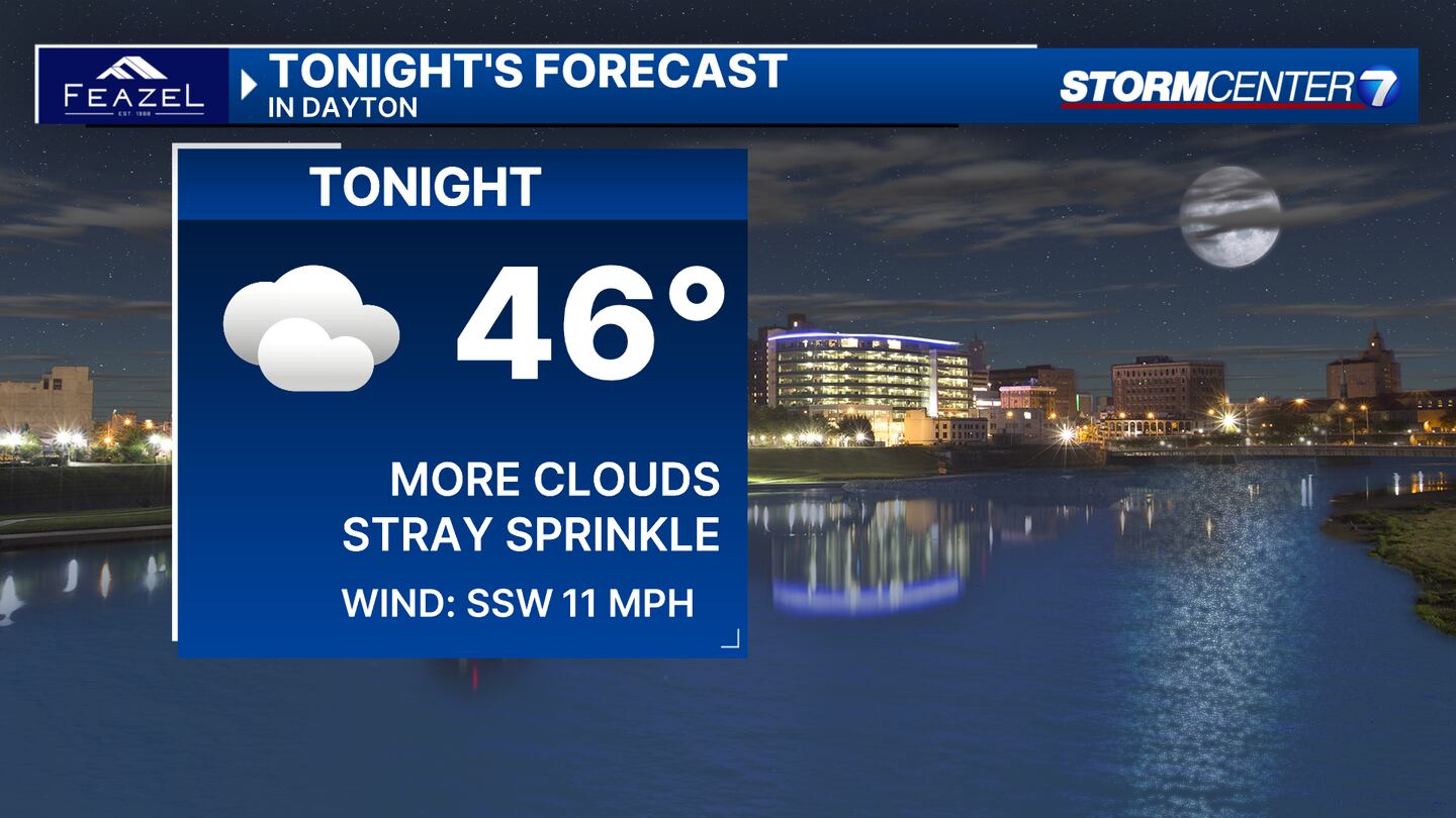
MONDAY: Clouds increase. Dry aside from a passing sprinkle overnight into Tuesday morning. Not nearly as cold overnight with lows in the middle 40s.
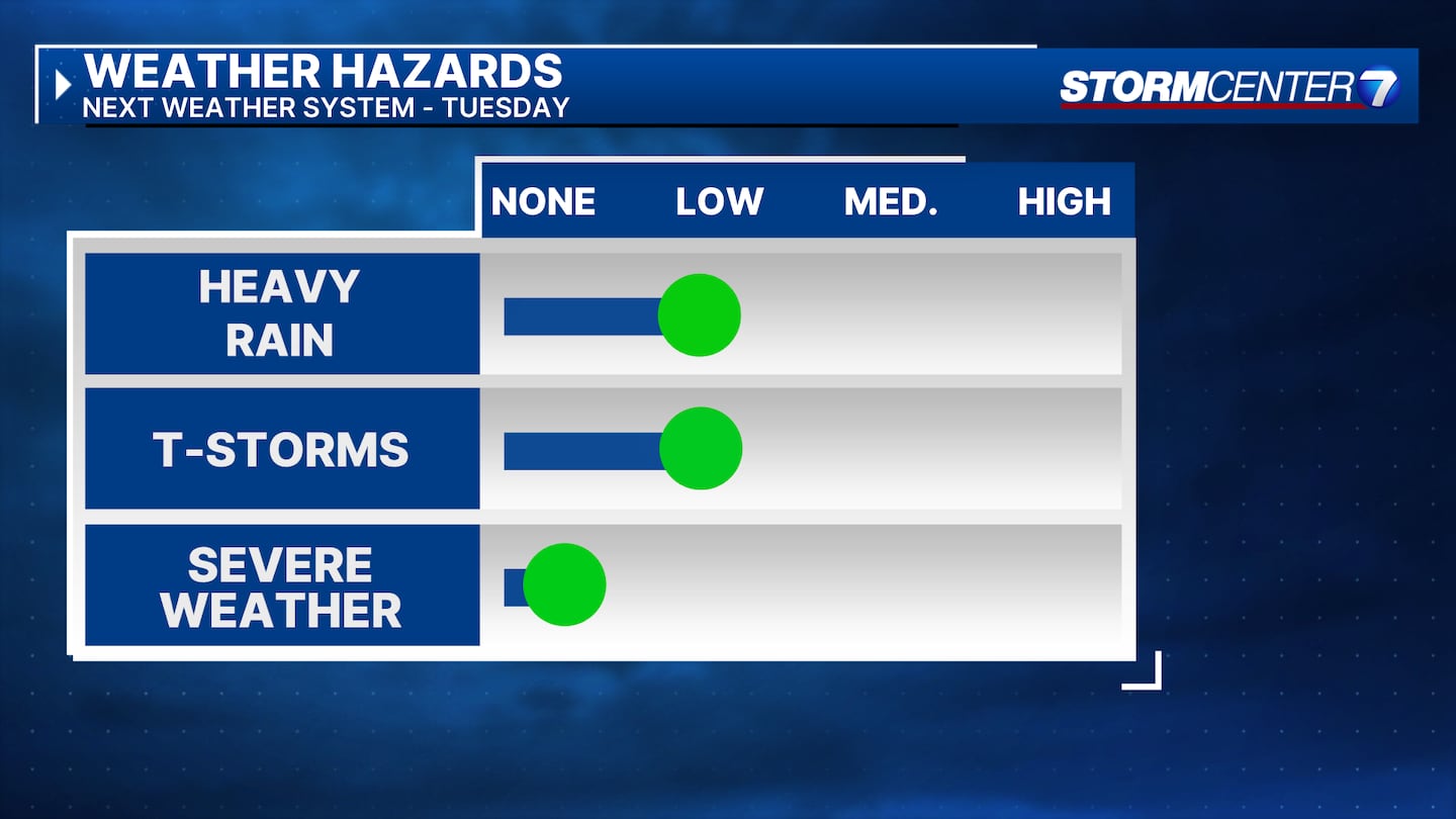
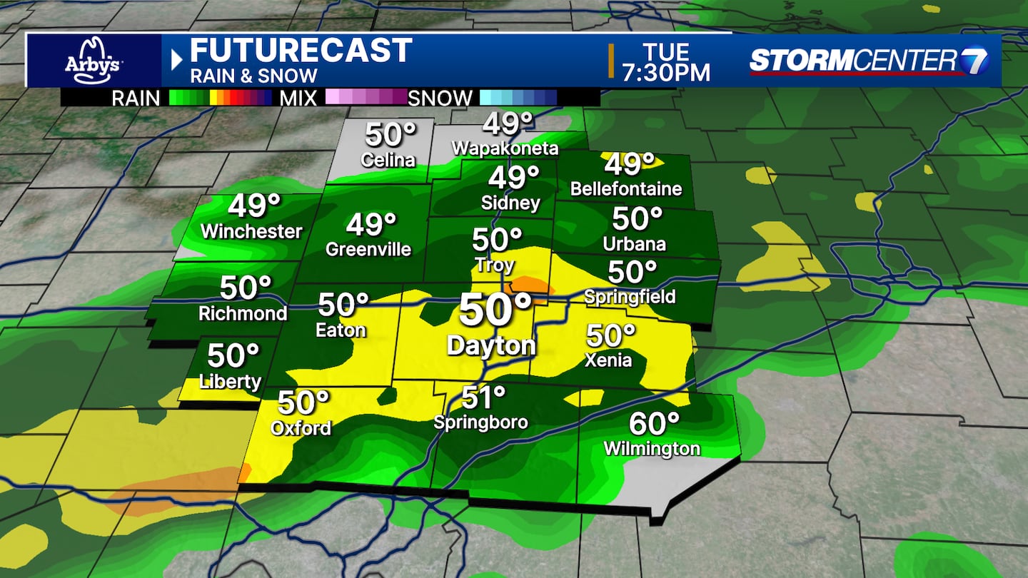
TUESDAY: Cloudy with a good chance of showers arriving later in the day.
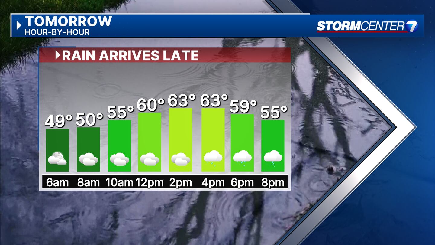
An isolated thunderstorm is possible, but we avoid the risk of severe weather. Mild with highs in the mid-60s.
WEDNESDAY: Clouds may be stubborn to clear, but at least we’re dry. Much cooler with afternoon temperatures struggling to get past the low 50s. Breezy.
THURSDAY: Mostly sunny mild with highs in the lower 60s.
FRIDAY: The chance of a few showers returns late in the day as of now with highs in the upper 60s to near 70.
SATURDAY: A chance for showers and thunderstorms. Much warmer with highs in the mid to upper 70s.
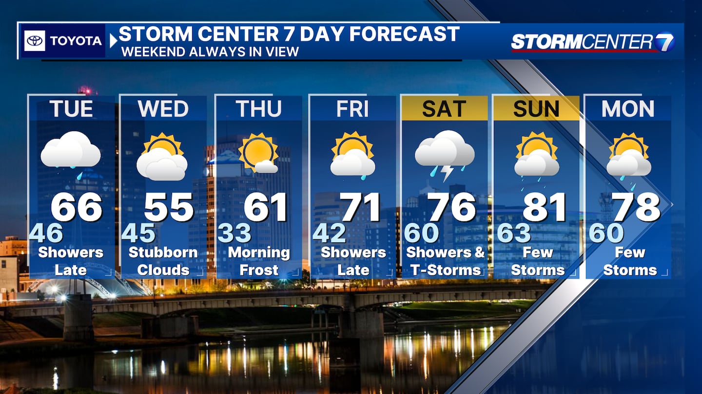
SUNDAY: Another chance for showers and thunderstorms. Keeping eyes on the potential for strong storms. Warm again with highs in the upper 70s to around 80.
MONDAY: Partly cloudy with another chance for storms. Highs in the upper 70s.
©2024 Cox Media Group


