
DAYTON — Good morning to all of you on this Friday! Meteorologist Nick Dunn here on what is the coldest start to any morning this season. Wapakoneta dropped to a low of -2 degrees this morning, while Dayton recorded a low of 12. Clouds helped us “warm” a bit overnight, but for early December this is definitely cold!
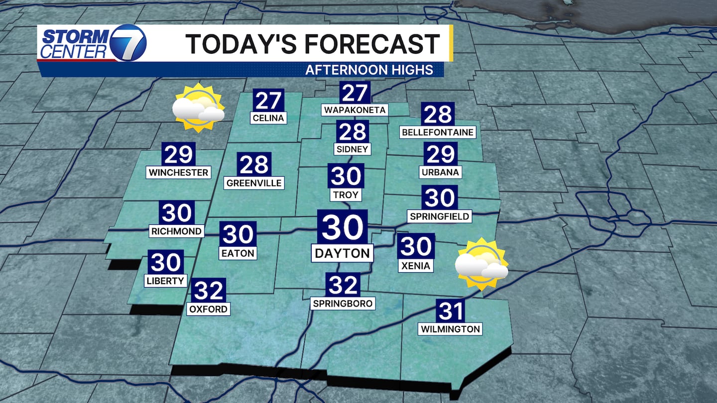
At least it is Friday! Highs climb into the upper 20s and lower 30s this afternoon and that is a solid improvement for most compared to where we started out today.
[DOWNLOAD: Free Storm Center 7 Weather app for alerts as news breaks]
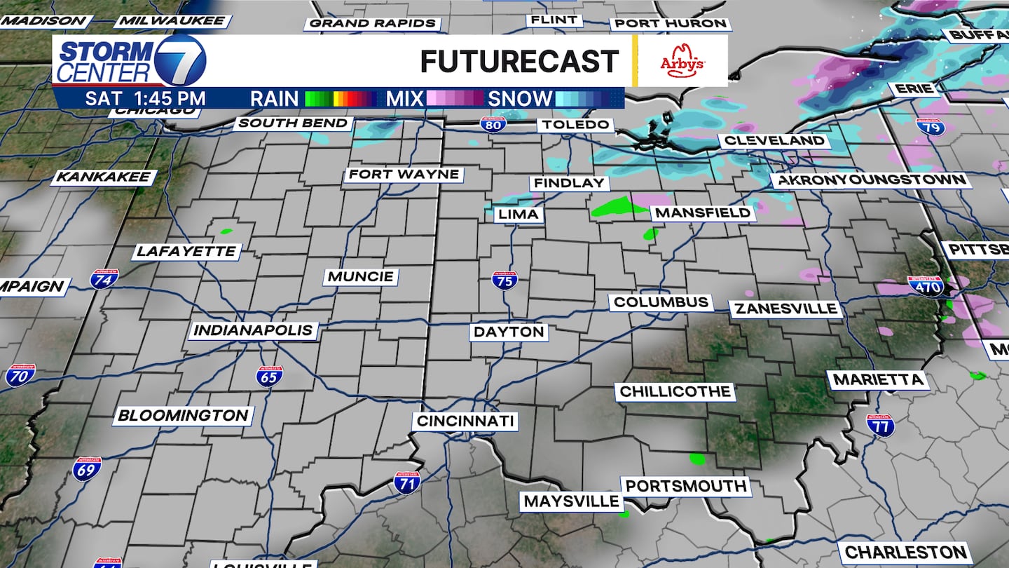
The first of two systems moves through tomorrow, but I think most stay dry. Highs climb to the lower and middle 30s. A few sprinkles or snowflakes may fall but I suspect little or no accumulation at best.
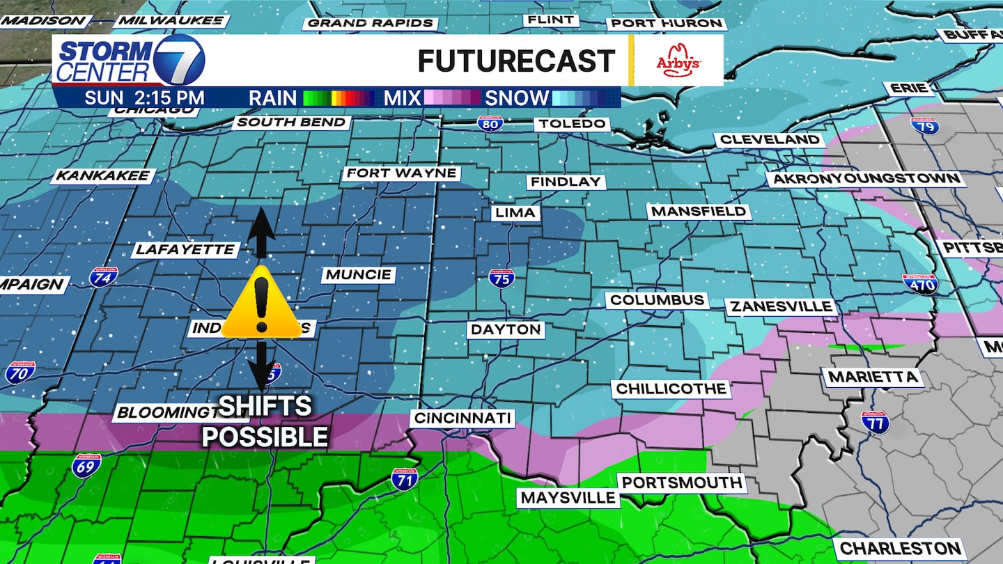
Sunday brings a stronger system into the region. While high temperatures may climb just above freezing in the afternoon, we may have enough snow to bring a light accumulation. Depending on the track of this system will dictate how much we see and if any rain mixes in. As of now, I am not expecting major impacts to travel given marginal temperatures in place, but let’s watch the trends to see if we need to make any adjustments.
[WATCH Storm Center 7 Weather on the following devices]
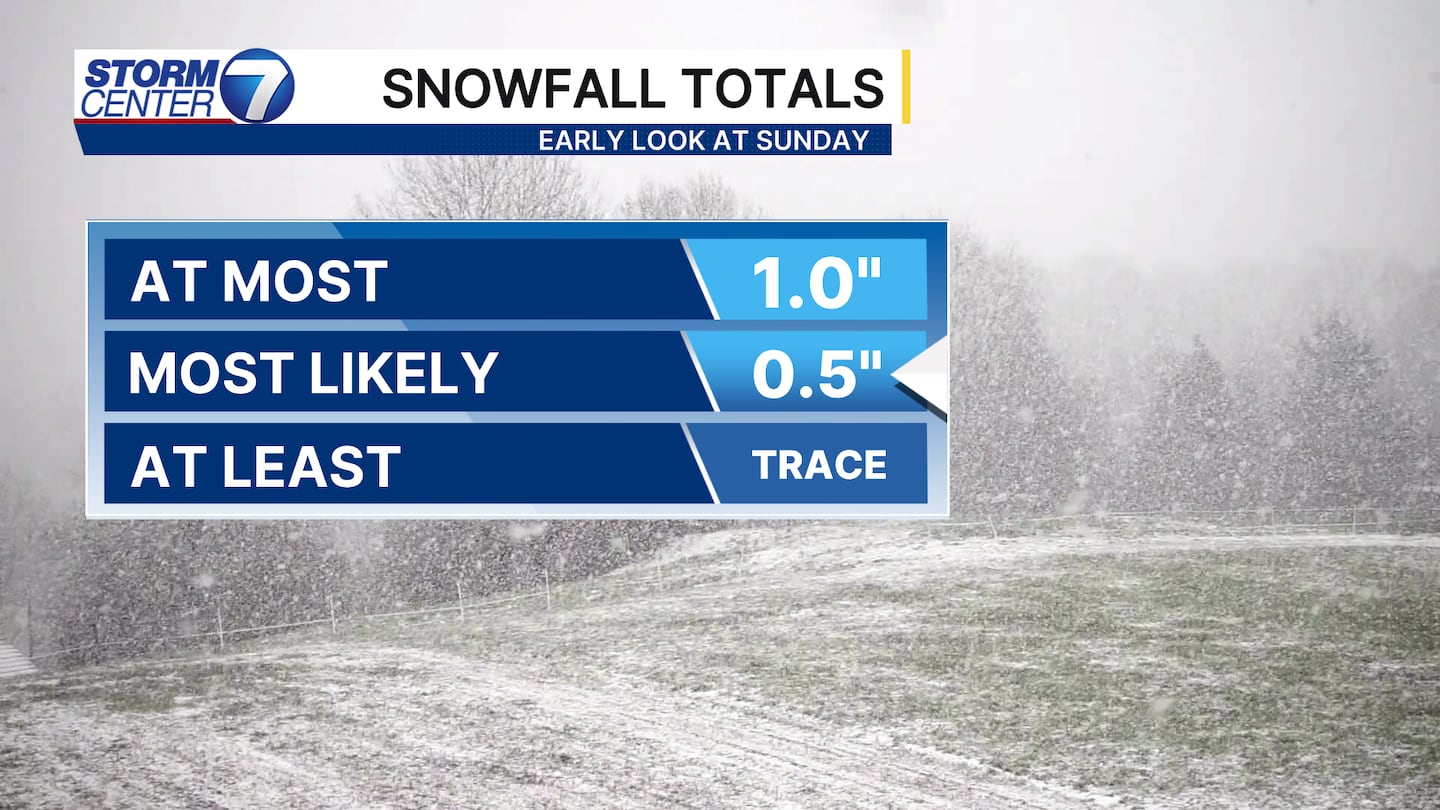
Snowfall totals do not look very impressive at all with Sunday’s system. In fact, as of this morning I expect no more than 0.5″ in most areas, with the top amount being 1″ if a band or two of snow out performs expectations. Newer data coming in over the next 24 hours will help us finalize if these current trends hold or if any changes are needed.
Enjoy the rest of your Friday and stay warm!


