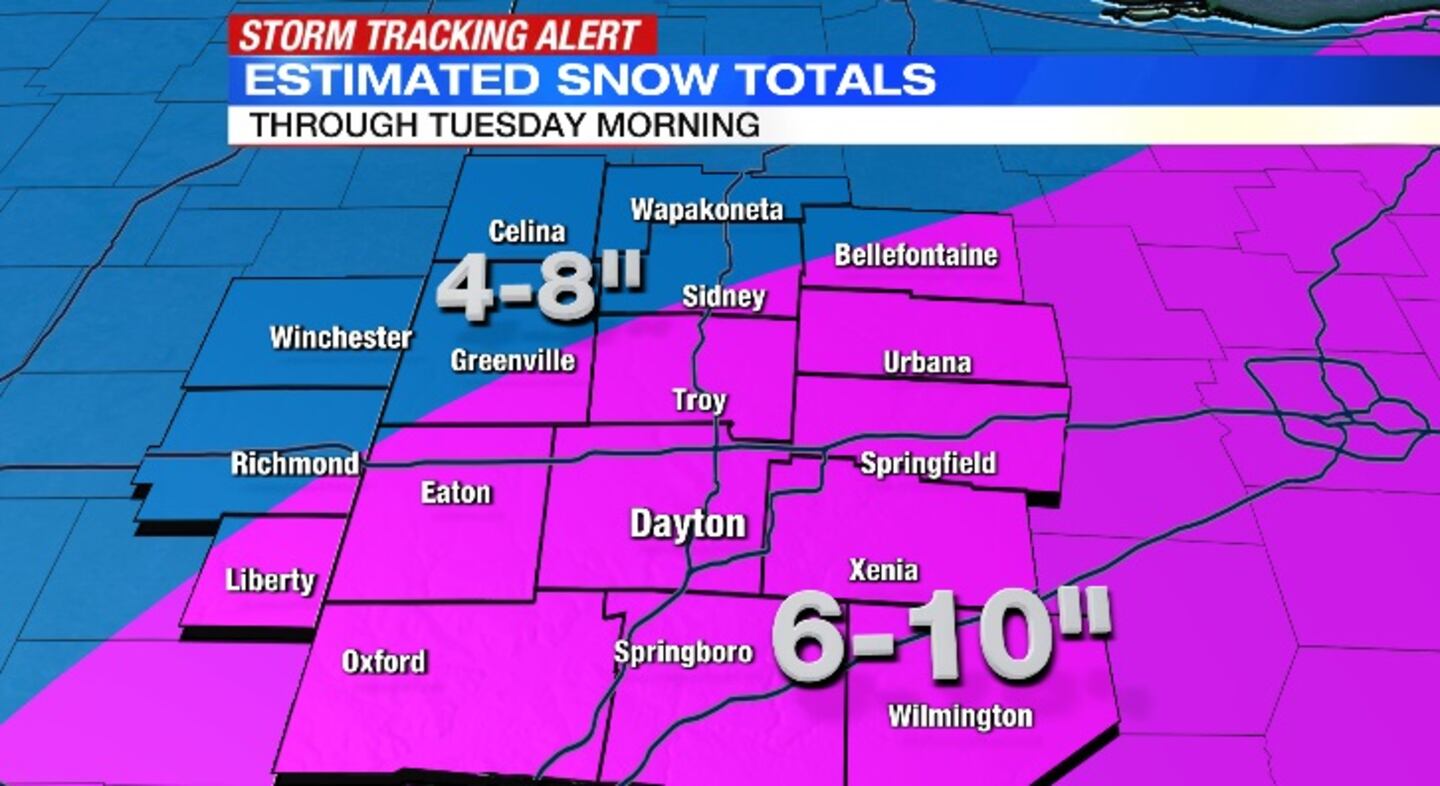
A Winter Storm Warning will be in effect from 1 a.m. Monday until 1 p.m. Tuesday.
QUICK-LOOK FORECAST:
- Winter Storm Warning
- Snow begins Sunday night
- Significant snow Monday, tapering off Tuesday AM
>>TRACK THE CONDITIONS: Live Doppler 7 Radar
DETAILED FORECAST:
>>What We Know: Snowstorm potential early next week
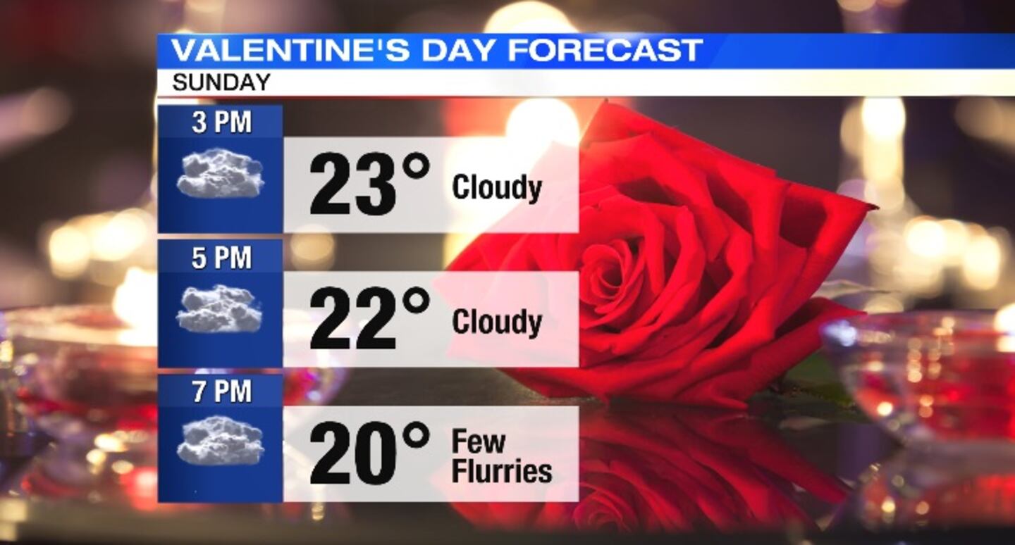
TODAY: Cloudy with a few flurries this evening. Temperatures will be falling through the 20s. Steadier snow arrives after midnight. Temperatures will fall to the middle teens with wind chills below zero.
MONDAY: Snow begins overnight with moderate to heavy snow, 1-3″ for the morning commute. Snow tapers off midday before another round of heavy snow arrives for the evening commute, sticking with us until after midnight. Another 5-7″ expected with a storm total of 6-10″. Highs in the low-20s. Winds will increase with gusts up to 30mph Monday night. This will create blowing and drifting snow. Visibility will drop quickly in spots.
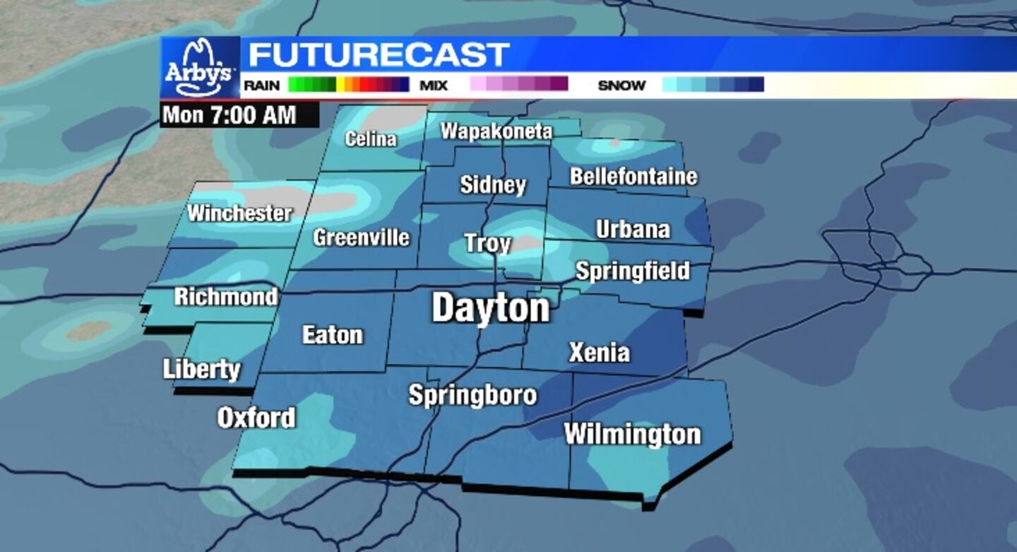
TUESDAY: Some light snow showers may linger into the start of Tuesday. Hazardous roads will remain through the morning. Mostly cloudy with a few flurries through the afternoon. Highs in the upper teens. Wind chills: 0s. Wind: NNE 5-10 mph.
WEDNESDAY: Bitter cold with wind chills below zero to start. A mix of clouds and sun later with highs in the middle 20s. Light snow showers return late day into Wednesday night
THURSDAY: Snow showers likely on Thursday. It will be a windy and cold day with highs in the lower 30s.
FRIDAY: Mostly cloudy, windy and cold with a few passing flurries. Highs in the lower 20s.

Cox Media Group


