
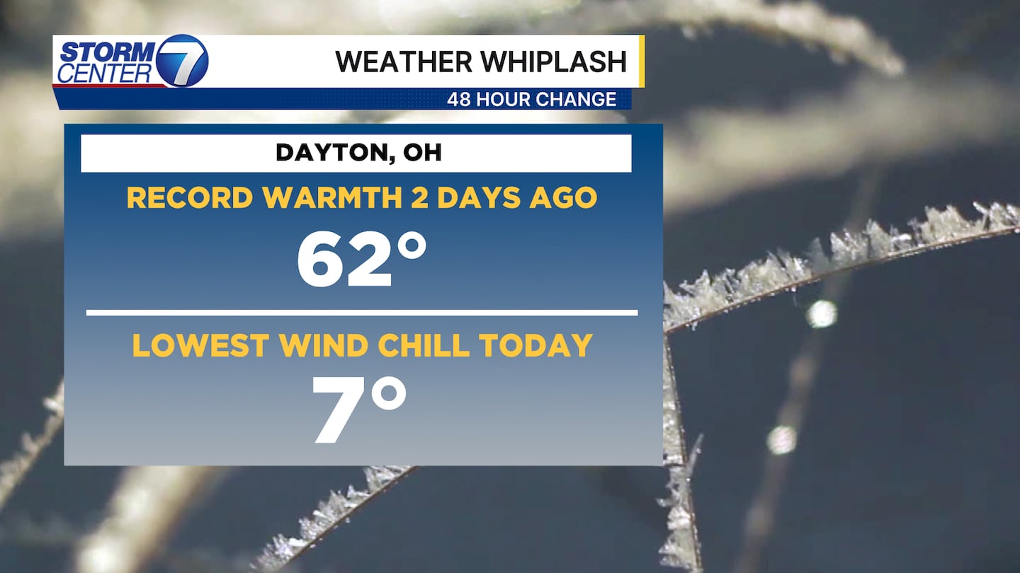
DAYTON — Good evening, everyone! Happy Sunday to you. I hope you had a great weekend. Meteorologist Nick Dunn here with you to walk you through what to expect this week. Hard to believe we are in the 20s with wind chills after being in the 60s a couple days ago, right? When we forecast a change that is a shock to the system...this verifies spot on!
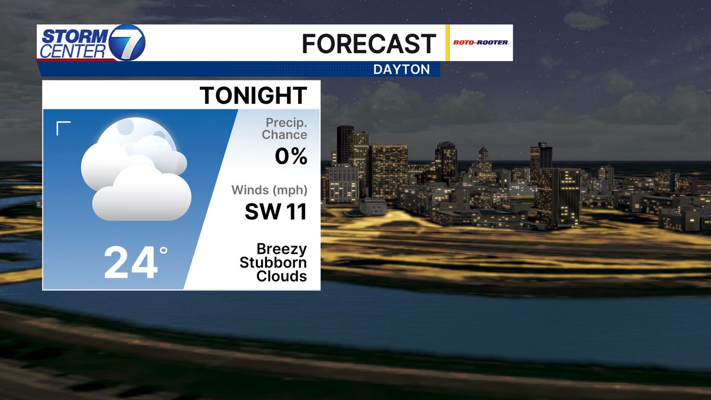
Overnight lows will not fall too far tonight. Expect middle 20s in the morning as we head out to work and school! Add in a breeze and it will feel more like the low to middle teens.
[DOWNLOAD: Free Storm Center 7 Weather app for alerts as news breaks]
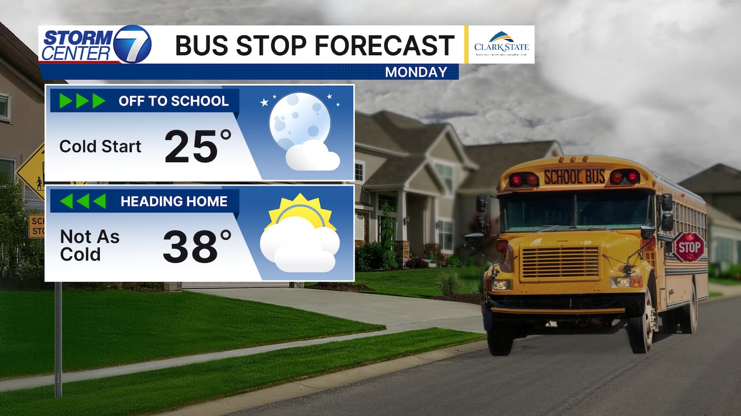
At the bus stop the kids will need a heavier coat early on. Expect a breezy day with variable cloudiness and highs in the upper 30s to low 40s. This is a bit milder than today, but it will still feel chilly.
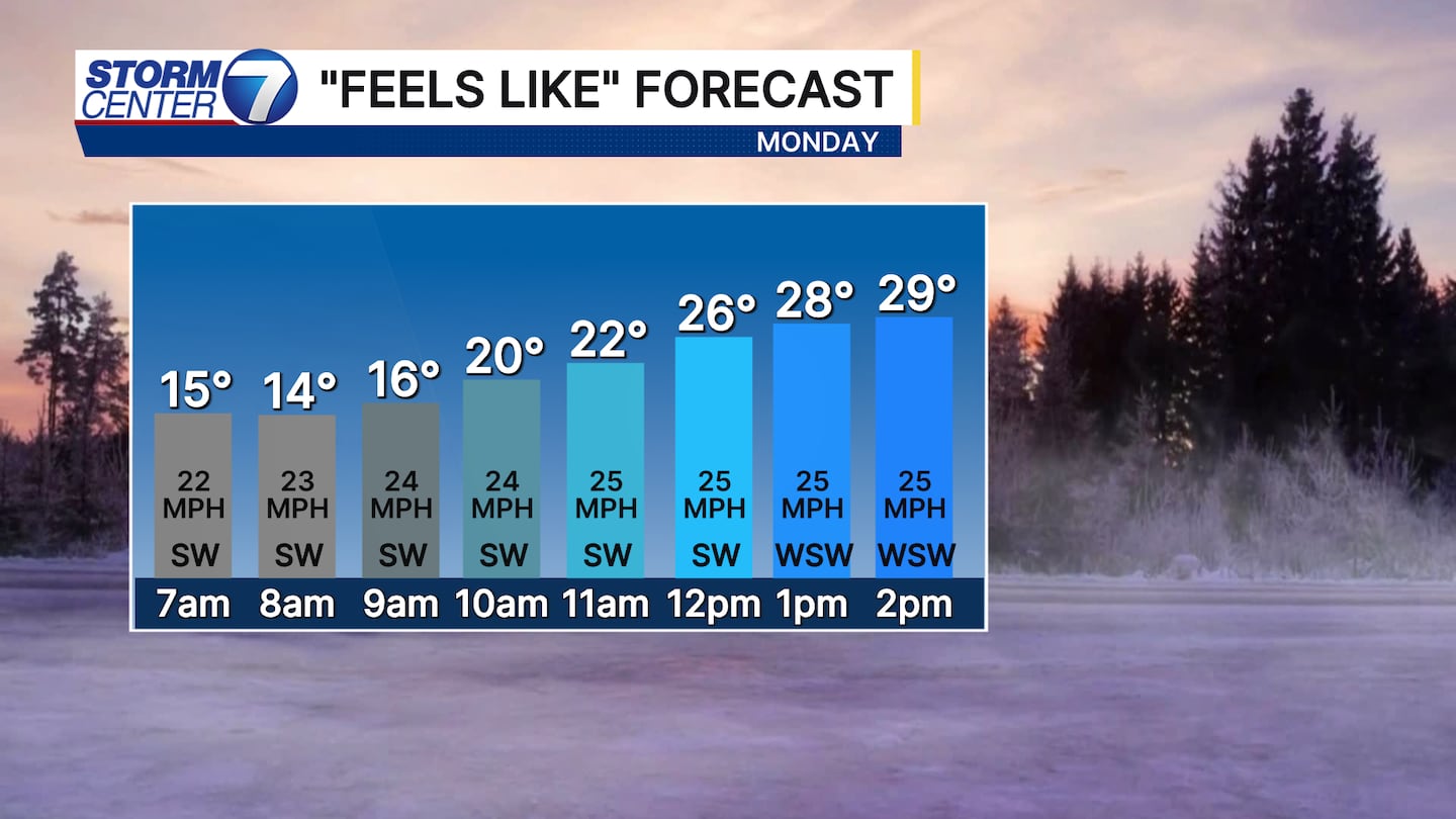
Your wind chill forecast for Monday shows gusts of 20-30 miles per hour adding a chill to the air through the day. The wind direction will help a bit being from the southwest.
[WATCH Storm Center 7 Weather on the following devices]
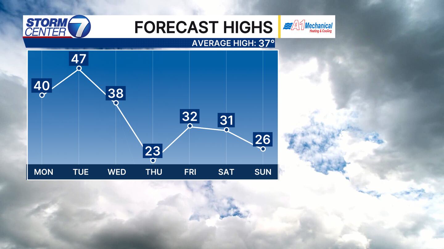
The temperature trends this week resemble another roller coaster! By Thursday, highs struggle to get out of the lower 20s! While maybe not as drastic of a change, it will still be a solid shock to the system. We are also watching a midweek system to be an inconvenience.
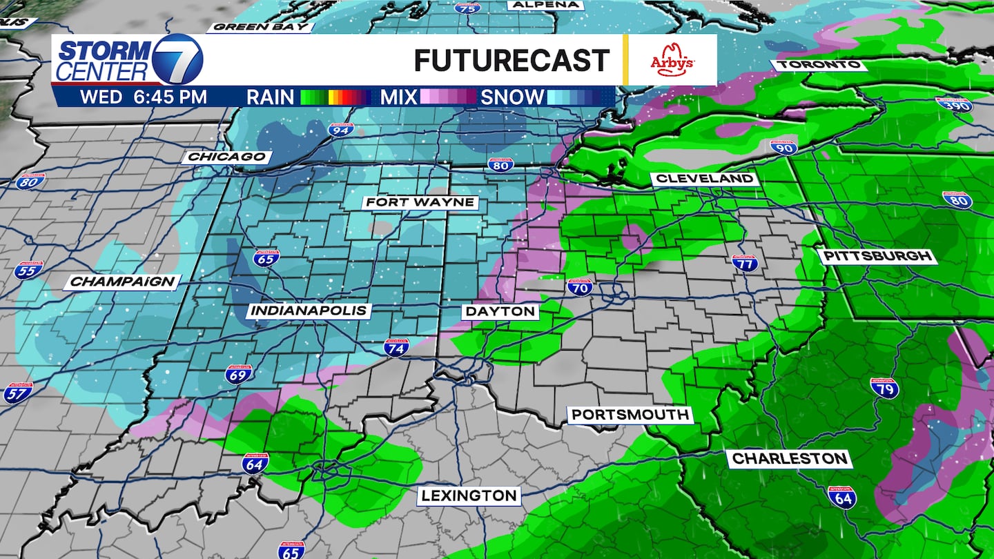
Rain showers Wednesday will mix with and change to snow during the nighttime hours. A few flurries or light snow showers could linger into Thursday morning as well. It remains too early for exact snow totals, but some light accumulations cannot be ruled out! Stay tuned this week and have a good one!
©2026 Cox Media Group


