DAYTON, OH — Heavy snow is less than 24 hours away from the Miami Valley. All of us will see snow. After the snow, we’ll get dangerously cold.
TIMING: Snow flurries and light snow showers are possible tonight into Saturday morning. The main event with the steady and heavy snow comes in around lunchtime on Saturday. Snow will taper off between 9PM and midnight.
[DOWNLOAD: Free Storm Center 7 Weather app for alerts as news breaks]
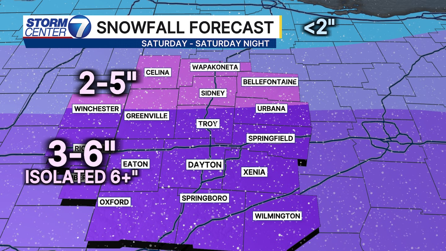
ACCUMULATION: Along and south of US-36, 3-6 inches of snow is likely. An isolated total above 6″ can’t be ruled out. North of US-36, we’re expecting 2-5 inches.
IMPACTS: Roads will quickly become snow covered on Saturday. With temperatures falling to near zero overnight Saturday into Sunday morning, salt will become ineffective. I expect travel issues to persist through Sunday, if not Monday morning.
[WATCH Storm Center 7 Weather on the following devices]
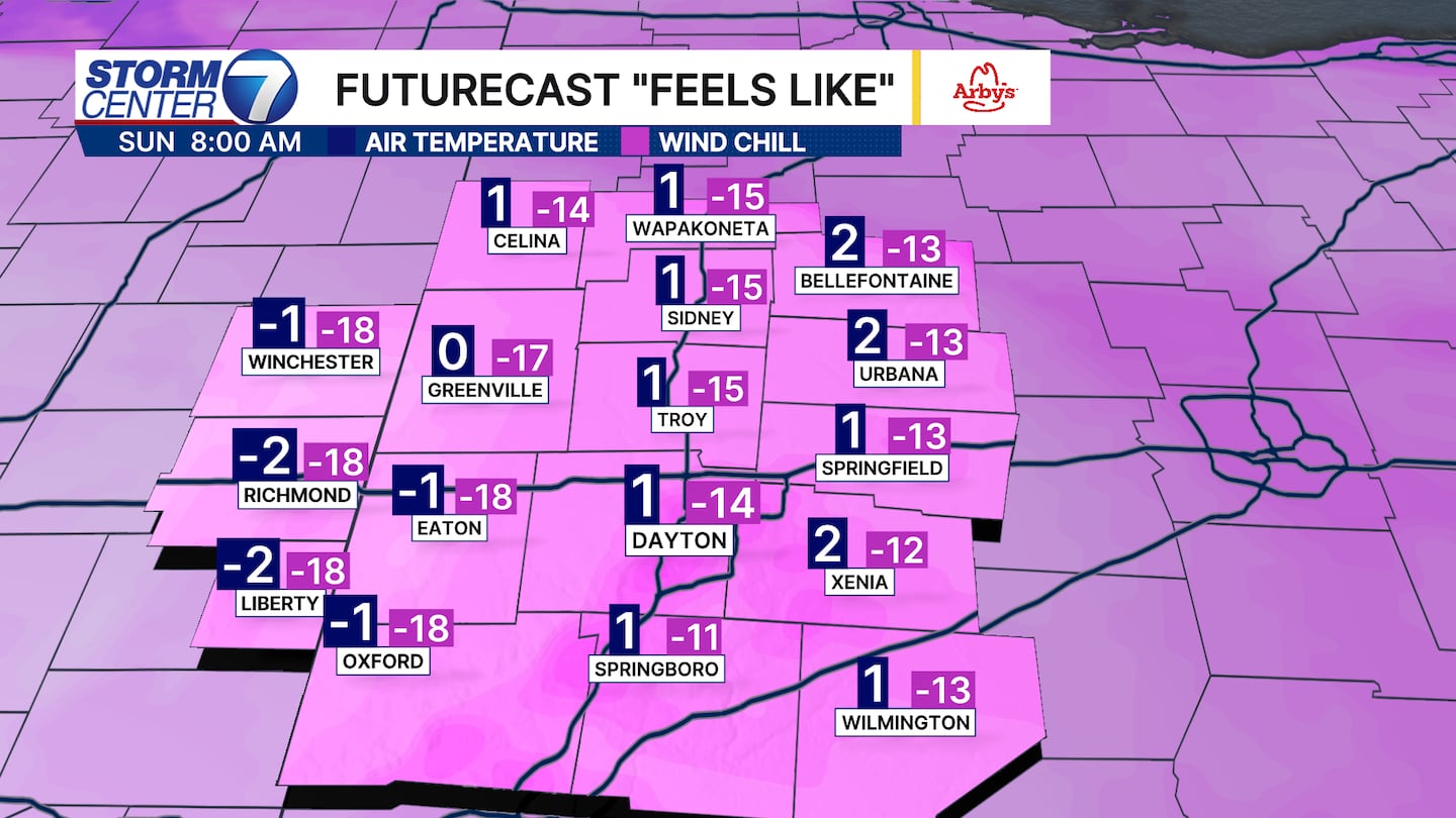
COLD: Sunday morning will be the coldest timeframe for the Miami Valley. Low temperatures will be near zero with wind chills down to -15. Frost bite can set in after only 30 minutes in this type of cold. Wear a hat and gloves, and dress in layers. Limit time outside. High temperatures on Sunday only rebound to the lower teens. We’ll drop to the single digits again Monday morning.