
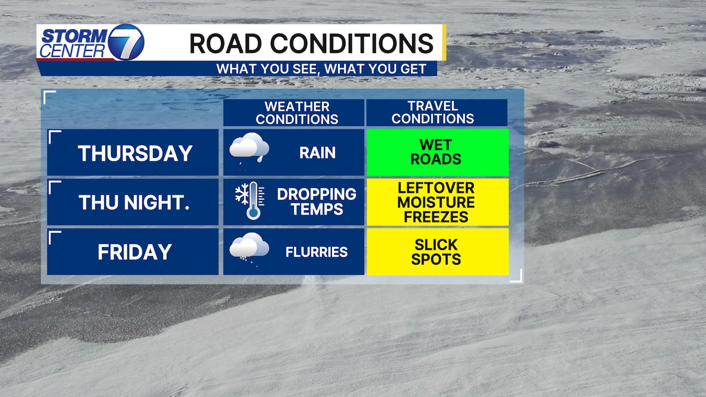
DAYTON, OH — We have a lot of weather to get through over the next 24 hours, all thanks to a strong cold front. This evening, rain showers are likely.
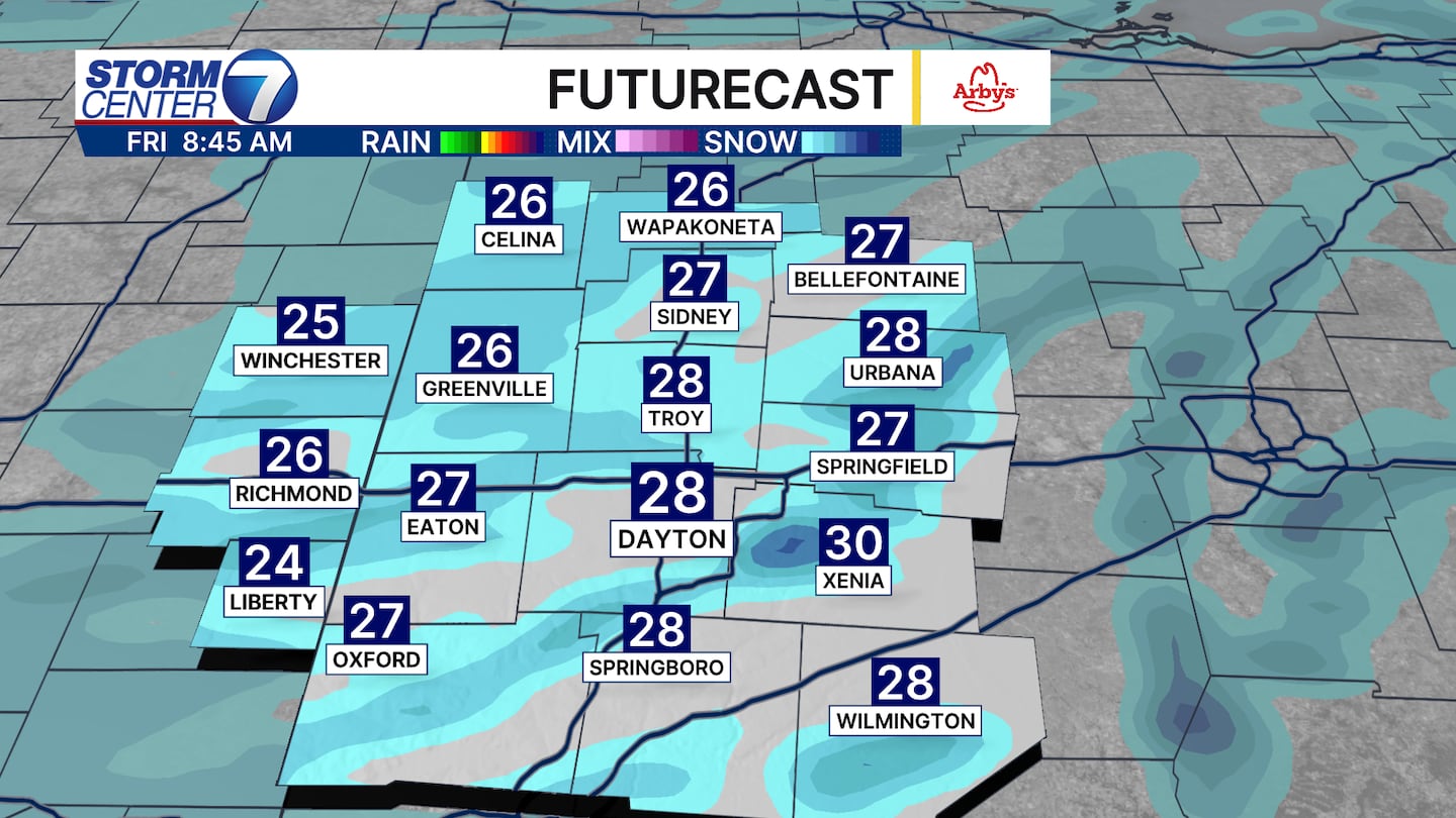
Late tonight into early Friday morning, we’ll have temperatures quickly fall below freezing. This will transition the remaining moisture over to snow showers with light accumulation possible.
[DOWNLOAD: Free Storm Center 7 Weather app for alerts as news breaks]
Watch out during the Friday morning drive into work. Wet roads from earlier rain, plus falling temperatures, and some snow will all combine to produce slick spots.
Roads may appear only wet, but with black ice possible, roads may easily be slick. Reduce your speed and give yourself extra time to reach your destination tomorrow morning.
[WATCH Storm Center 7 Weather on the following devices]
The weather stays windy between this evening and Friday, with gusts in excess of 40MPH possible. These winds, combined with temperatures in the teens and low 20s on Friday, could produce wind chills in the single digits.
The cold blast will be short-lived. We rebound to the 40s on Saturday.


