QUICK-LOOK FORECAST:
- Overcast, chilly tonight into Monday
- Weak system brings rain/snow Tuesday
- Several dry days in a row after Tuesday with sunshine poking through
>> TRACK THE LATEST CONDITIONS: Live Doppler 7 Radar
DETAILED FORECAST:
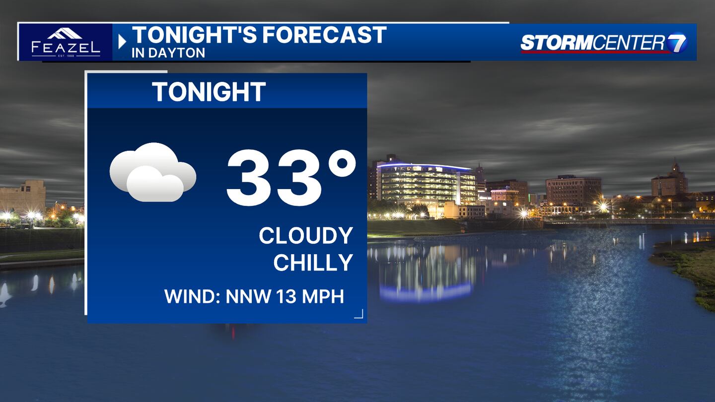
SUNDAY: Showers coming to an end aside from a stray flurry or sprinkles. Winds gradually weaken some as well with lows not dropping much into the lower to mid-30s.
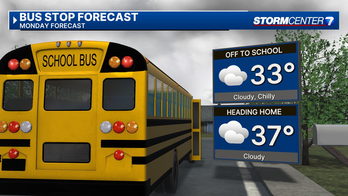
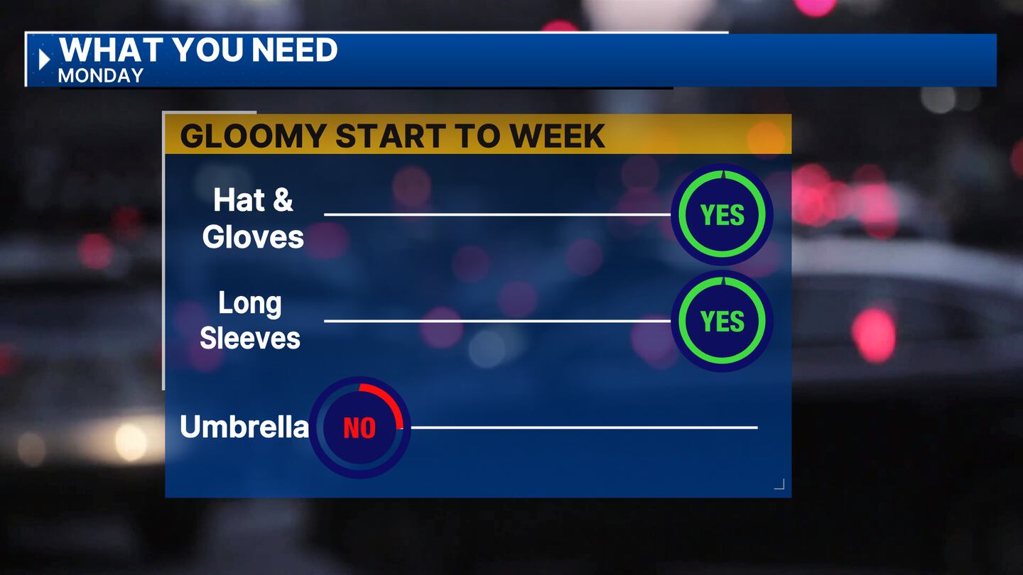
MONDAY: Mostly cloudy and a bit colder with highs in the mid to upper 30. An isolated sprinkle or flurry before daybreak is possible.
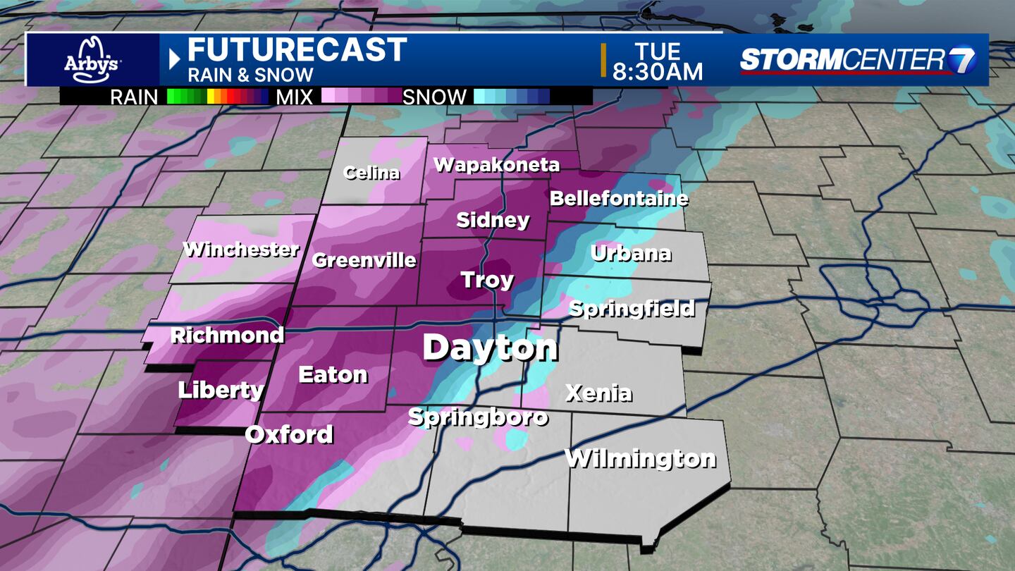

TUESDAY: Mostly cloudy with highs near 40. Rain and snow changing to rain with no accumulations currently expected. Based on forecast data available, this could start as snow and then change to a mix. No travel impacts thanks to warmer surface temperatures.
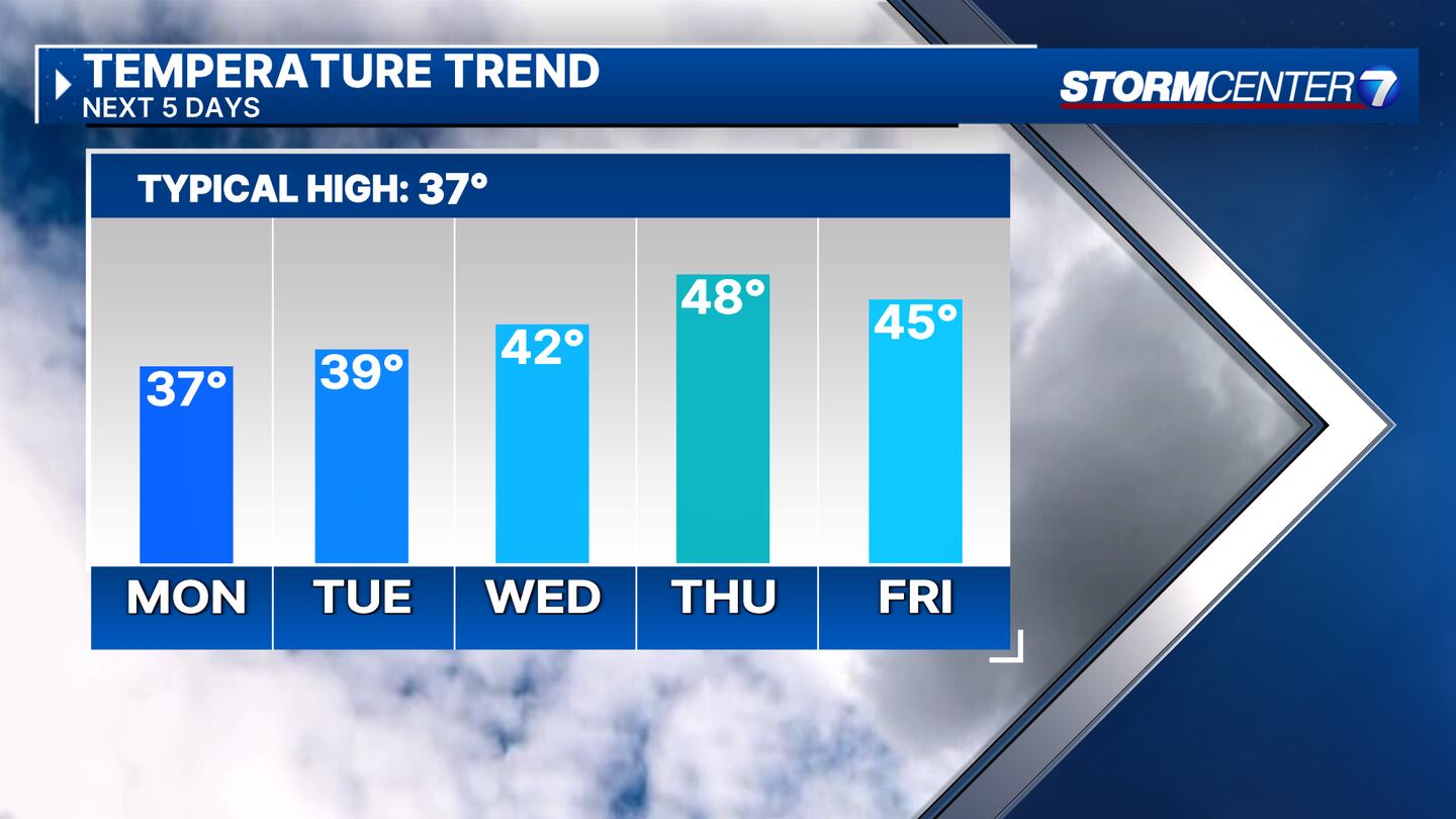
WEDNESDAY: Mostly cloudy. Cool with highs in the lower 40s.
THURSDAY: Sunshine looks to poke through finally and mild with highs in the mid to upper 40s.

FRIDAY: Partly cloudy with highs in the mid-40s.
SATURDAY: Sunshine with highs in the upper 30s to lower 40s.
SUNDAY: Sunshine and cool with highs near 40.
©2024 Cox Media Group


