QUICK-LOOK FORECAST:
- Warming trend Thursday through Saturday
- Strong cold front this weekend
- Rain likely, much colder air follows
>>TRACK THE LATEST CONDITIONS: Live Doppler 7 Radar
DETAILED FORECAST:
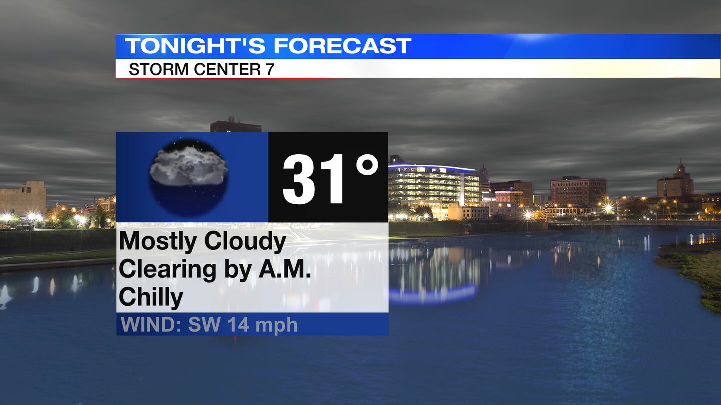
WEDNESDAY: Mostly cloudy skies persist from this evening into tonight, according to Storm Center 7 Chief Meteorologist Austin Chaney. Skies should gradually clear closer to daybreak. It will be a cold night with lows near freezing.
THURSDAY: Becoming sunny on Thursday. Dry, warmer, breezy. Expect highs in the lower 50s. Winds could gust to 20-30 m.p.h.

FRIDAY: A mix of sun and clouds. The warming trend continues with highs climbing to the mid-50s. These temperatures will be running about 10 degrees above normal for this time of year. Breezy again.
SATURDAY: The next chance for Showers arrives on Saturday. While the best chance for rain rolls through overnight, you’ll want to keep the rain gear handy with scattered showers possible during the day. Quite warm for this time of year with highs near 60. Breezy.
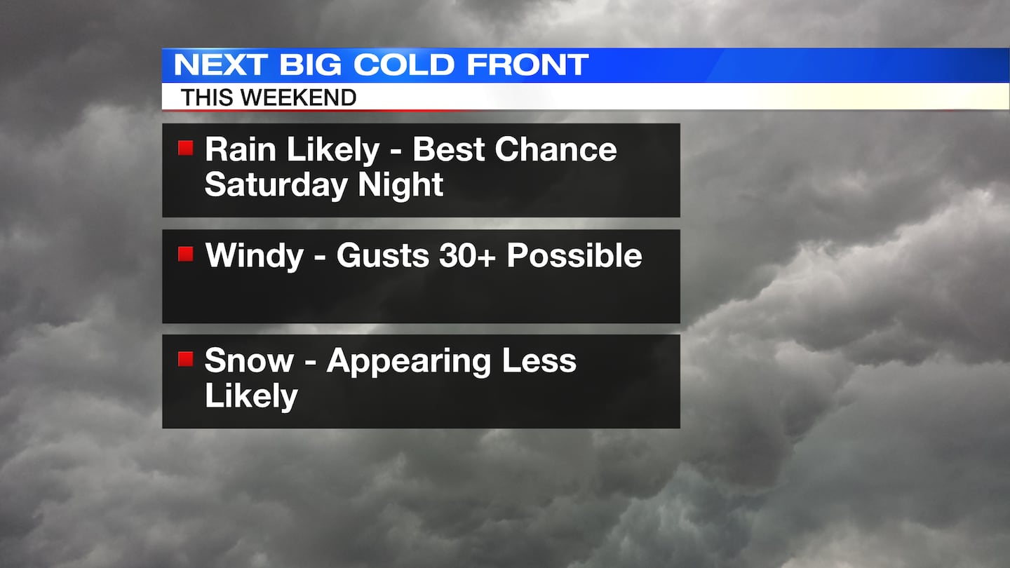
SUNDAY: Widespread rain early Sunday, then drying out. Much colder as the front passes. With the frontal passage now looking a bit earlier in the day, the afternoon looks colder. Expect highs only near 40.
Sunday should be a classic race to see if the cold air arrives in time to overlap with any moisture. Right now, it appears most moisture is gone before we have a chance to see any meaningful snowfall. A few flakes can’t be ruled out. Breezy.
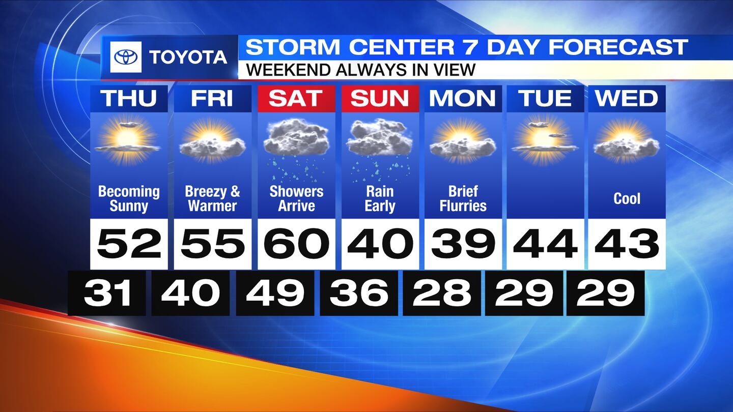
MONDAY: Mostly cloudy early Monday with a few flakes possible. Then clearing skies. Cold with highs in the upper 30s to lower 40s.
TUESDAY: Partly cloudy and dry by Tuesday. Cool with highs in the lower 40s.
WEDNESDAY: Partly to mostly sunny on Wednesday with highs in the lower 40s.
©2023 Cox Media Group