
DAYTON — Good morning, Miami Valley! I hope your first full week of the new year has been off to a great start! Meteorologist Nick Dunn here with on a gloomy, but mild, Wednesday morning.
You could find a hoist of descriptions for this week to describe the temperatures! Winter hiatus...mid-Winter thaw...and others fit well. Today we continue the above average temperatures with highs in the upper 40s. If we can squeeze out more sun than expected we could go a bit warmer.
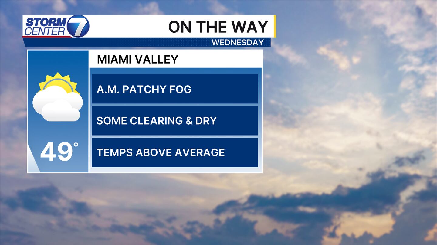
Any patchy fog or drizzle we have will fade away and the clouds will likely hang tough. If we do manage to clear the sky out tonight we will have to watch for thicker fog in the morning on Thursday.
[DOWNLOAD: Free Storm Center 7 Weather app for alerts as news breaks]
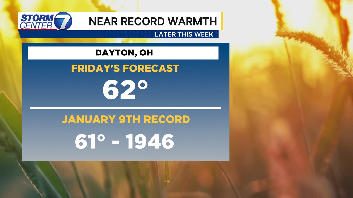
Friday still looks pretty warm across all forecast guidance! The record for January 9th is 61 degrees from 1946. I think we have a solid chance to break it! I have 62 in the forecast, but some guidance is even warmer. That comes down to how much rain we get and if we can squeeze out enough dry hours to warm things up even more!
[WATCH Storm Center 7 Weather on the following devices]
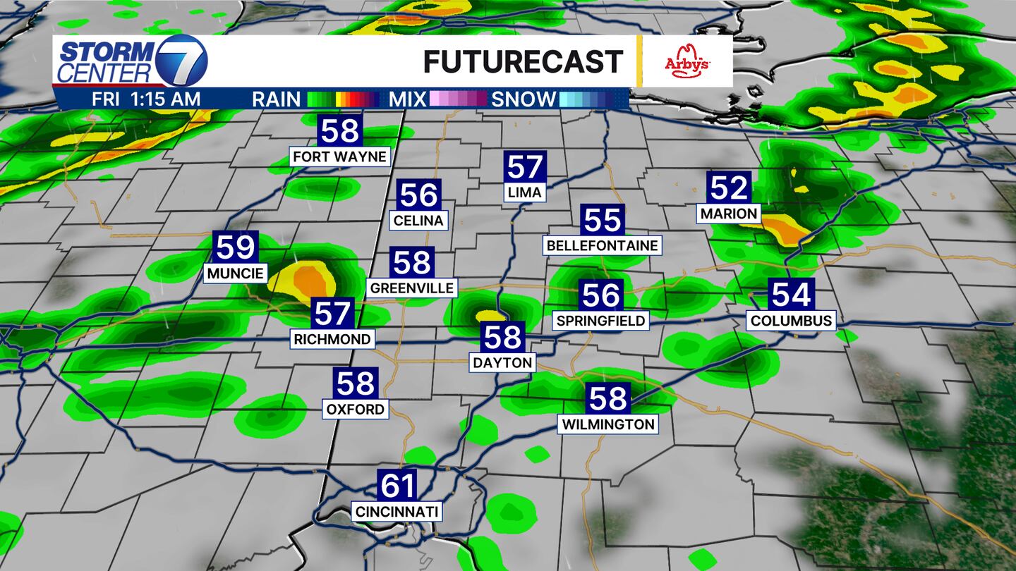
You will want to keep the rain gear around for overnight Thursday through Friday and into Saturday. No total washouts are in the forecast. However, the heaviest rain is expected overnight Thursday into early Friday. A rumble of thunder or two is also possible, but no severe weather is expected.
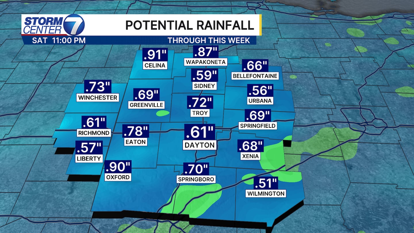
Rainfall totals through Saturday will be around 0.50 inch for most. A few locally lower or higher totals are possible.
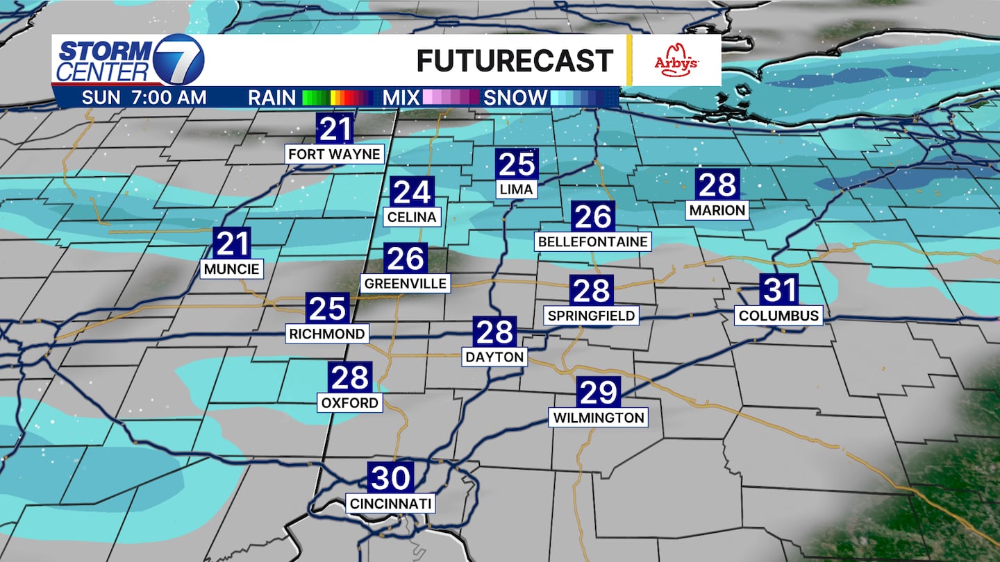
By Sunday morning a cold front will have cleared us and that means temperatures tumble! Any moisture left will fall as a few snow showers on Sunday. While not as drastic of a swing as a couple weeks ago, this will still bring a shock to the system.
©2026 Cox Media Group


