A Tornado Warning has been cancelled for Champaign and Miami Counties.
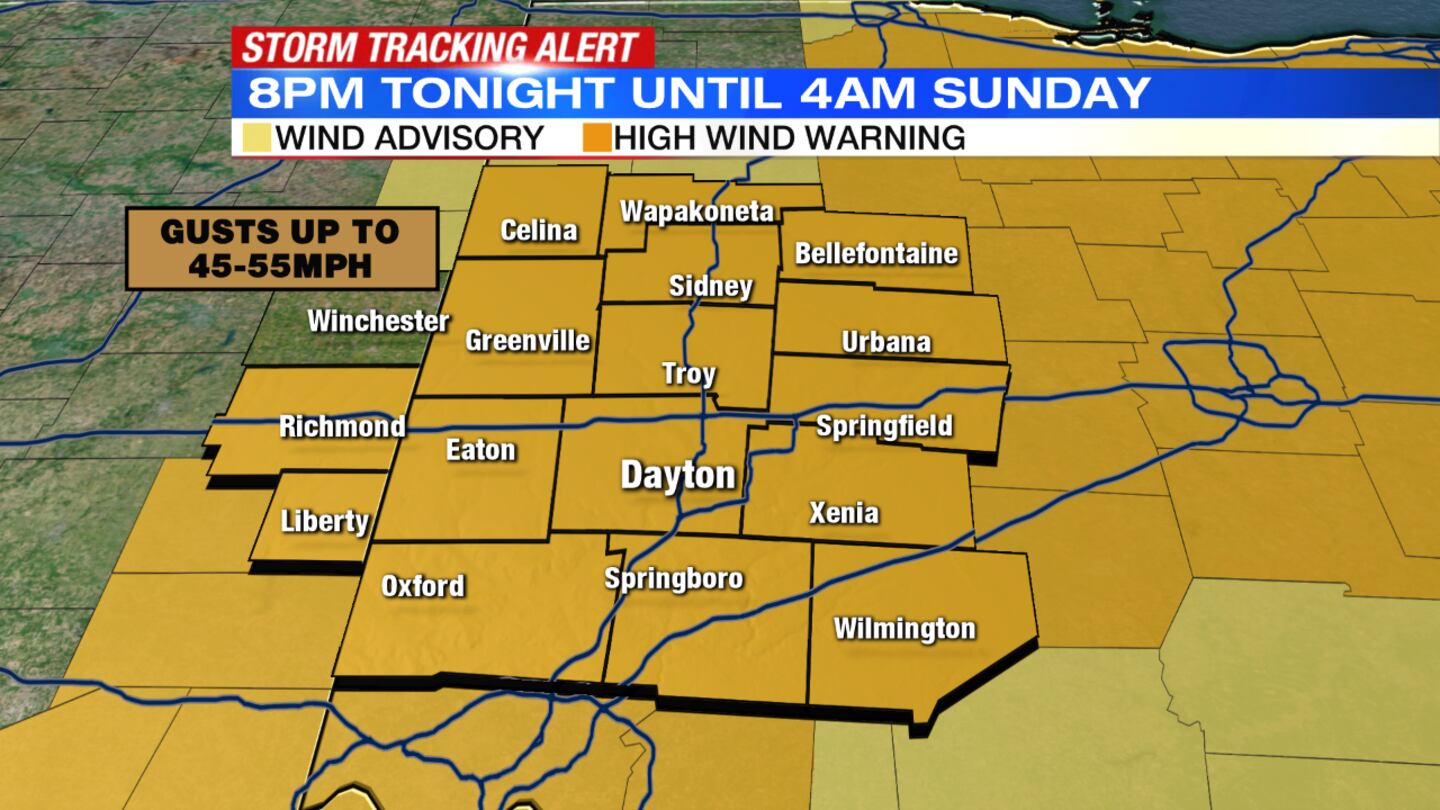
A High Wind Warning will go into effect at 8 p.m. tonight and will last until Sunday at 4 a.m. for the Miami Valley.
QUICK-LOOK FORECAST
- Rounds of rain continue this evening
- Gusty winds up to 40-50 mph possible
- Dry weather returns Sunday
>> INTERACTIVE | Live Doppler 7 Radar
DETAILED FORECAST
>> Wet weather driving: What you need to know
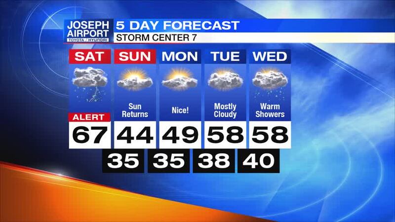
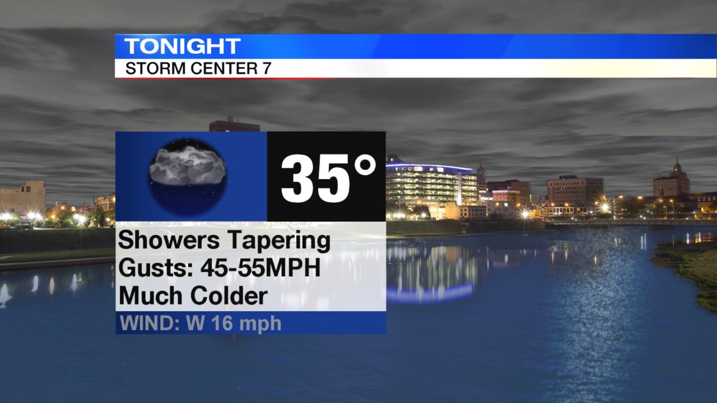
Overnight: Rain and showers will taper off into the night but windy conditions remain, according to News Center 7 Meteorologist Molly Coates. Wind gusts could get up to 55 mph and isolated higher gusts can't be ruled out. Temperatures will fall into the 30s by Sunday morning.
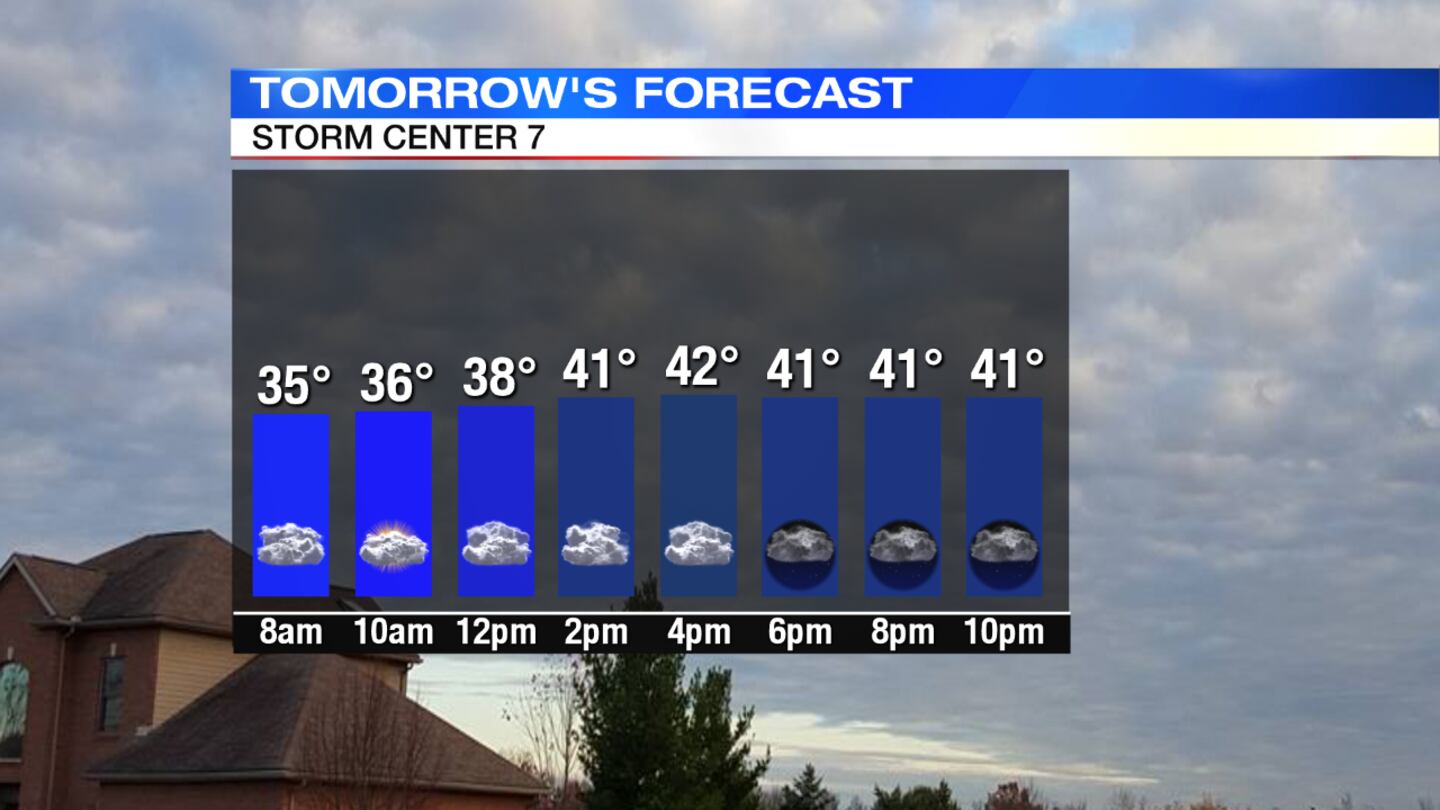
Sunday:The day is to be dry but windy, especially in the morning. Wind gusts may reach speeds of 30 to 35 mph with cooler temperatures of mid 30s. Highs will reach the lower 40s in the afternoon with sunshine and scattered clouds.
>> What a wildfire the size of Australia fire would look like here
Monday: The week starts quietly with sunshine and a few scattered clouds. Monday will be not nearly as breezy with highs reaching 50 degrees.

Tuesday: Clouds will increase Tuesday, with a slight chance of a stray shower south of Dayton, but most areas will remain dry. Highs are to be in the upper 50s, once again reaching temperatures that are unusually warm this time of year.
Wednesday: Highs are in the upper 50s once again. The day is to be cloudy with scattered showers and increasingly windy.
Thursday: Thursday brings much colder, blustery weather. Temperatures dip down to the lower 40s with a partly cloudy sky.
Friday: There's chance of rain and snow showers, with partly to mostly cloudy skies. Friday is projected to be cool with highs descending into the low 40s.