QUICK-LOOK FORECAST:
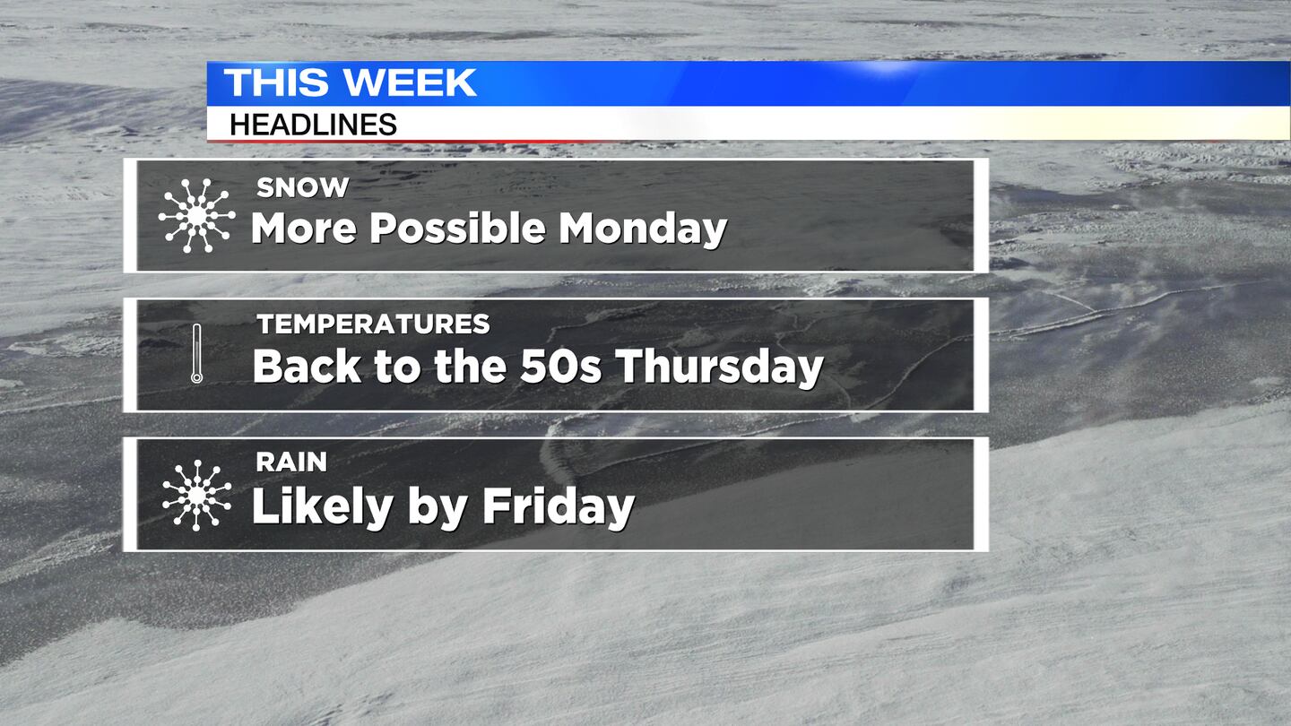
- Light accumulating snow Monday
- Huge warm up ahead this week
- Rain returns late this week
>> TRACK THE CONDITIONS WITH LIVE DOPPLER 7
DETAILED FORECAST:
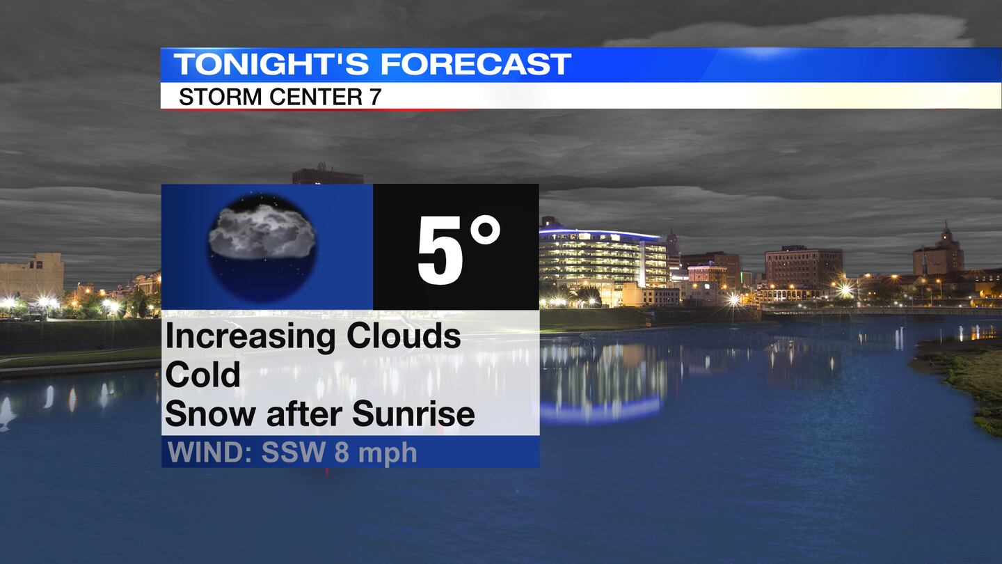
TONIGHT: Cloud cover increases overnight, but we stay dry through about daybreak. Very cold yet again. Overnight lows around 5 or 6 degrees with wind chills down to -2.
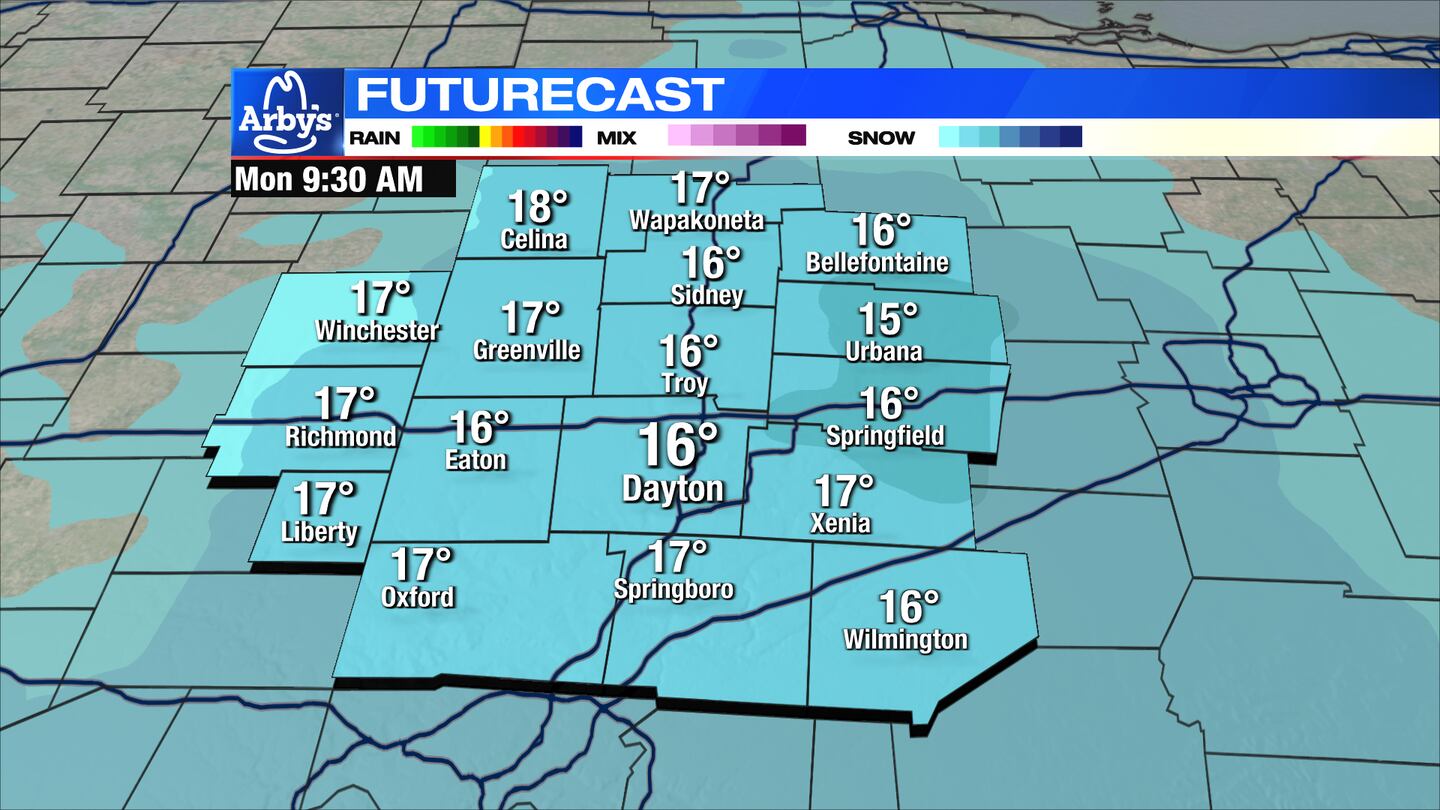
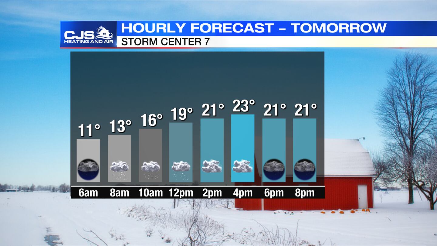
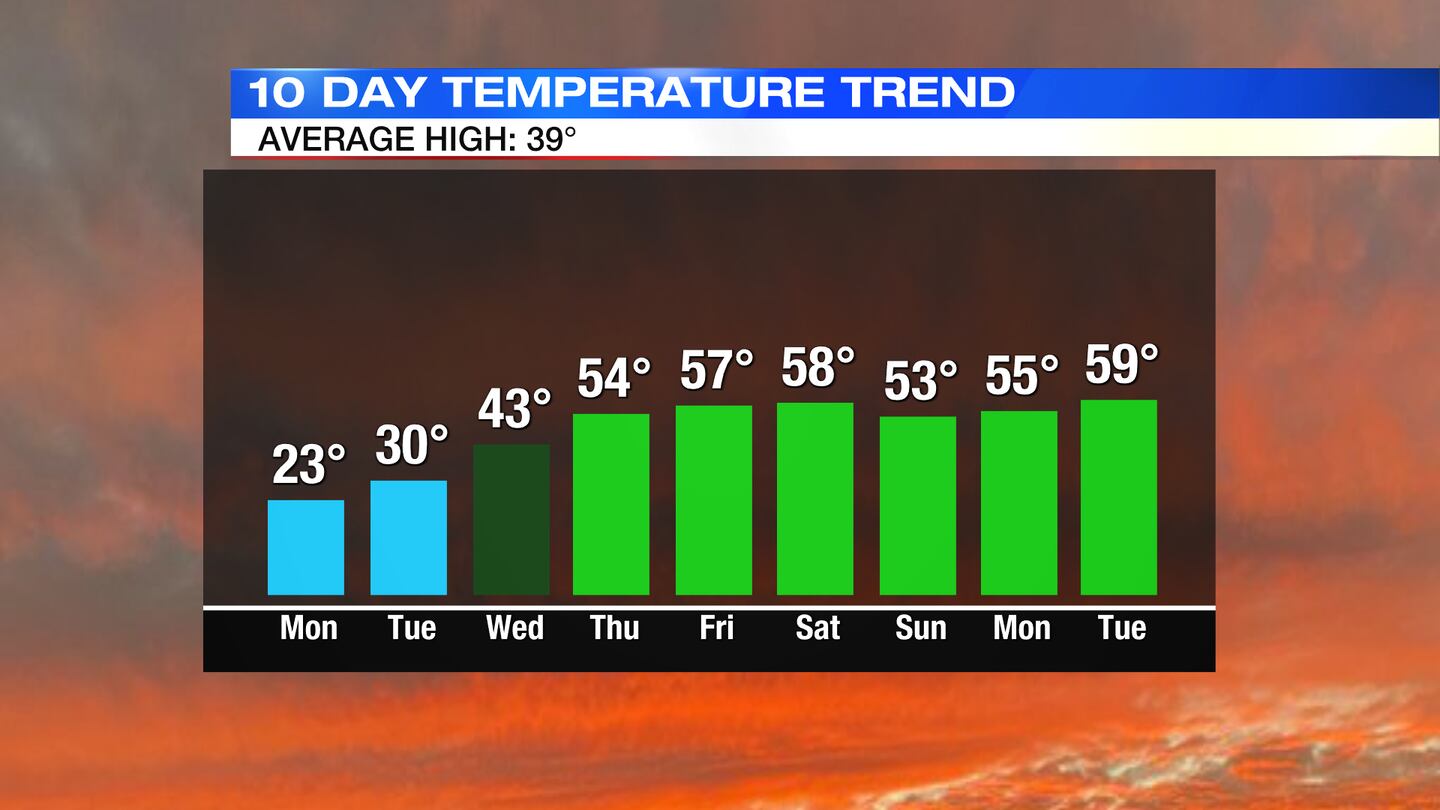
MONDAY: A clipper system brings light snow to the Miami Valley on Monday. The best chance of this will be from daybreak into the early part of the afternoon. With temperatures in the 20s, snow will stick leading to more issues on the roadways. Most areas see around an inch or less.
>> RELATED: Snow Emergencies issued for area counties; What does it mean?
TUESDAY: Dry but cloud hang around into Tuesday Still cold but improving with highs in the upper 20s to near 30.
WEDNESDAY: A noticeable warming trend kicks in. Highs return to the lower 40s under partly cloudy skies.
THURSDAY: Clouds increase, but Thursday looks to be a dry day for now. High temperatures in the low to mid 50s.
FRIDAY: Passing rain showers off and on. Warmer than normal in the upper 50s.
SATURDAY: Upper 50s to near 60... after all of this cold it will feel very warm outside! Rain is likely, however. More showers persist into the night.
SUNDAY: Mostly cloudy skies with a few showers remaining. Still mild with highs in the middle 50s.
©2022 Cox Media Group


