>> STAY INFORMED: Schools, businesses announce closures, delays
QUICK-LOOK FORECAST
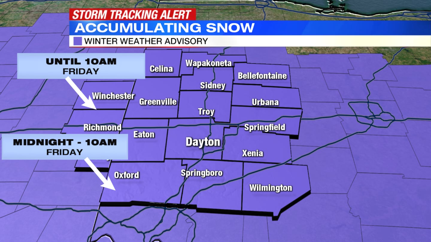
- Slick spots possible as snow falls across region into Friday morning; 2 to 4 inches expected
- Winter Weather Advisory in effect through 10 a.m. Friday for Auglaize, Butler, Champaign, Clarke, Clinton, Darke, Greene, Logan, Mercer, Miami, Montgomery, Preble, Shelby, Warren and Wayne (Indiana) counties; and from 3 to 10 a.m. Friday for Randolph County (Indiana).
- Warmer weather this weekend
>> Sheriff’s deputy among reports of crashes as heavier snowfall blankets region
DETAILED FORECAST
Overnight: Steady, widespread snow will lead to snow-covered, slippery roads, Storm Center 7 Chief Meteorologist McCall Vrydaghs said. Temperatures in the teens will do little to help road salt, so Friday morning's commute is expected to be messy. Snow will taper around sunrise, with total accumulations between 2 and 4 inches.
>> WIND CHILLS: See how low the wind chills were in your area
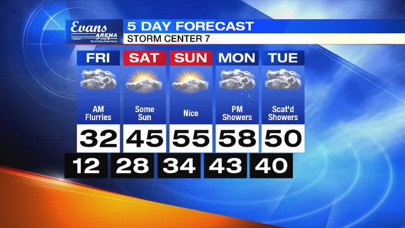
Friday: Scattered snow tapers off in the morning with accumulations between 2 and 4 inches expected.
“Since it will be cold, it should create snow-covered roads pretty quickly for the morning drive,” Vrydaghs said.
A few flurries or some drizzle could linger briefly after the steady snow wraps up in the morning. Highs will reach the low 30s for the afternoon. It remains dry for the night.
>> Live Doppler 7 HD Interactive Radar
Saturday: We get a chance to thaw out as highs reach into the upper 40s to start the weekend. Temperatures will quickly melt the snow as sunshine returns into the evening. We'll see increasing clouds and most areas staying dry, though those father north could see a passing rain shower at night.
Sunday: An even warmer end to the weekend as it feels more like spring. Highs reach in the lower to middle 50s with sun and clouds through the day. It should stay dry until closer to Monday morning.
Monday: Another system will bring only rain to start the workweek. Highs will be in the upper 50s with a little breeze.
>> YOU NEED THIS: Download the WHIO Weather App
Tuesday: Mostly cloudy and mild with a few showers possible. Highs will be around 50 degrees.


