QUICK-LOOK FORECAST
- Sunshine and breezy today
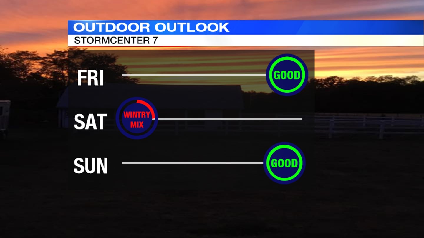
- Rain and snow showers Saturday
- Mild next week
DETAILED FORECAST
>TRACK THE CONDITIONS: Live Doppler 7 Radar
TODAY: Gusty winds are expected through most of the day today but dry conditions will be in place, according to Storm Center 7 Meteorologist Molly Coates.
Sunny skies are expected with highs climbing to around 50 degrees. Windy conditions are expected with gusts between 25 and 35 mph.
Partly to mostly cloudy skies are expected tonight with lows falling into the upper 30.
>> Download the FREE WHIO weather app
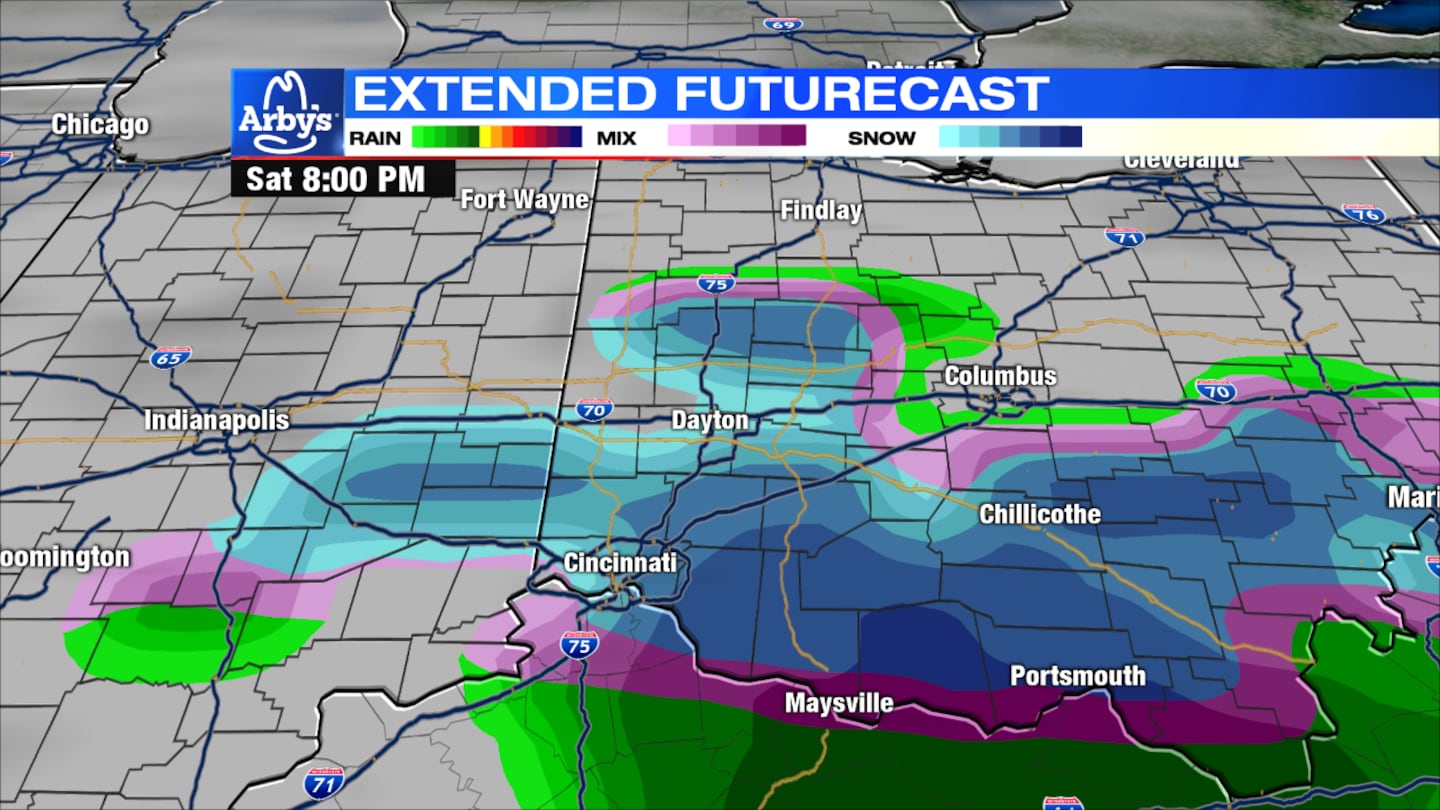
SATURDAY: Another storm moves in for the afternoon and evening. It will be a dry morning, but scattered showers arrive during the midday.
Highs in the low 40s rain showers mix and change to wet snow showers especially south of I-70. Some light accumulation possible on the grass with a colder night dropping into the 20s.
>>Snow, sleet, and freezing rain: What determines the type of winter precipitation?
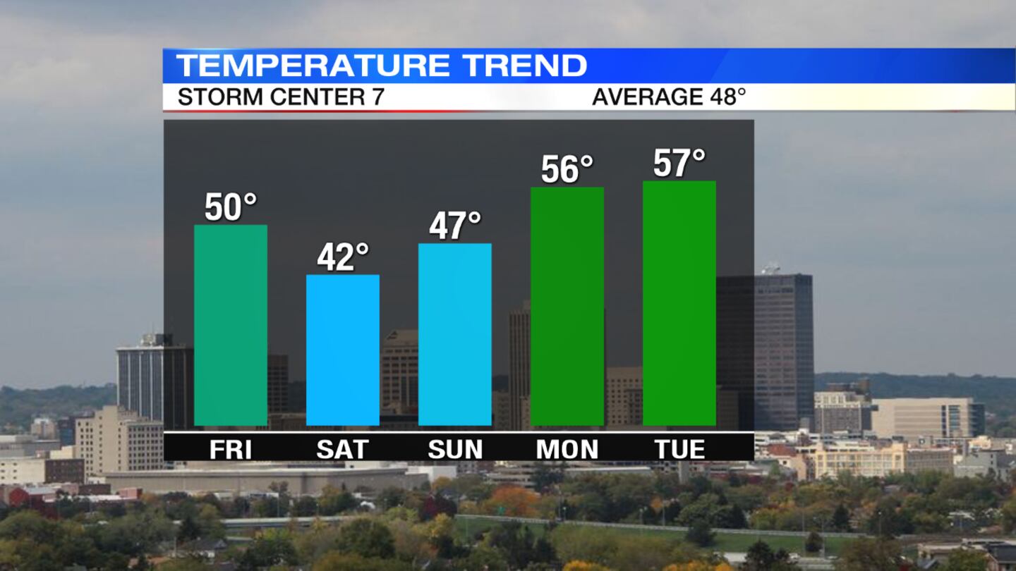
SUNDAY: We dry out for the day. If any snow sticks from Saturday it will melt because the highs will be in the upper 40s. Some sunshine with scattered clouds will come in through out the day.
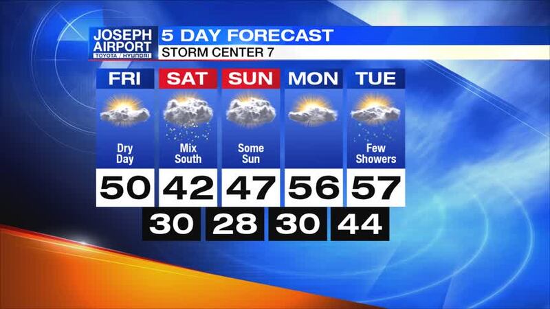
MONDAY: It will be a dry start to the week. Highs will be back above normal with temperatures in the middle 50s. There may be some showers possible at night.
TUESDAY: There will be a few more passing showers early with highs in the mid to upper 50s.


