QUICK-LOOK FORECAST:
- Few showers around Wednesday
- Heavy rain at times Thursday and Friday
- Flooding possible end of week
>> TRACK THE CONDITIONS WITH LIVE DOPPLER 7
DETAILED FORECAST:
TODAY: Cloudy skies with a few passing showers, according to Storm Center 7 Chief Meteorologist McCall Vrydaghs. Temperatures will fall to a low in the lower 40s.
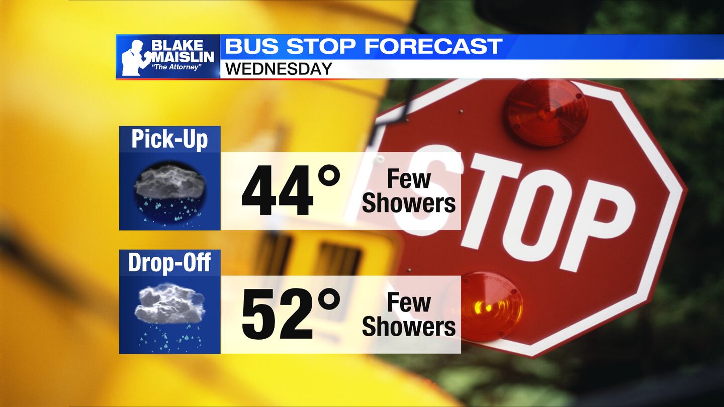
WEDNESDAY: Some passing showers around early and then again more likely into the evening and at night. Cloudy skies, breezy, and mild with a high in the lower 50s.
THURSDAY: Passing downpours and storms to start the day. Activity will drift south through the afternoon. Highs in the upper 60s. Gusty winds. Rain becomes steady overnight especially south of I70.
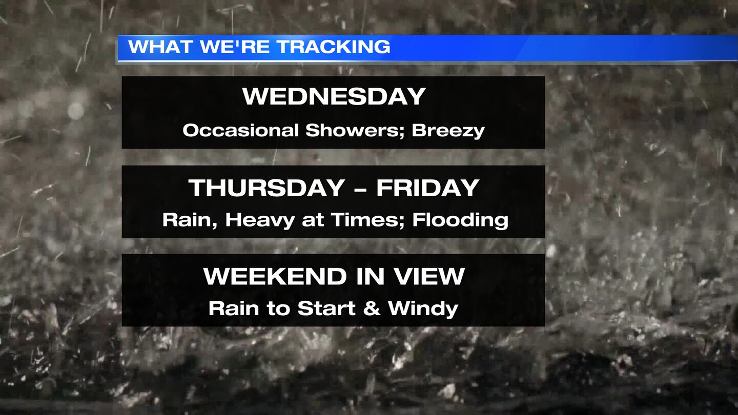
FRIDAY: Heavy rain continues through the day shifting back north. Could lead to some flash flooding and a rise in creeks, streams and rivers. Rain totals from Wed-Fri could reach 2-5 inches. Highs in the upper 50s. Gusty wind at times.
SATURDAY: Widespread showers lifting north and out of the Miami Valley for the first half of day. Some dry time but staying windy for afternoon. Some gusts up to 40mph posible. Highs in the upper 50s.
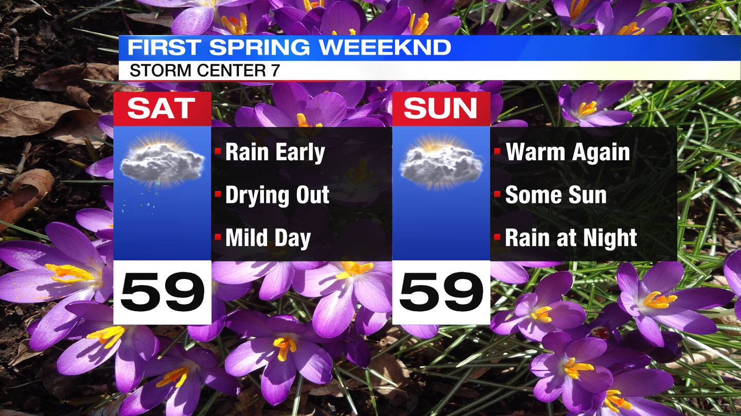
SUNDAY:Starting off dry. Highs around 60. Clouds increase again and another disturbance will bring rain showers at night.
MONDAY: A few more showers, highs around 60.
TUESDAY: Mostly cloudy with a passing shower still possible. Highs in the lower 50s.
©2023 Cox Media Group