
MIAMI VALLEY — QUICK-LOOK FORECAST:
- Few snow showers possible tonight
- 60s return for Friday
- Wet end to the week
>>TRACK THE CONDITIONS: Live Doppler 7 Radar
DETAILED FORECAST:
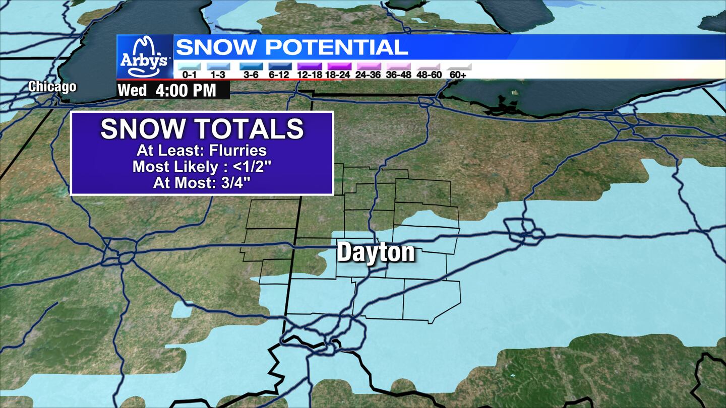
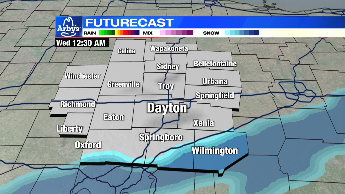
TODAY: A weak weather disturbance brings a chance for a few light snow showers or snow flurries this evening and overnight, mainly south of Dayton.
Models depict a band of light snow briefly lifting into our area before sliding east. This snow will have to overcome a good bit of dry air before reaching the surface.
Therefore, accumulations if any will be light. Still, with overnight lows in the low 20s, any snow may lead to a few slick spots Wednesday morning.
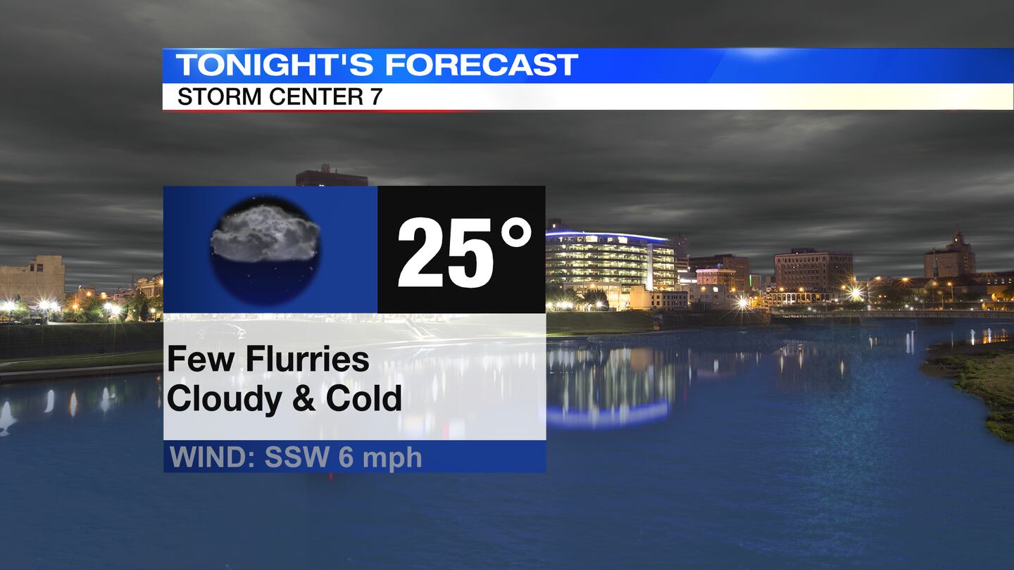
WEDNESDAY: Any overnight snow flurries quickly taper off Wednesday morning. Dry, mostly cloudy, and cold conditions follow for the rest of the day. High temperatures reach the upper 30s. More clearing into Wednesday night and cold. Lows in the middle 20s.
THURSDAY: Morning sun gives way to clouds on Thursday. Chance for a few showers around Thursday night. Highs return to the upper 40s.
FRIDAY: Chance of a few showers, especially after noon and into the night otherwise cloudy and mild. Highs in the mid 60s.

SATURDAY: Cloudy skies with showers likely in the morning. Mostly cloudy with passing flurry or sprinkle may return for the afternoon, mainly north. High temperatures will likely be during the morning around 60 degrees then falling through the day.
SUNDAY: A drier and colder day with highs in the middle 40s. More sunshine is expected with a few passing clouds.
MONDAY: Mostly sunny and cool. Highs in the upper 40s.
TUESDAY: Partly sunny and mild. Highs in the lower 50s.
©2021 Cox Media Group


