
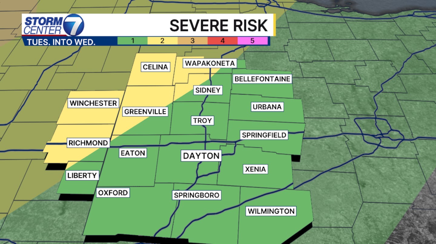
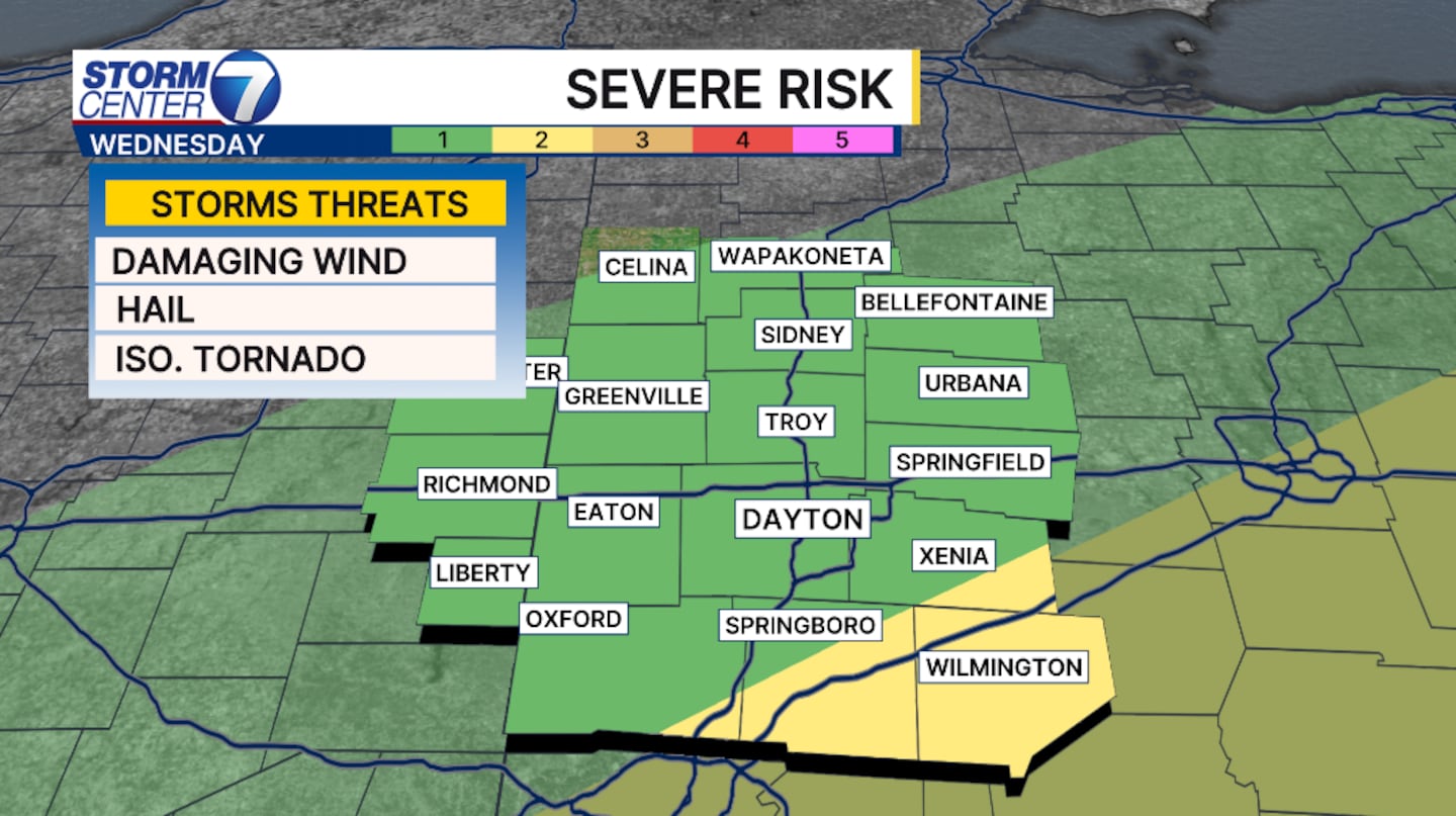
DAYTON — Strong to severe storms are possible once again this week. Unfortunately, another potent cold front will push close to the Valley late Tuesday into Wednesday.
Ahead of this front warm moist air builds right over SW Ohio. This will help fuel the potential for stronger thunderstorms. There will be two windows for severe weather opportunities.
[DOWNLOAD: Free Storm Center 7 Weather app for alerts as news breaks]
Early Wednesday after midnight and again late Wednesday afternoon into the evening. The low that will develop hasn’t matured at this time, making it difficult to breakdown the timing perfectly. Both of these windows bring the threat of wind and hail as the primary threats, but isolated tornadoes are possible. The threat is low, but can’t be ruled out.
[WATCH Storm Center 7 Weather on the following devices]
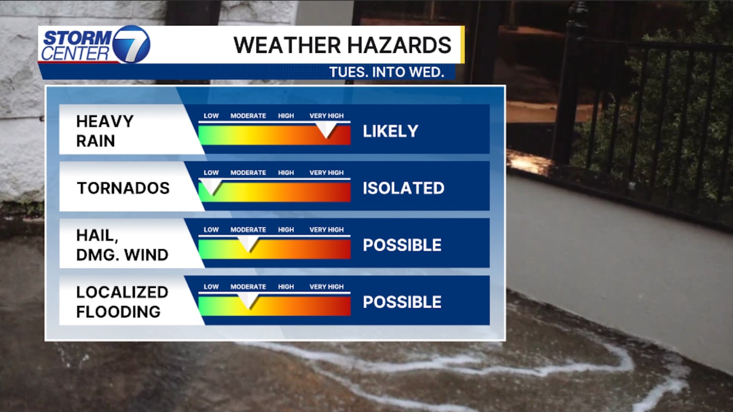
Another concern we’ll focus on will be flooding. Our grounds are already saturated from previous rains, now we have the potential to pick another inch to two inches of rain through Wednesday. Isolated higher amounts are possible under stronger storms.
©2026 Cox Media Group


