
DAYTON — UPDATE: 9:20 p.m.
The National Weather Service has issued a Dense Fog Advisory for the entire region until 10 a.m. on Tuesday.
INITIAL REPORT:
Wednesday is looking to be the warmest day so far this year and may either tie or approach record temperatures! Hey it’s Storm Center 7 Meteorologist Ryan Marando.
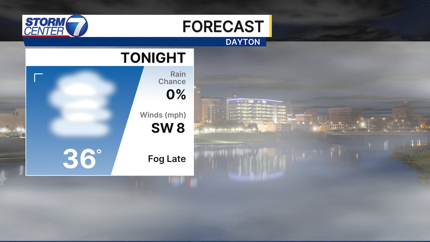
With more moisture near the ground with snow melting and calm winds overnight, fog looks to be dense again for Tuesday morning. A reminder to use the low beams when driving in dense fog. The fog should mix out through the mid morning hours.
[DOWNLOAD: Free Storm Center 7 Weather app for alerts as news breaks]
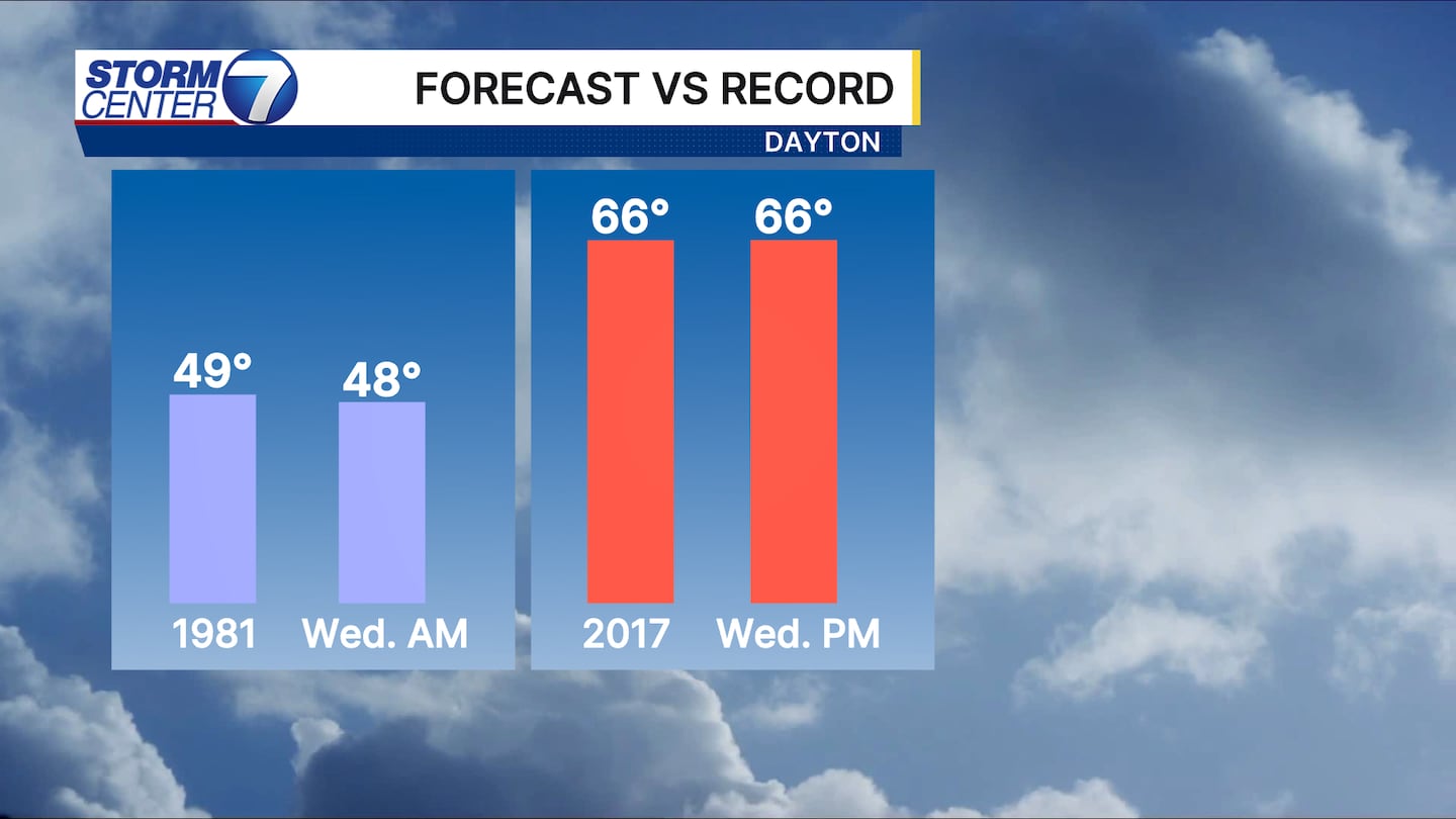
Then we get the warmest day on Wednesday! We will come close to either tie or break the record high which is 66 degrees that was set back in 2017. The morning low is also near the warmest overnight low temperature!
[WATCH Storm Center 7 Weather on the following devices]
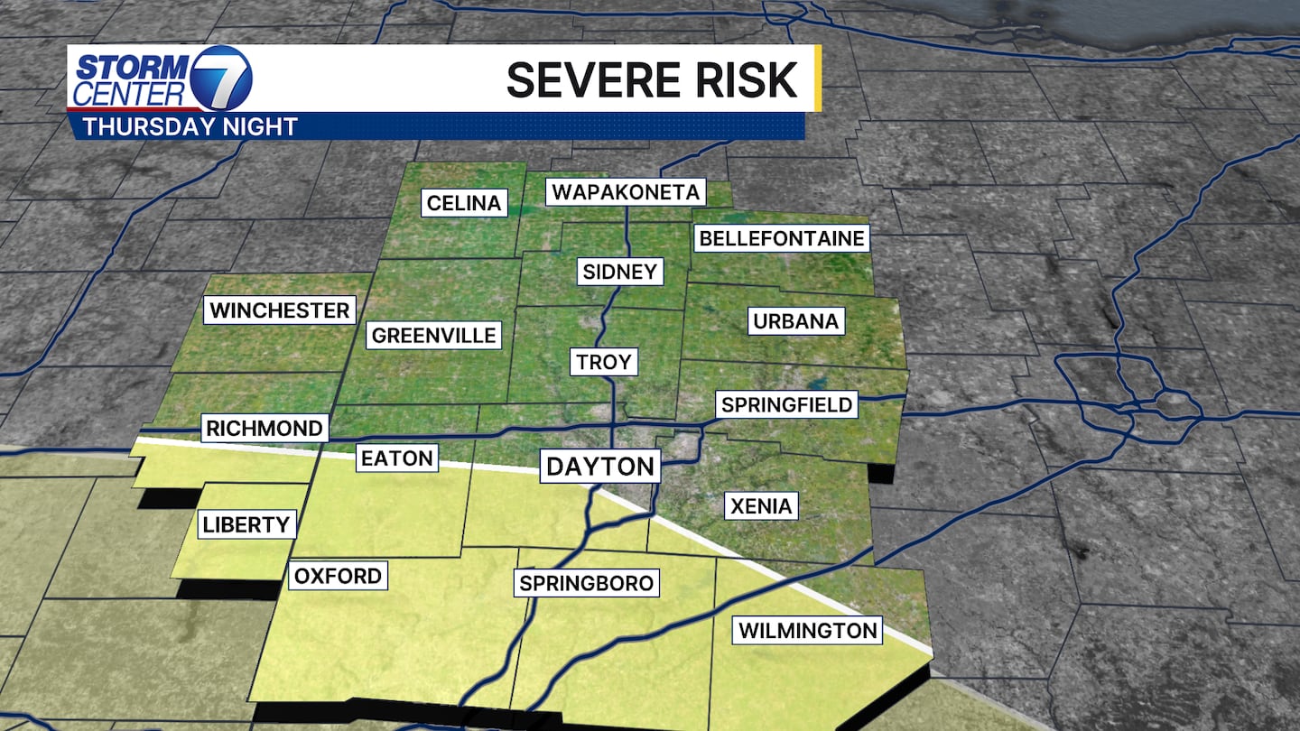
It is coming with some trade offs. Scattered showers are possible on Wednesday and with the surge of warm air to stay in place Thursday, we are watching for a small severe weather risk on Thursday night. We will keep you posted if the ingredients look to remain in place for a stronger thunderstorm late Thursday.
©2026 Cox Media Group


