
DAYTON — Good Thursday afternoon, everyone. Meteorologist Nick Dunn is checking in with you. It is quite a nice afternoon.
You certainly can not tell we are watching the threat of wintry precipitation, including accumulating snow, by late this weekend into next week. That will come after a very mild and nice Friday and Saturday.
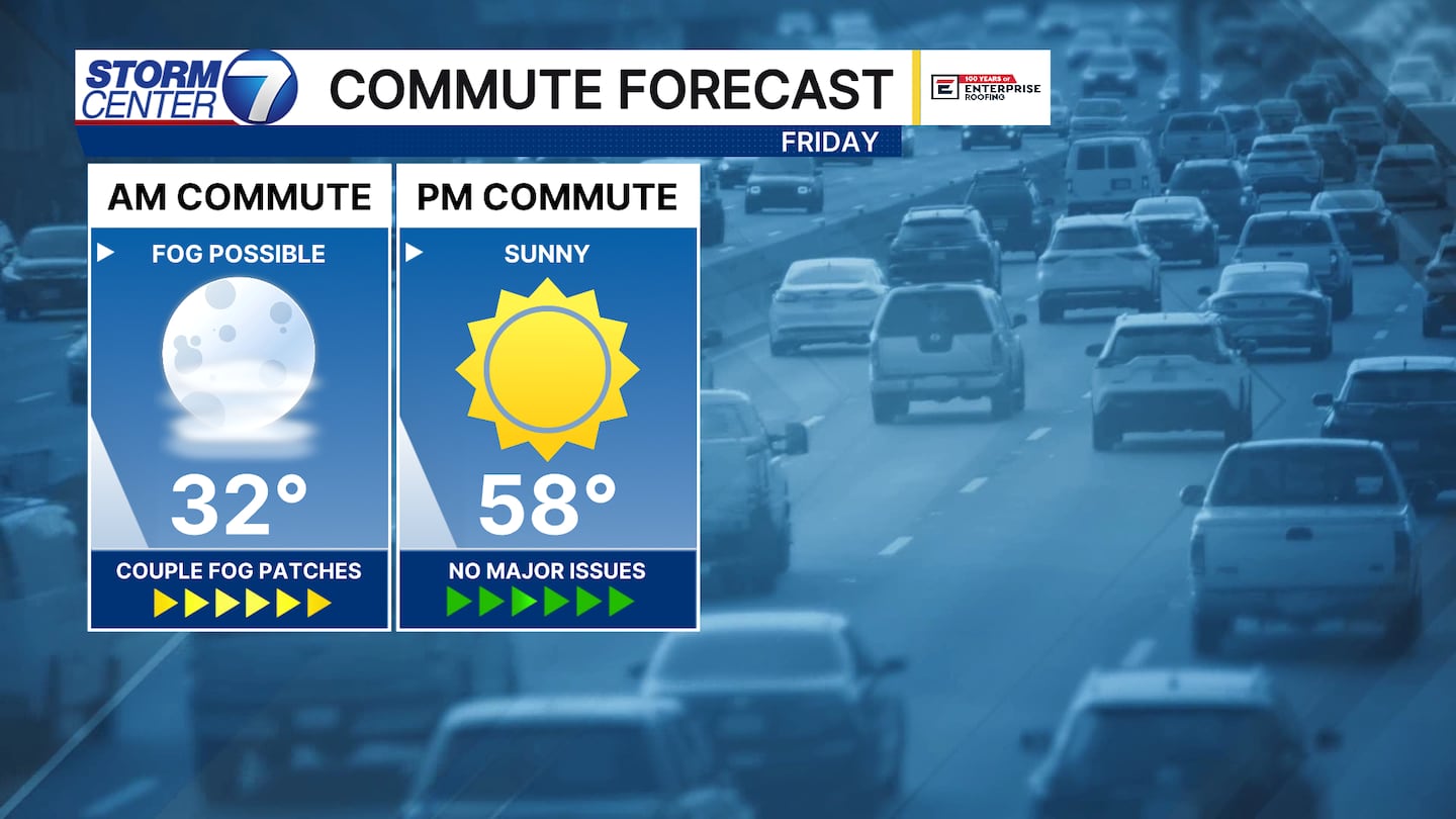
After a chilly night tonight, we find a fantastic Friday on tap. Highs will be pushing 60 degrees. Saturday also looks rather mild with highs in the middle 50s.
[DOWNLOAD: Free Storm Center 7 Weather app for alerts as news breaks]
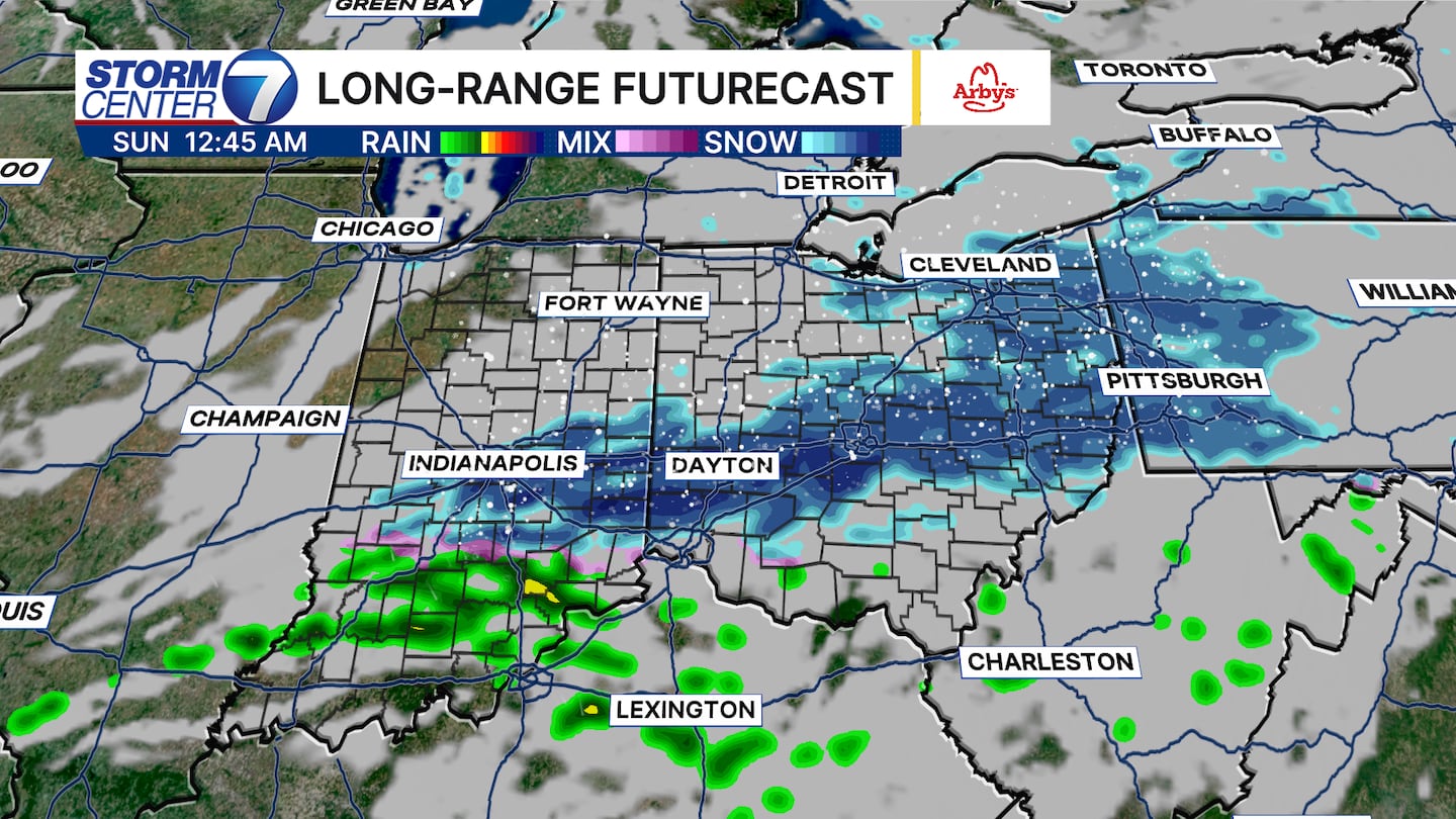
A quick-moving disturbance and cold front bring a chance of snow and mixed precipitation overnight Saturday into very early Sunday.
Around one inch of snow could occur here, but overall impacts seem limited due to the quick-moving nature of things. Precipitation ends by sunrise, and Sunday overall looks dry but a bit cooler.
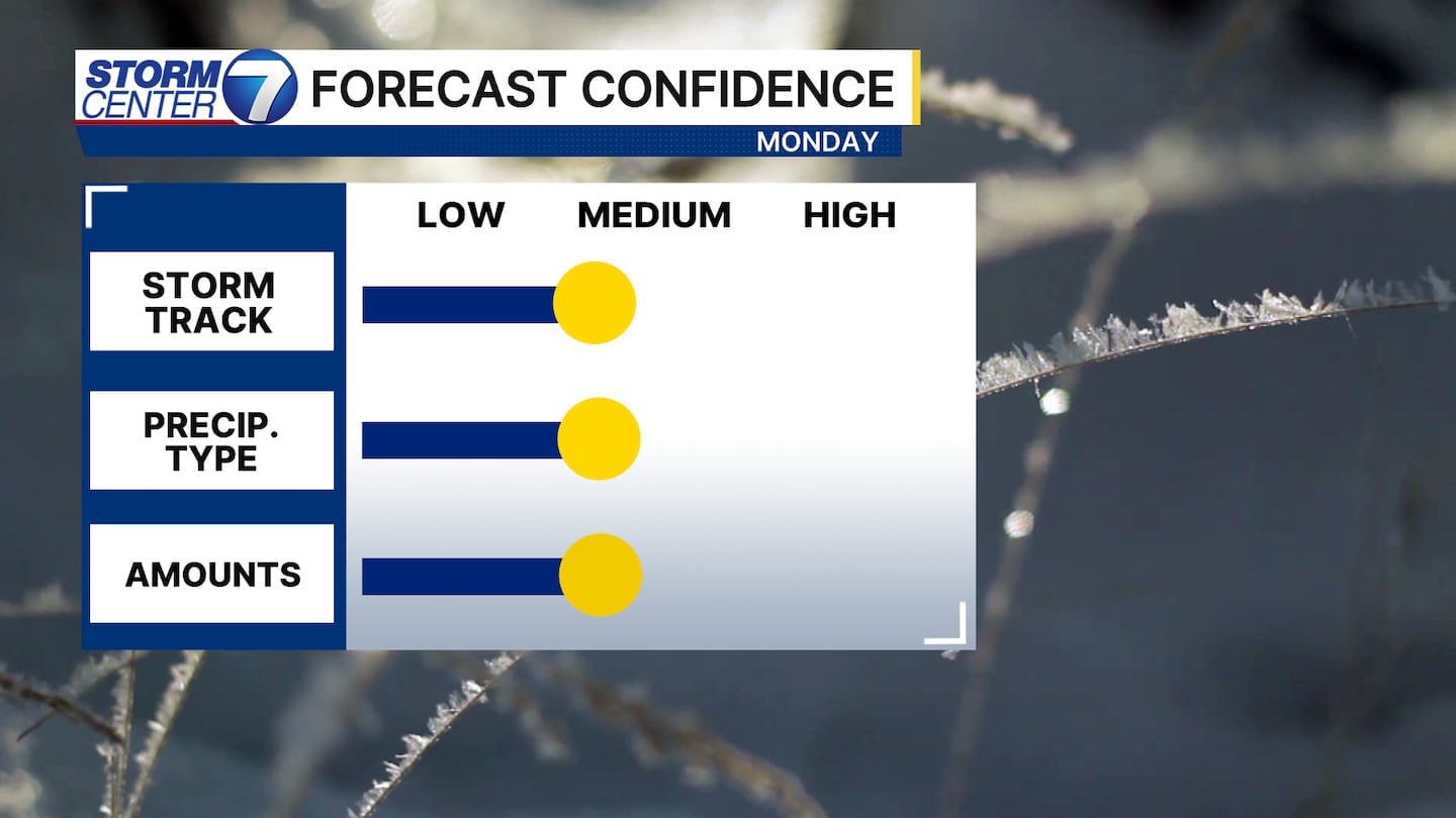
Overall confidence for Monday remains rather low to medium regarding specifics. We have some model disagreements to work through, and that will help us iron out precipitation type, amounts, and locations. Impacts for Monday look likely. We just need to narrow things down a bit.
[WATCH Storm Center 7 Weather on the following devices]
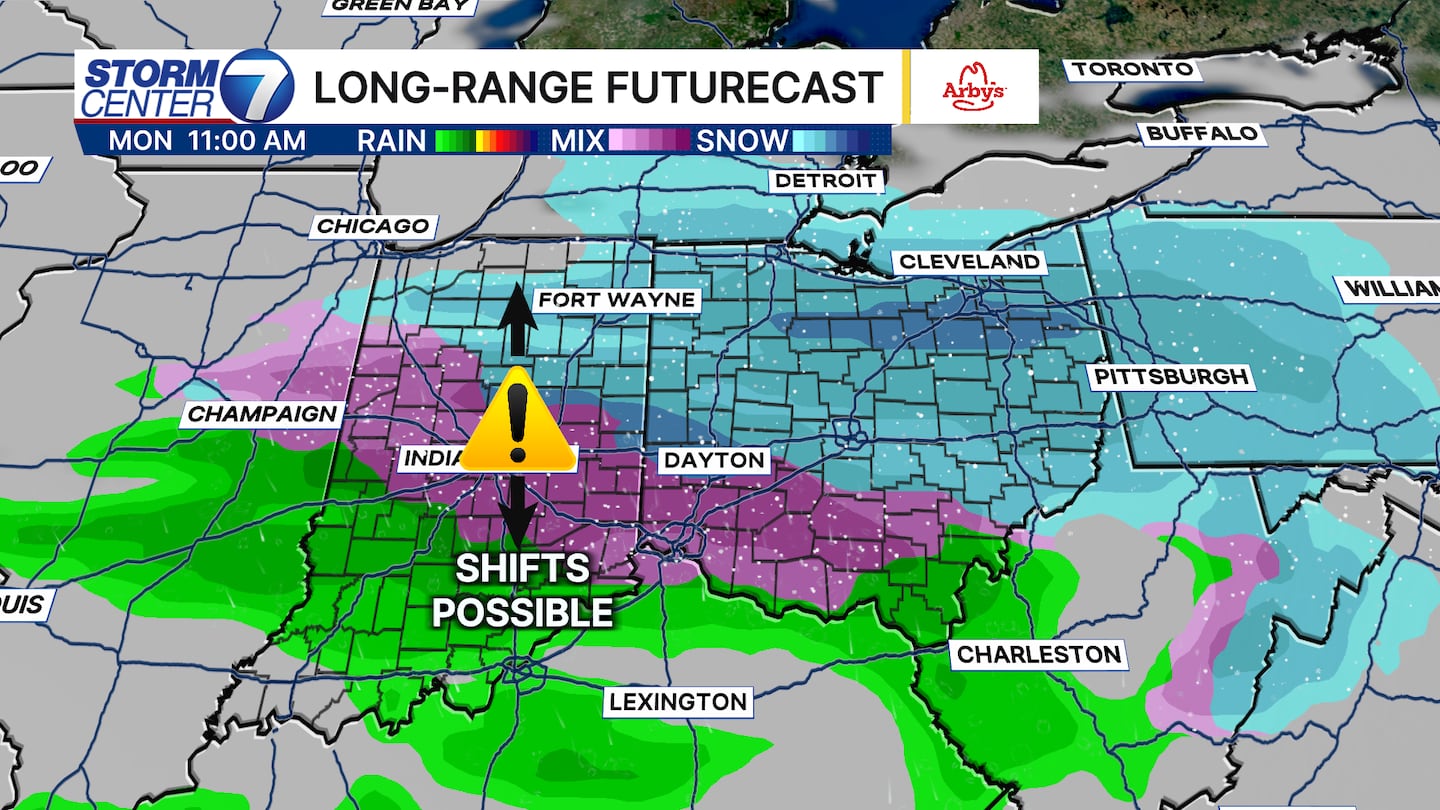
The latest guidance above shows snow and mixed precipitation for Monday. As of right now, this looks to start Monday morning and continue into the afternoon.
Given warmer temperatures at the surface by the time precipitation ends, any snow that would stick likely starts melting fairly quickly. Lots to keep our eye on between now and then.
©2026 Cox Media Group


