DAYTON — Hello, everyone! Meteorologist Nick Dunn here with you on Christmas Eve to check the latest forecast as we navigate through the holiday week. We certainly had a foggy start this morning and even a few spots reporting freezing fog where temperatures got cold enough. Once we got past that it turned out be a nice afternoon. However, the changes are far from done!
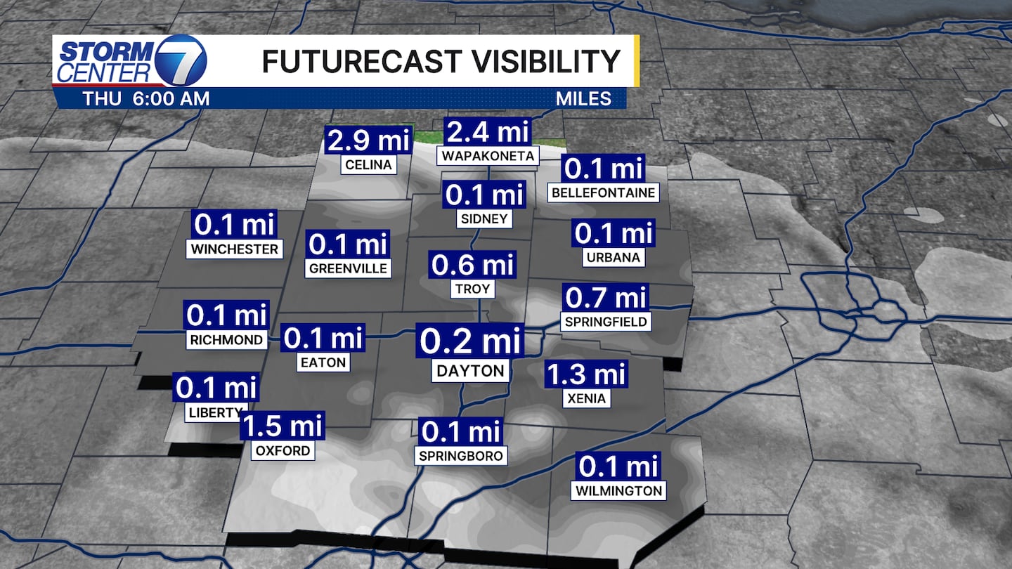
Confidence is a bit lower than last night on fog potential. However, signals from models indicate another round of patchy to dense fog tonight after rain comes to an end. There is a Dense Fog Advisory already for Randolph County beginning at 10PM tonight and lasting through 11AM Christmas Day.
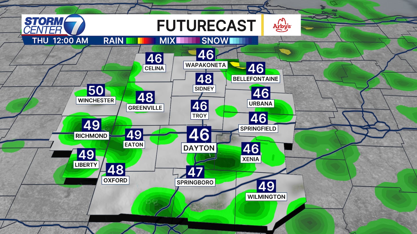
A few rain showers, and perhaps a rumble of thunder, will move through tonight as well. Rain totals from this will be less than 0.25″ as temperatures start in the middle 40s around Midnight and climb into the low 50s by mid-morning Thursday.
The rest of Christmas Day features a mostly cloudy sky and temperatures ticking down a bit by the end of the day into the middle 40s.
[DOWNLOAD: Free Storm Center 7 Weather app for alerts as news breaks]
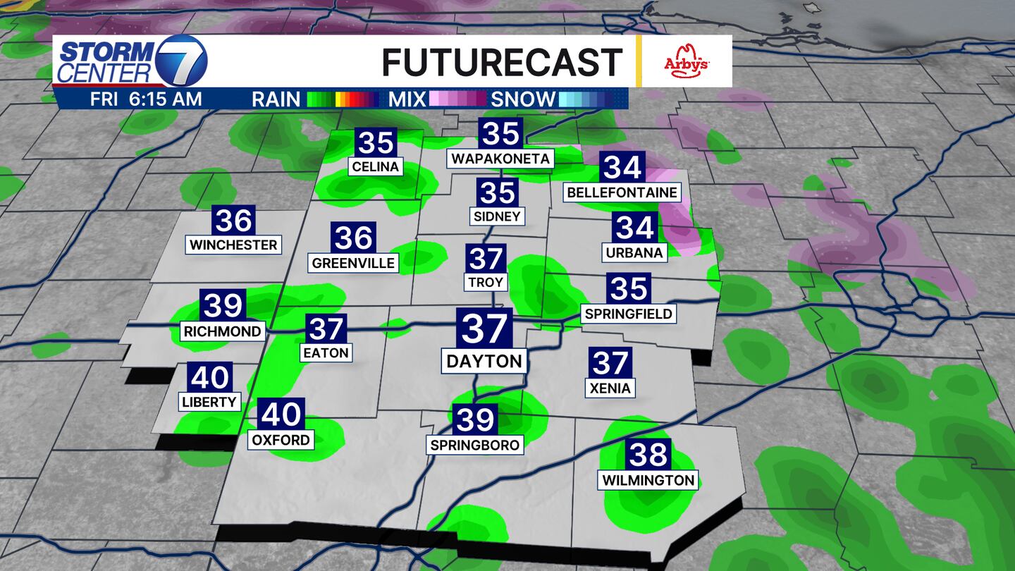
A bit of a complex forecast in store for Friday morning. There is a very low chance of freezing rain around Wapakoneta and Bellefontaine where temperatures could be around 32 early on. We will all find temperatures rising, but check out how the afternoon looks below and you will see how the forecast is tricky!
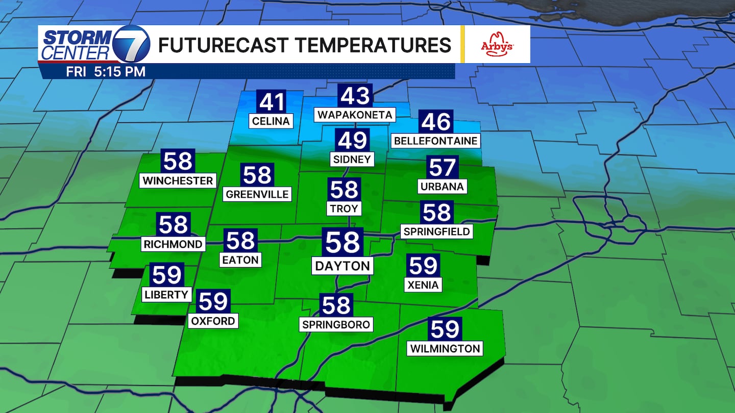
A stationary boundary will be draped across the northern counties. This means we have a nearly 20 degree temperature difference from north to south. It is very tricky as even a 20 mile shift could make some of you warmer or cooler.
[WATCH Storm Center 7 Weather on the following devices]
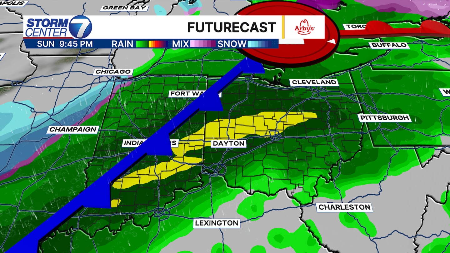
Into this weekend, a cold front will swing through the Great Lakes and bring a big temperature drop. The problem is it has been delayed and is trending later and later in the day. That means highs could easily approach 60 before the front comes through with rain, wind, and a few rumbles of thunder.
We might even see a few snowflakes as precipitation end with falling temperatures Monday. You will need the heavier coats, hats, and gloves by Monday with temperatures falling into the 20s by the afternoon.


