
DAYTON — Good afternoon, everyone. Meteorologist Nick Dunn checking in with you. It has been another very windy day out there across the Miami Valley this afternoon. The strongest gust of the day to this point is at the Dayton International Airport where a gust of 61 miles per hour was measured. The winds will continue, but I am also tracking a threat for severe storms tonight. Here is the latest you need to know.
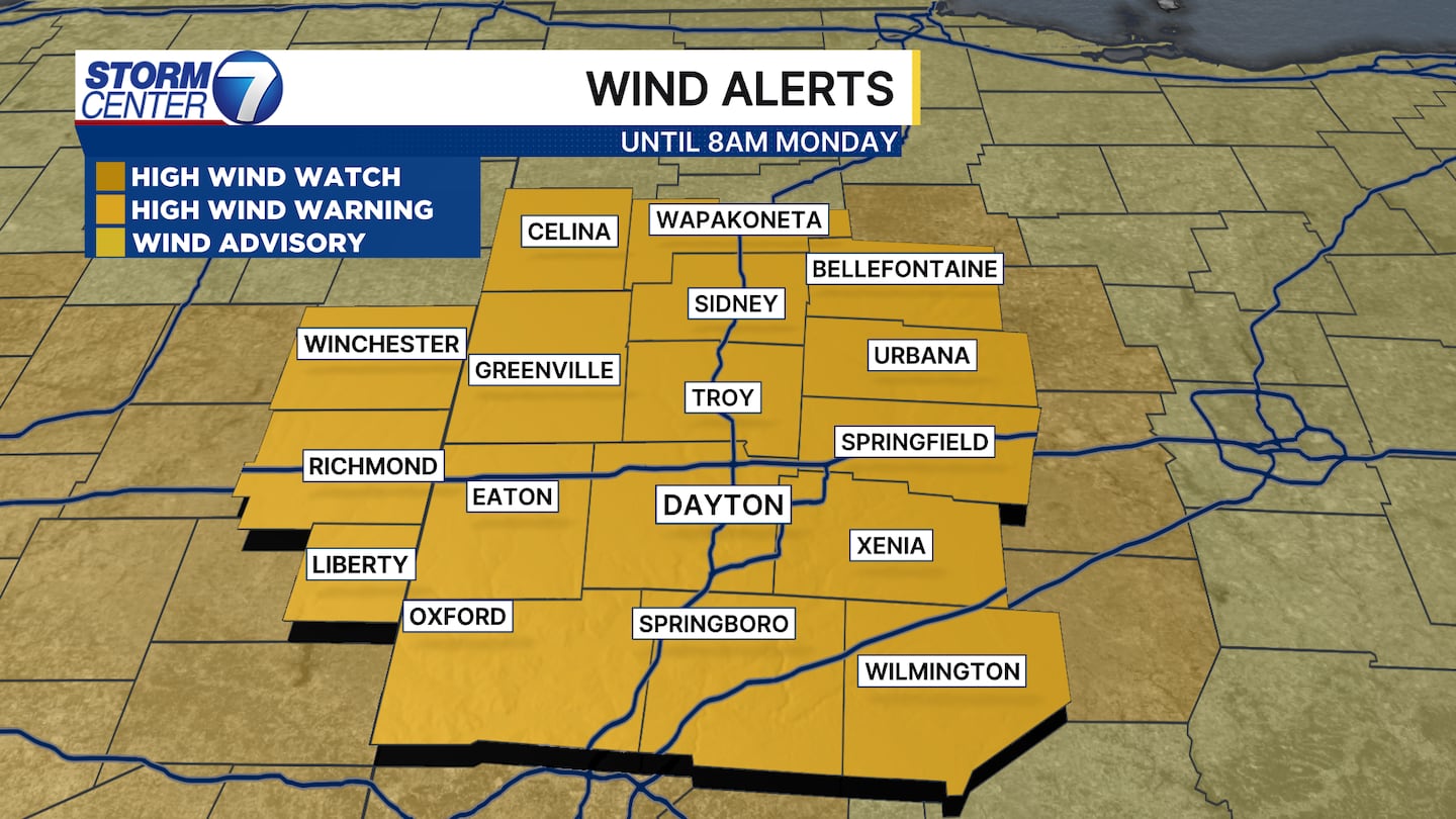
A High Wind Warning has been issued for the second time in three days for the entire Miami Valley. Gusts to around 60 mile per hour are possible at times through late tonight and early Monday morning. This may cause new power outages and tree damage to occur. Loose outdoor items can easily be blown around as well.

I am also tracking a threat of severe weather. A Level 2 (Slight) risk on a scale of 1 to 5 has been put in place for all of us by the Storm Prediction Center. The best chances for severe weather look to be between 11PM and 4AM, with damaging winds being the main threat. A quick moving line of storms will race through as a cold front ushers in a huge drop in temperatures.
[DOWNLOAD: Free Storm Center 7 Weather app for alerts as news breaks]
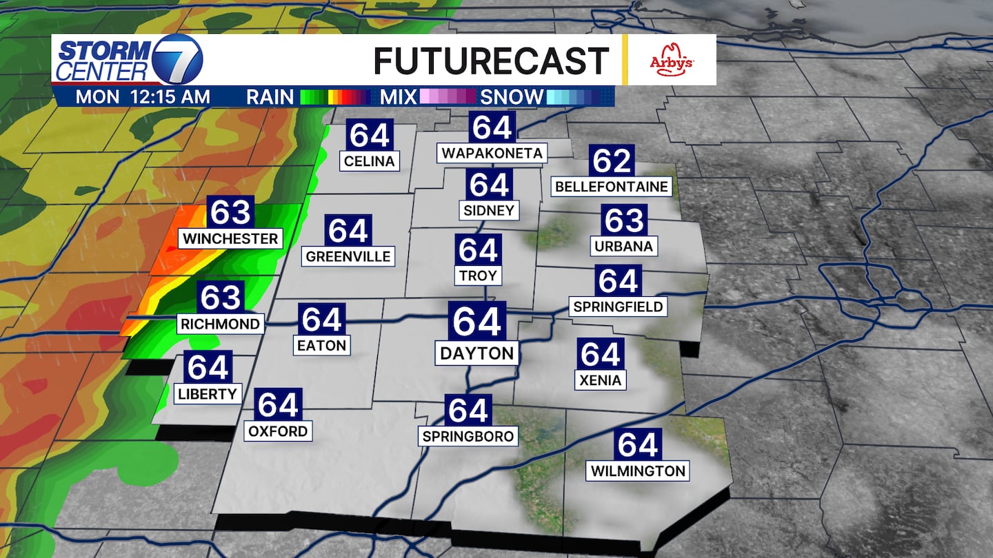
Futurecast has the line approaching the state line around Midnight. Instability will be limited, so we hope to avoid a more widespread severe weather event. A brief tornado is possible, but I emphasize that damaging winds are the biggest threat.
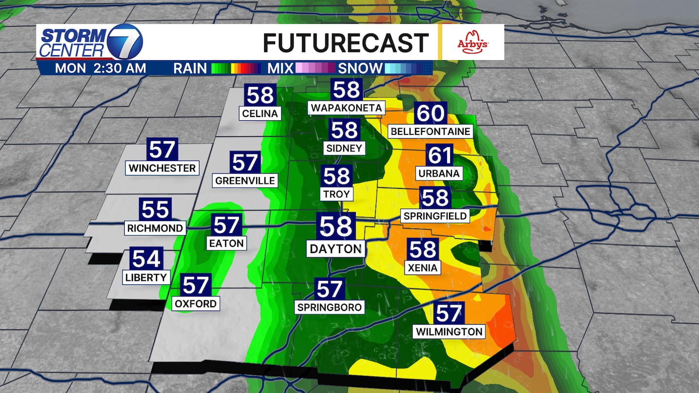
By 2-3AM the line is racing out of the Miami Valley and continues to weaken. Any severe threat will last about 20-30 minutes at any one given spot with how fast the line is moving.
[WATCH Storm Center 7 Weather on the following devices]
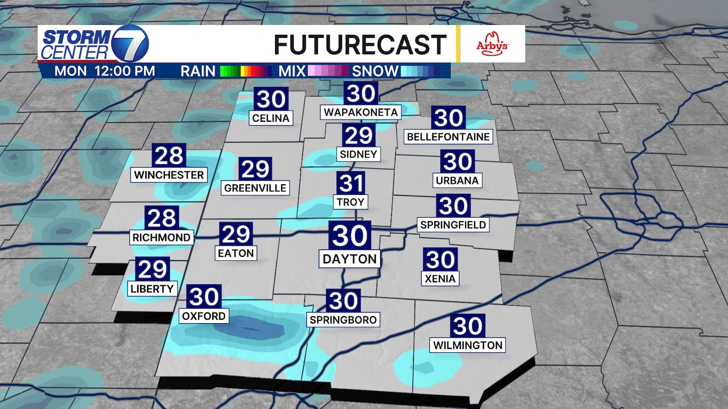
By midday Monday we have snow showers scattered around the Miami Valley with wind chills in the teens. Be sure to check in with us on air and online for the latest updates.
©2026 Cox Media Group


