A Flood Warning has been issued for the Little Miami River in Greene County until Wednesday at 11 p.m.
QUICK-LOOK FORECAST:
- Colder, but dry for Wednesday
- Wintry mix likely Thursday through Friday morning
- Quiet and chilly weekend

>>TRACK THE CONDITIONS: Live Doppler 7 Radar
DETAILED FORECAST:
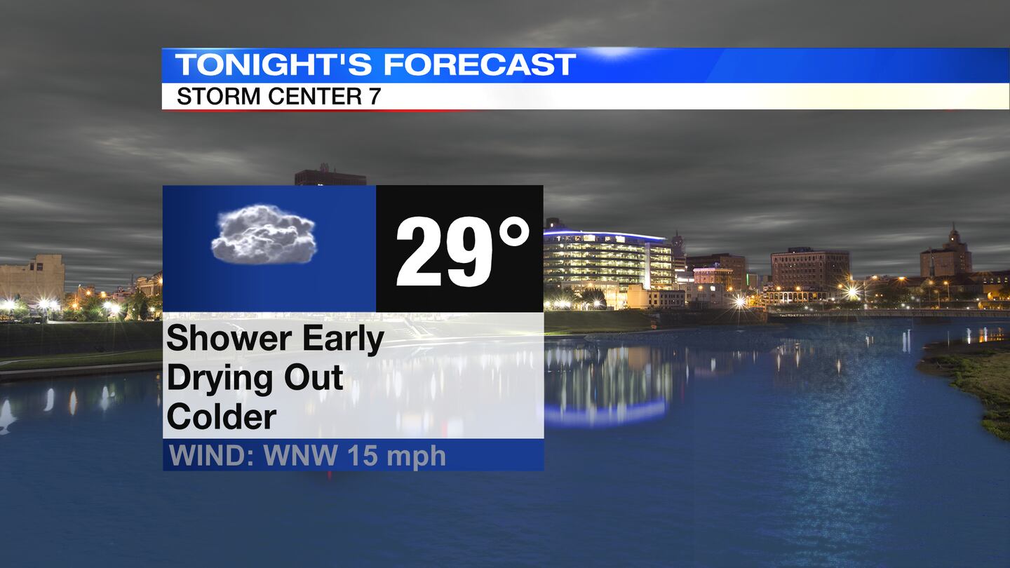
TODAY: Clouds linger through the evening with a few stray showers still possible then drying out overnight. Temperatures will fall, even with the cloud cover, to lows in the upper 20s as winds turn out of the north.
>> Dangers of driving through floodwaters
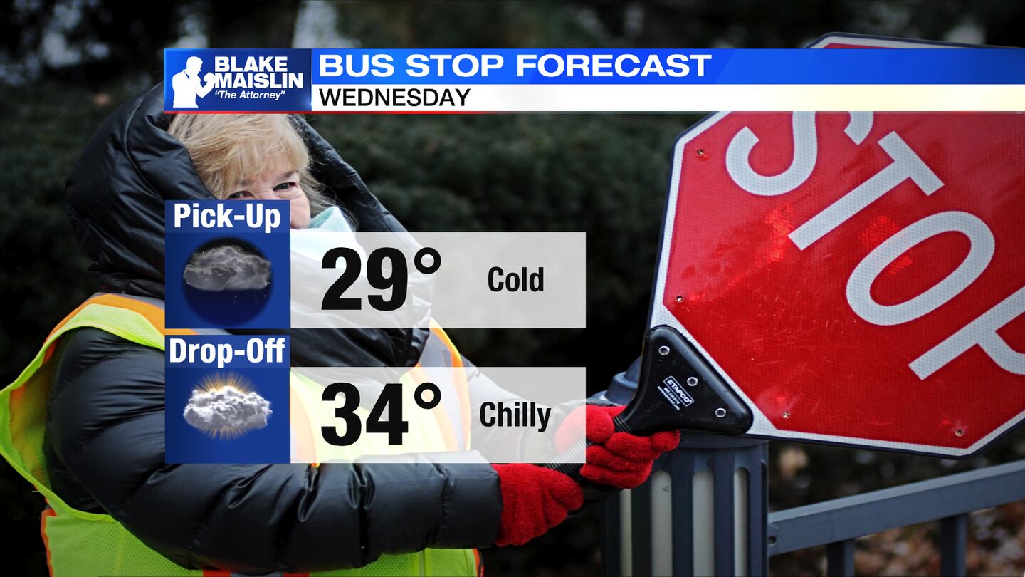
WEDNESDAY: Dry and chilly for Wednesday with partly sunny skies. The high temperature for the day likely occurs around midnight in the middle 40s. Temperatures will fall to around freezing by Wednesday morning, and will only rebound to the middle 30s for Wednesday afternoon. A light breeze during the day will make it feel more like the 20s outside.
Our next weather maker will arrive Wednesday night with a few snow showers or wintry mix showers by Thursday morning.
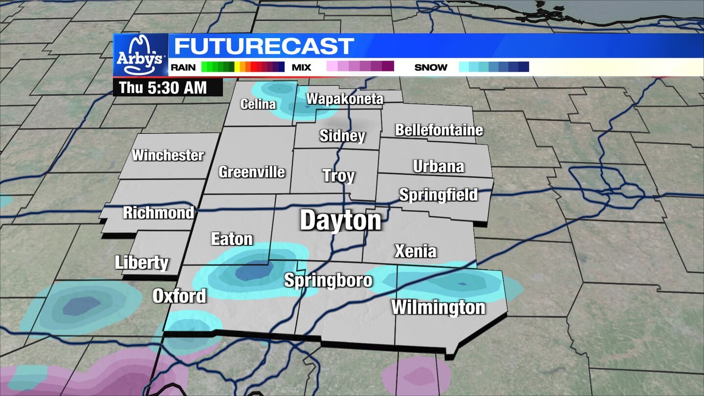
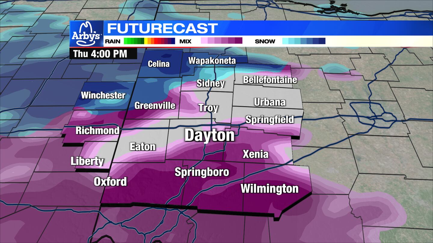
THURSDAY: More clouds and chilly for Thursday. Chance of a few passing snow showers, which could be mixed with sleet to start the day. A brief lull in the precipitation by midday then another round of more substantial precipitation arrives. This will likely be a mixed bag with snow, sleet, and freezing rain all possible. Accumulations should be lighter than with our previous winter storm, but travel impacts are still possible if not likely, especially overnight Thursday into Friday morning. Here’s an early estimate on accumulations.
>>Wintry weather could create dicey conditions late week: What we know now
>> Snow, sleet and freezing rain: What determines type of winter precipitation?
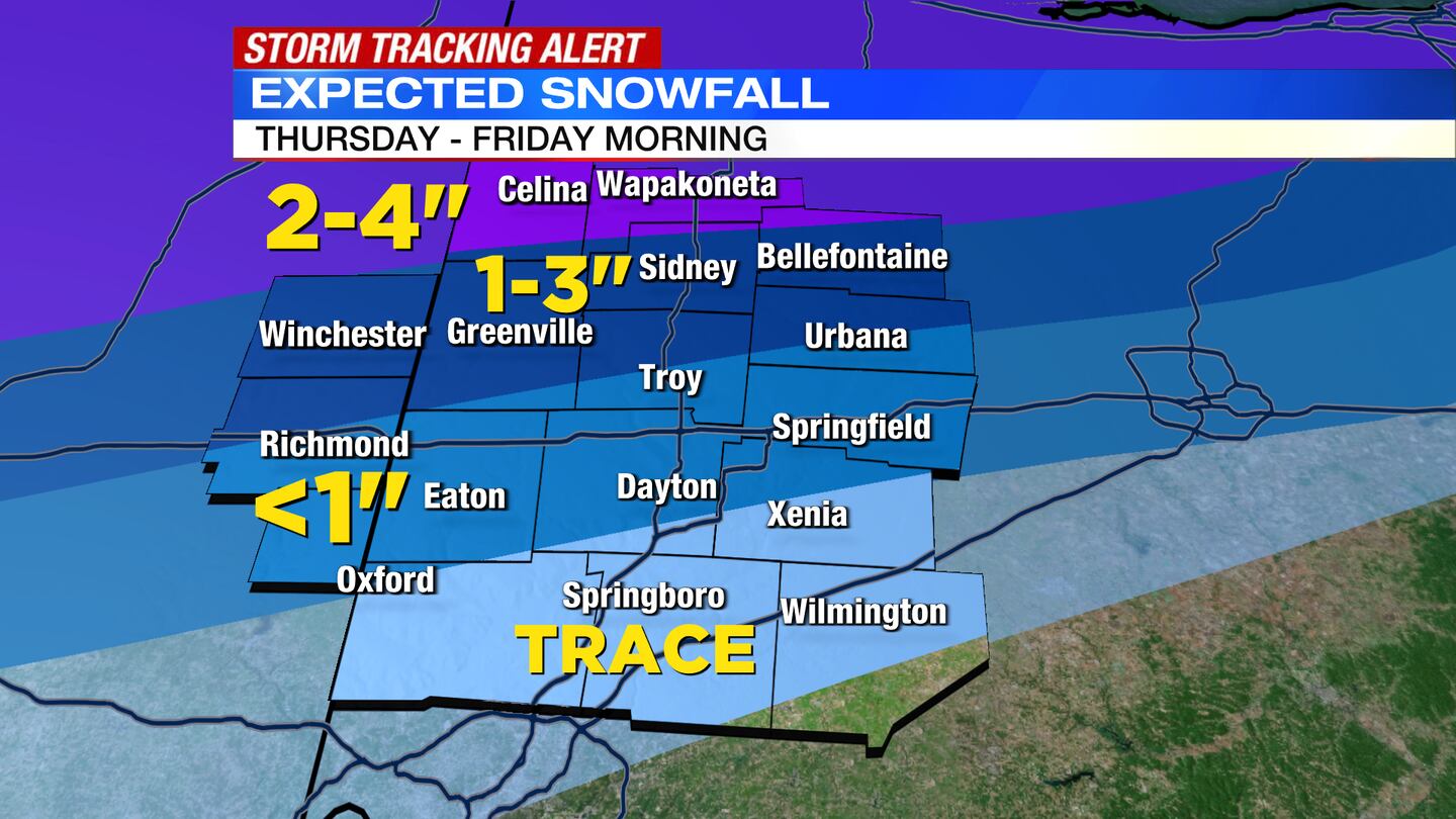
EXPECTED SNOWFALL THURSDAY THROUGH FRIDAY MORNING:
- Celina, to Wapakoneta: 2-3″, isolated 4″
- Winchester, to Greenville, to Piqua, to Bellefontaine: 1-3″ (Accumulations quickly drop off further south)
- Eaton, to Dayton, to Springfield: Less than 1″ (likely mixed with sleet)
- Far southern Miami Valley: Trace
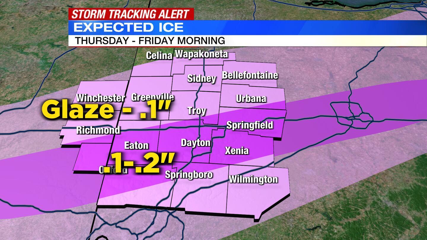
EXPECTED ICE ACCUMULATION THURSDAY THROUGH FRIDAY MORNING:
- Much of the Miami Valley could see a glaze to .1″
- There will likely be a zone of .1″ to .2″ with some higher totals. Exact placement could shift.
- For now, Oxford, to Dayton & Springboro, to Xenia: .1″ up to .25″
FRIDAY: Chance for a few snow showers Friday morning followed by drier conditions and some clearing by the afternoon. Cold with high temperatures in the upper 20s and lower 30s.
SATURDAY: Partly cloudy and still cold with highs in the middle 30s.
SUNDAY: Partly sunny with high temperatures in the middle to upper 30s.
MONDAY: Partly sunny and chilly. Highs in the upper 30s.
TUESAY: Mostly sunny and seasonable, but windy. Highs in the lower 40s.
©2022 Cox Media Group


