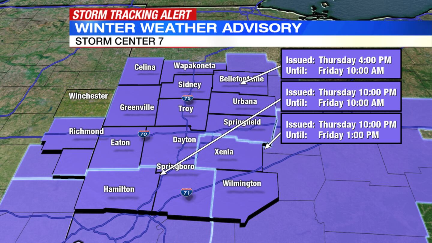
A Winter Weather Advisory is in effect through 10 a.m. Friday for Auglaize, Butler, Champaign, Clark, Darke, Logan, Mercer, Miami, Montgomery, Preble, Shelby, Warren and Wayne, Indiana, counties; and until 1 p.m. Friday for Greene and Clinton counties.
>> WHAT TO EXPECT: Timing and expected road conditions from Thursday night’s snow
QUICK-LOOK FORECAST
- Another round of snow to affect Friday morning commute
- Slick travel for Friday
- Chance of light snow showers Saturday
>> TRACK THE CONDITIONS | Live Doppler 7 Radar
>> CLICK HERE FOR THE LATEST CLOSINGS AND DELAYS <<
DETAILED FORECAST
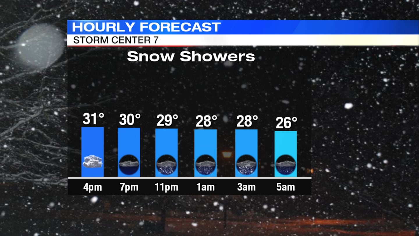
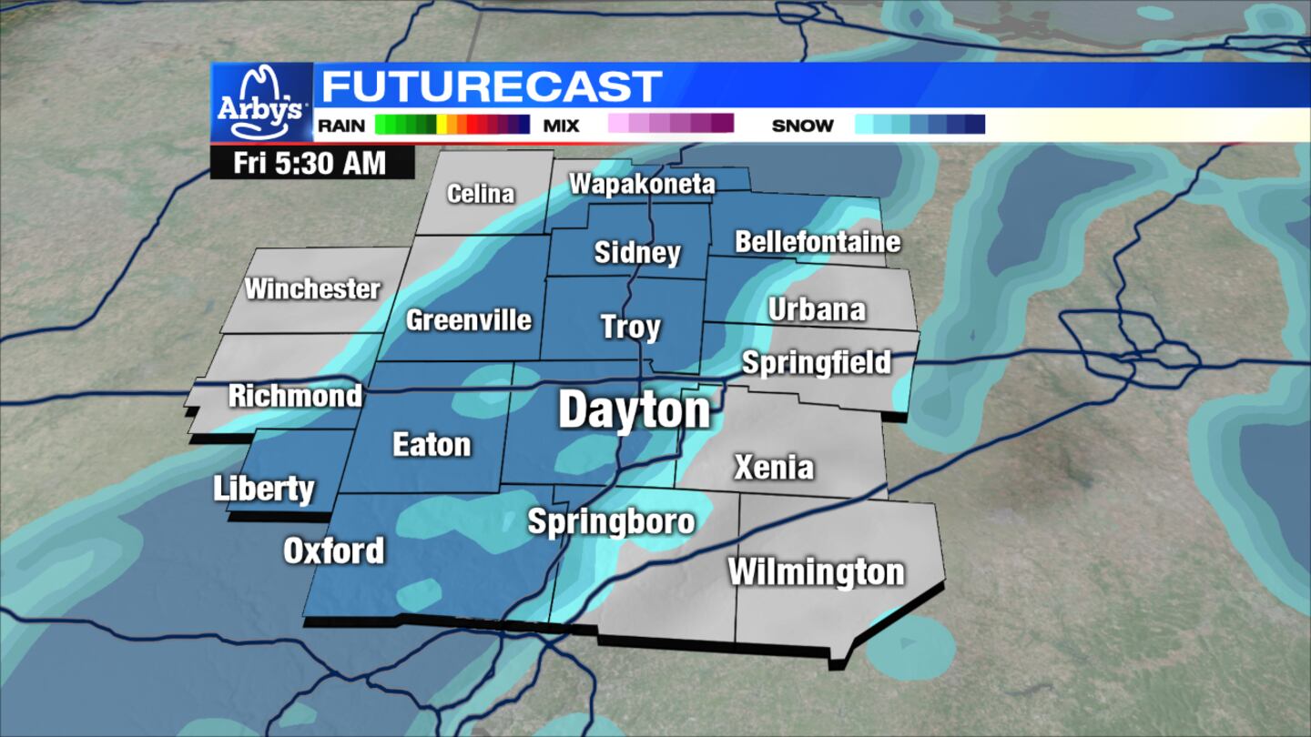
Overnight: Another round of snow will arrive after midnight and into the Friday morning commute, Storm Center 7 Meteorologist Jesse Maag said. This could make for poor travel conditions. With temperatures dropping into the middle 20s, icy patches are likely for untreated roads. Winds slightly increase from 10 to 15 mph.
>> Winter weather: Tips for driving on snow and ice
>> Different types of winter precipitation
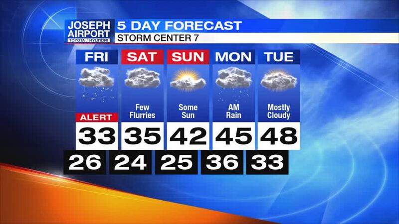
Friday: Scattered snow showers continue through the morning and into the midday hours. After the snow ends, clouds will remain with some more flurries possible into the afternoon. It will be cold with highs for the day only reaching the low 30s.
Saturday: It will be another chilly and cloudy day. Highs will be in the low to mid-30s with another chance at a few light snow showers.
>> What is a winter weather advisory?
Sunday: Expect a mix of sun and clouds with highs in the low 40s. Conditions will be dry during the day, but at night some rain showers will arrive.
Monday: Showers arrive early, mainly in the southern Miami Valley, though it will be dry most of the day. Highs will be in the middle 40s.