DAYTON — Good Saturday evening, everyone! Meteorologist Nick Dunn here checking in! I hope you have enjoyed the milder temperatures today because big changes are just over the horizon. Whether you are a fan or not, we have rain, snow, and the coldest air of the season all ahead over the next 24-48 hours.

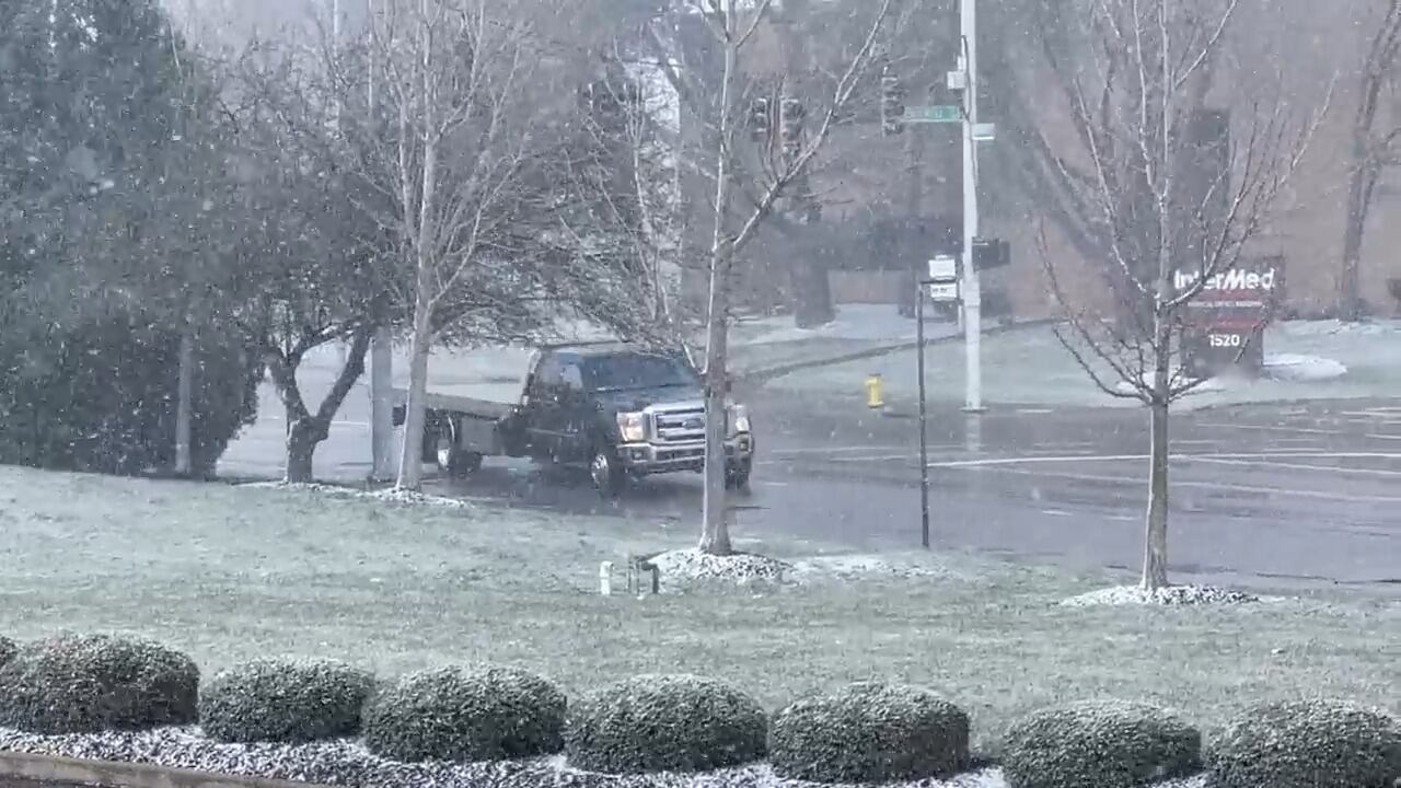
For tonight you will find clouds increasing and rain arriving overnight. The rain may start light, but steadier showers and perhaps a thunderstorm arrive before sunrise on Sunday morning.
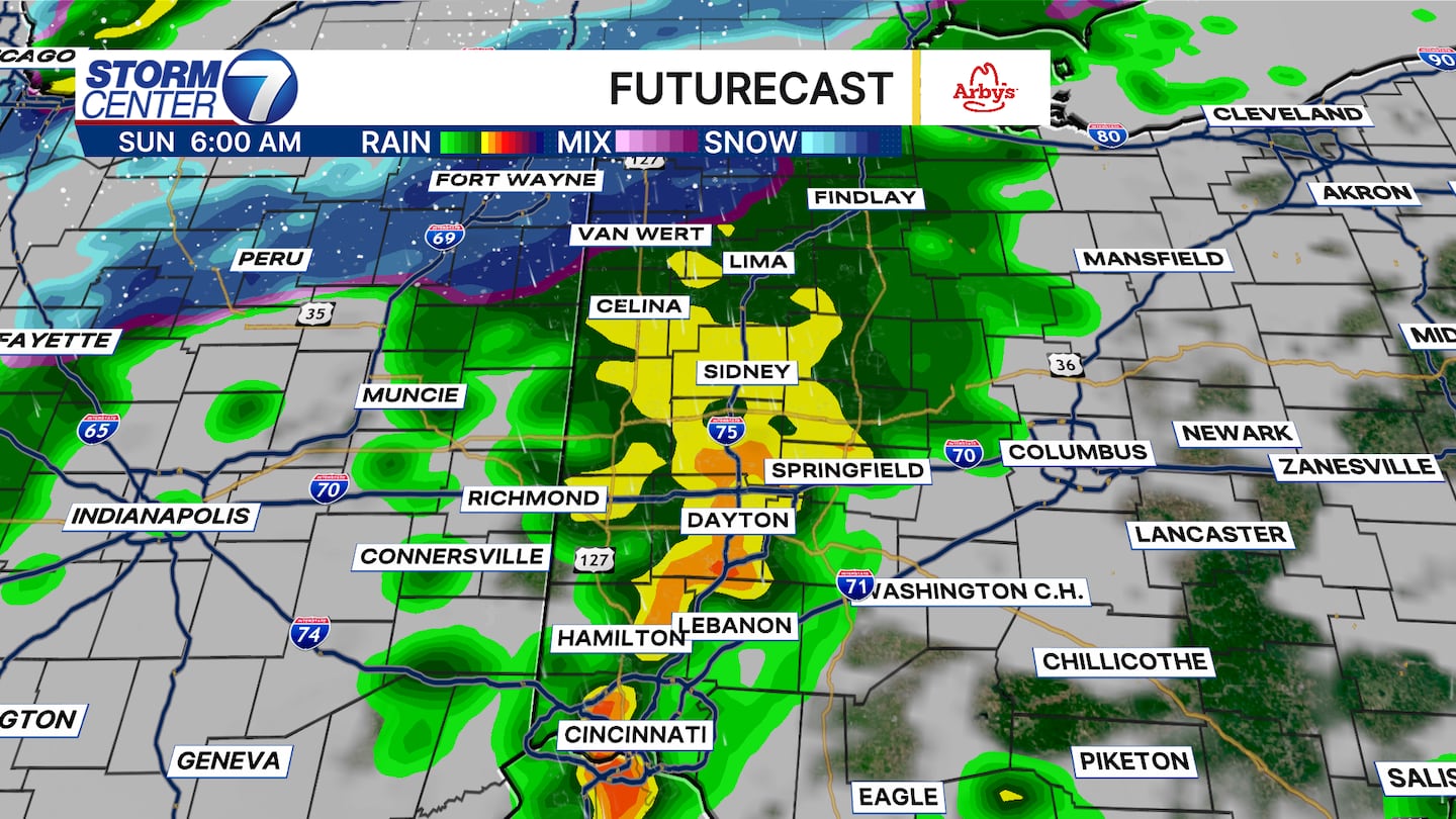
Futurecast paints a very interesting picture! We will have a cold rain here, and yes, thunderstorms can occur in the 40s. However, if we drive 2 hours north you see we change over to snow showers! That shows you the dynamics of the system and what a 50 mile shift south would mean for us.
[DOWNLOAD: Free Storm Center 7 Weather app for alerts as news breaks]
We will catch a break from the heavier precipitation in the afternoon, but few rain and snow showers may fall as moisture lingers behind the first system. Temperatures will fall into the 30s by the afternoon and evening. Eventually, a secondary piece of energy will slide through the Great Lakes to help spark snow showers overnight into Monday morning.

Futurecast shows a good coverage of light to moderate snow showers for Monday morning. Add in the wind, and the feels like temperatures will be between about 15 and 20 degrees! Road impacts look minimal at this time, however, if a heavier burst of snow lasts long enough in a given area you may find an isolated slick spot on a bridge or overpass. Warm ground temperatures should help to keep things in check overall, but it is better to mention an isolated slick spot than say “all will be fine” just in case!
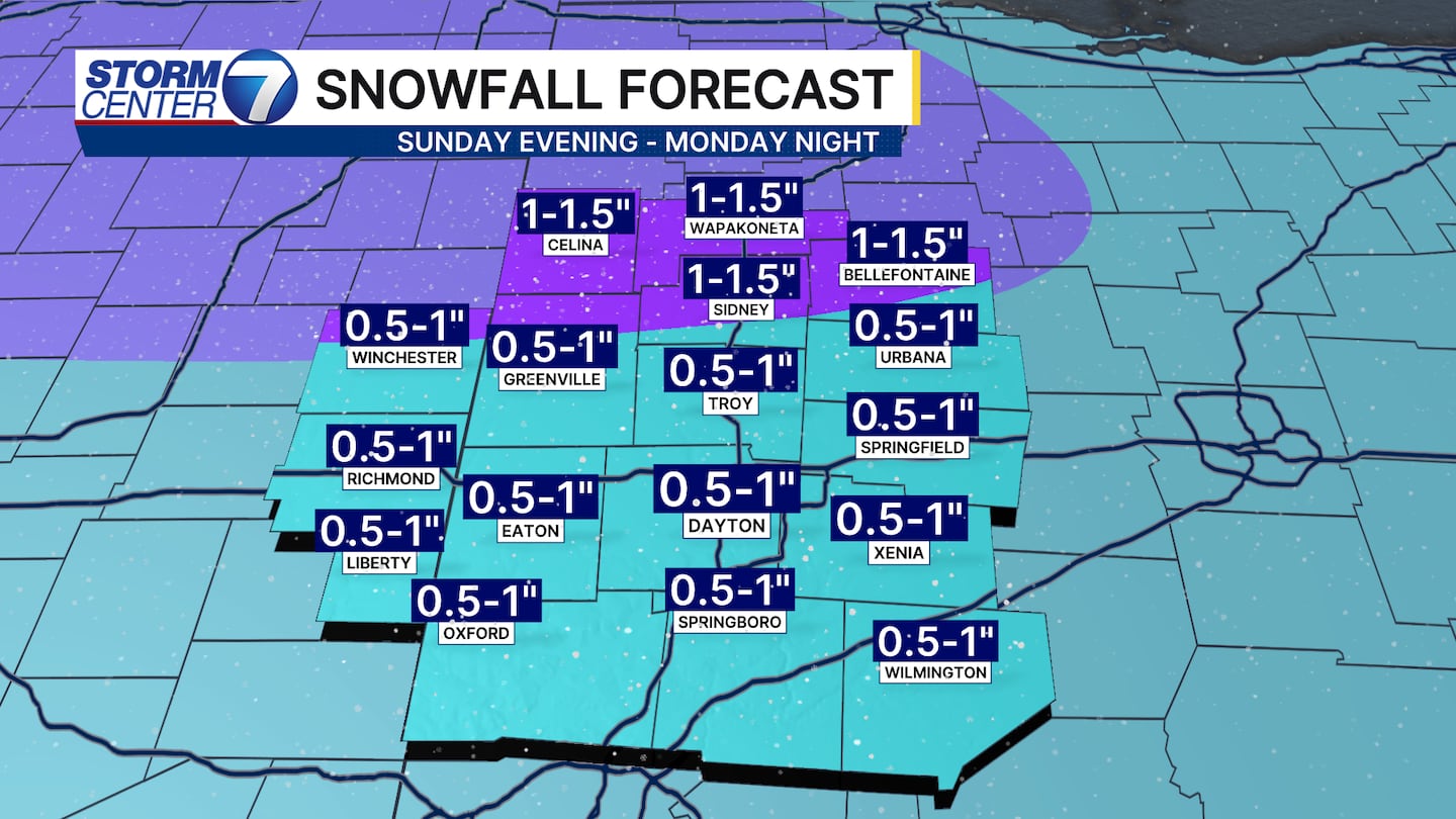
Snow will come to an end by Monday night. So, how much are we expecting? Certainly not a major event, but 0.5-1.5″ is what we can expect across the Miami Valley. To the north where the changeover happens first combined with some lake enhancement, they have the best chance of seeing 1″+ of snow.
[WATCH Storm Center 7 Weather on the following devices]
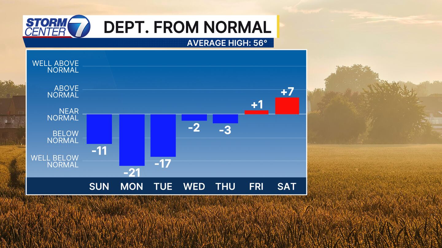
It stays cold through Tuesday before things change again and temperatures moderate! By next weekend, we look to be back above normal. So, we have a little something for everyone in the days ahead. Buckle up! Be sure to check in with us on air and online for more updates and keep the WHIO App handy!


