QUICK-LOOK FORECAST
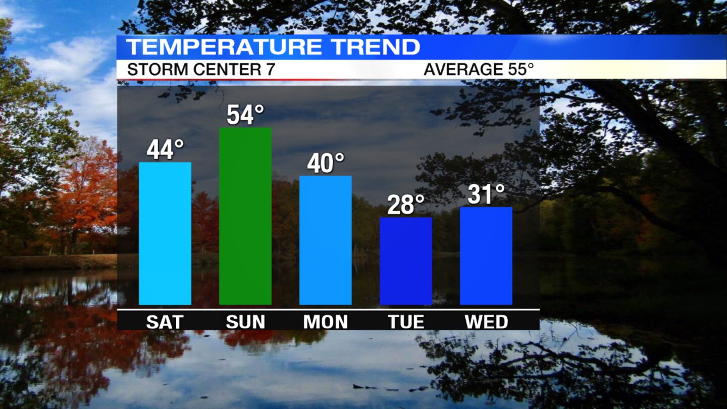
- Brief "warm" up this weekend
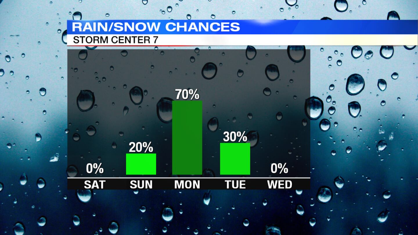
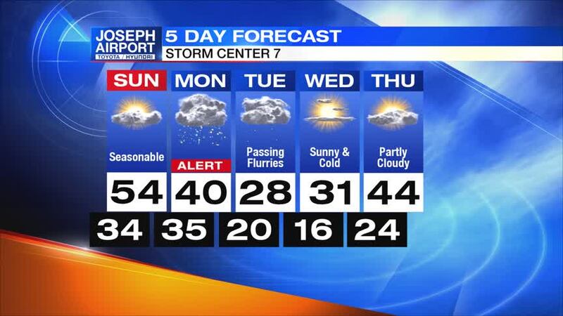
- Snow accumulations possible Monday
- Coldest air of the season (record-breaking) next Tuesday/Wednesday
>> Touchdown 7 Football Forecast: Playoffs Week 1
DETAILED FORECAST
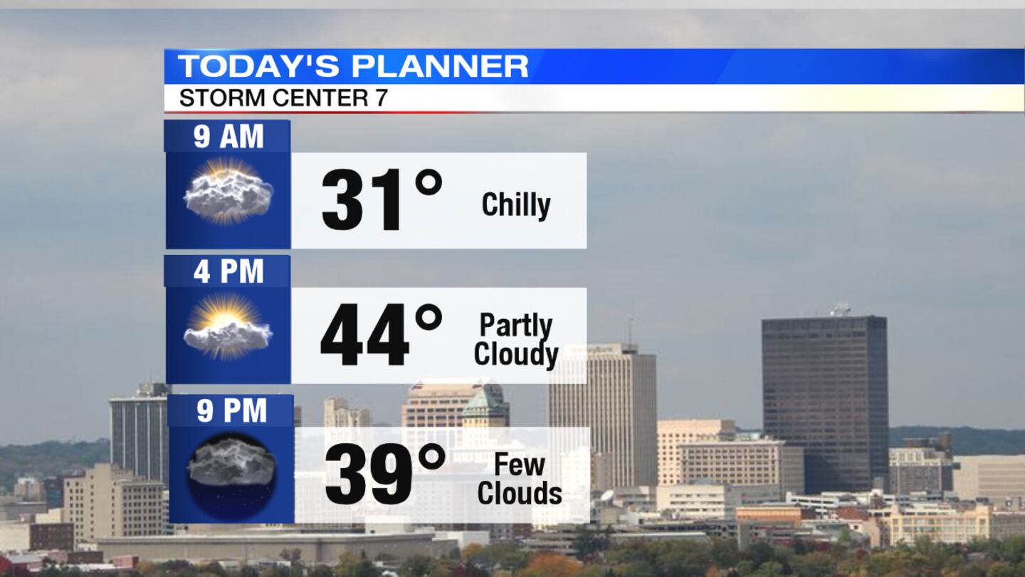
Tonight: Expect partly to mostly cloudy skies across the area tonight, according to News Center 7 Molly Coates. Overnight lows will be in the 30s.
>> Wind chills explained: How they are calculated and tips to stay safe
Sunday: This will be one of the last "warmer" days. Highs will reach back into the middle 50s, which is normal for this time of year. We will see more clouds through the day, with the chance for showers moving in around midnight.
>> TRACK THE CONDITIONS: Live Doppler 7 Radar
Monday: Another cold weather system will bring with it more snow. Highs will reach the low 40s during the morning but fall through the day, so it looks like some rain showers for the morning commute, then a transition to snow showers.
The timing now puts the chance for snow in the mid- to late afternoon through the evening hours. A light accumulation looks possible now. Temperatures will fall quickly at night into the 20s.
>> Cold Weather Awareness: What to have in your emergency car kit
Tuesday: It will be a cold morning around 20 with some spots in the teens. Scattered clouds and flurries will be possible. We will have to watch for slick spots or ice on the roadways, could make for a messy morning commute.
It will be a breezy and cold day, only reaching the upper 20s for the afternoon. The record for the coldest high temperature that day is 30, so we could break that record.
Wednesday: It will be a quieter day with sunshine, but will still stay cold with temperatures in the lower 30s. This could also break records for the coldest high temperature on this date (13 degrees was the record low set in 1986).
Thursday: It will be partly cloudy with slightly warmer temperatures. Highs will be in the low 40s.


