
DAYTON — Here’s what we know.
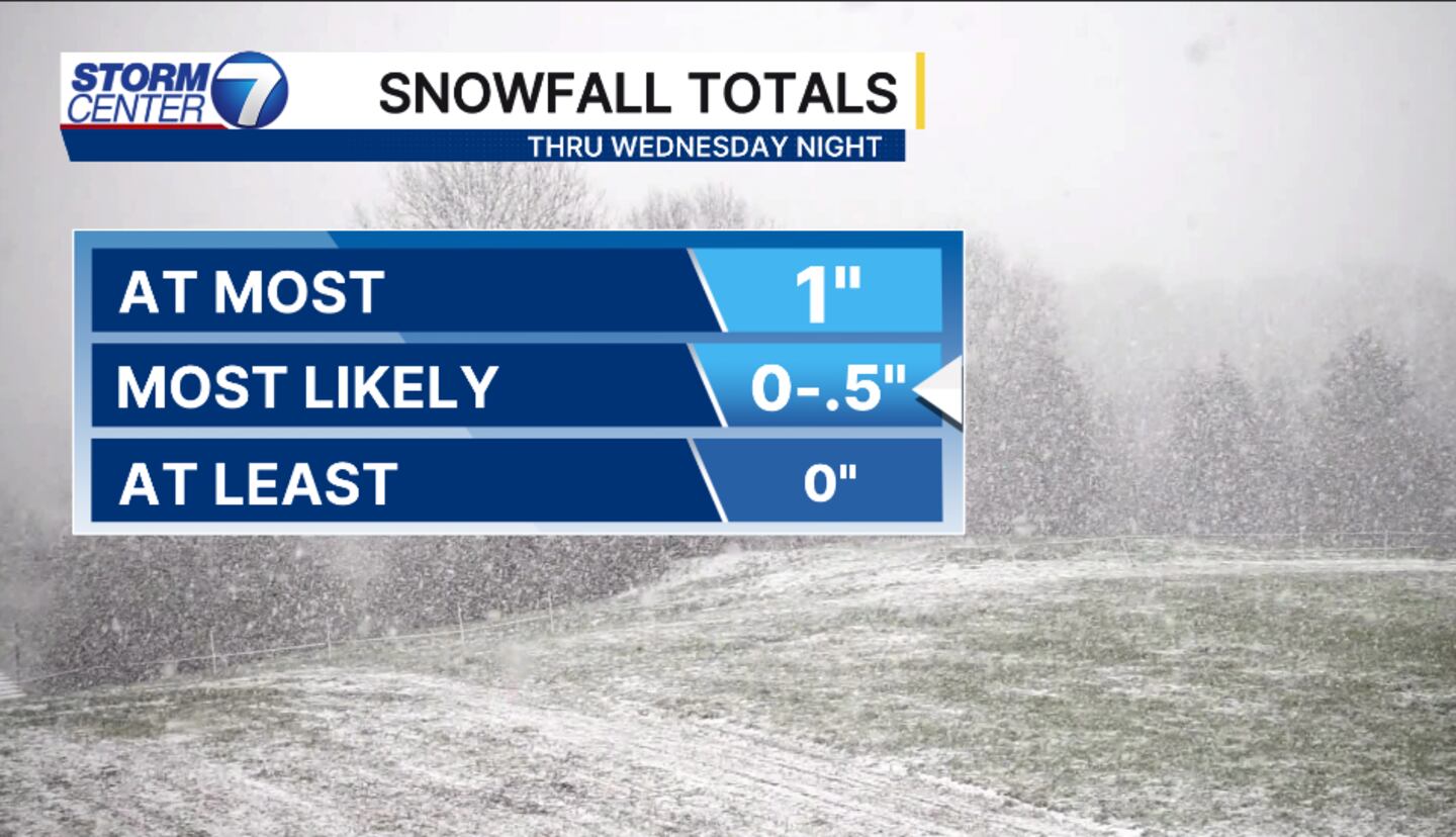
An area of low pressure has set up over the Great Lakes. The greatest snow chances will reside to our north, but we do have the possibility of light snow late day and into Wednesday evening. Snowfall totals look to stay around a half inch. At most an inch of snow is forecast, but the likelihood is low.
[DOWNLOAD: Free Storm Center 7 Weather app for alerts as news breaks]
Snow chances linger throughout the week and into the weekend with a second cold front. However, we are too far out to give totals just yet on the second system. What we can say, there will be slick spots each morning now through the beginning of next week.
[WATCH Storm Center 7 Weather on the following devices]
A second good chance for snow will arrive late Thursday into the early morning hours Friday. Accumulations look to be likely, especially north of I70. The next opportunity looks to be Saturday and again Sunday, but there is uncertainty on the track of the low.
©2026 Cox Media Group


