DAYTON, OH — Get ready for a snow day across the Miami Valley! Widespread snow moves in around lunchtime today. In addition to the snow, extreme cold is looking more likely tonight.
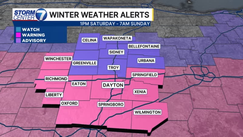
A Winter Storm Warning has been issued for Butler, Clark, Clinton, Greene, Montgomery, Preble, and Warren counties, starting at 1 p.m. on Saturday until 7 a.m. on Sunday. Randolph and Wayne counties in Indiana are included in this warning.
A Winter Weather Advisory has been issued for Auglaize, Champaign, Darke, Logan, Mercer, Miami, and Shelby counties, starting at 1 p.m. on Saturday until 7 a.m. on Sunday.
A Cold Weather Advisory has been issued for the entire region starting at 7 p.m. on Saturday until 11 a.m. on Monday.
TIMING: Snow flurries and light snow showers are possible tonight into Saturday morning. The main event with the steady and heavy snow comes in around lunchtime on Saturday. Snow will taper off between 9PM and midnight.
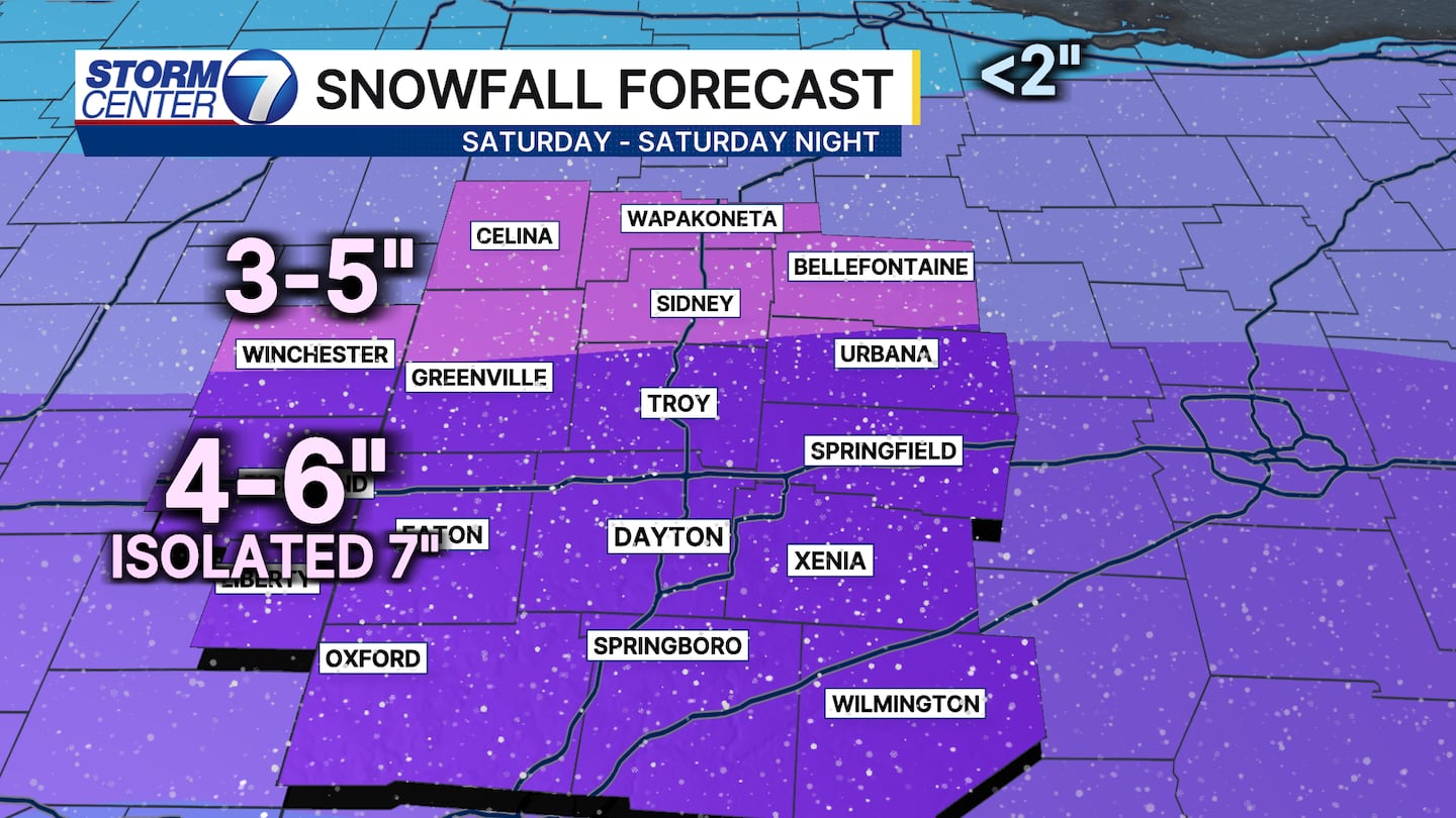
ACCUMULATION: Along and south of US-36, 3-6 inches of snow is likely. An isolated total above 6″ can’t be ruled out. North of US-36, we’re expecting 2-5 inches.
[DOWNLOAD: Free Storm Center 7 Weather app for alerts as news breaks]
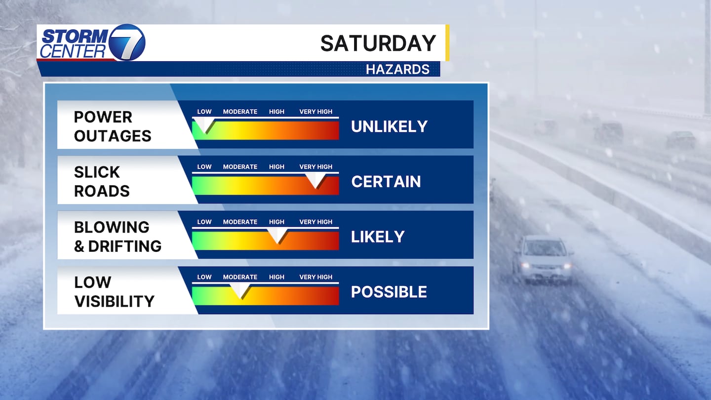
IMPACTS: Roads will quickly become snow-covered on Saturday. With temperatures falling to near zero overnight Saturday into Sunday morning, salt will become ineffective. I expect travel issues to persist through Sunday, if not Monday morning.
[WATCH Storm Center 7 Weather on the following devices]
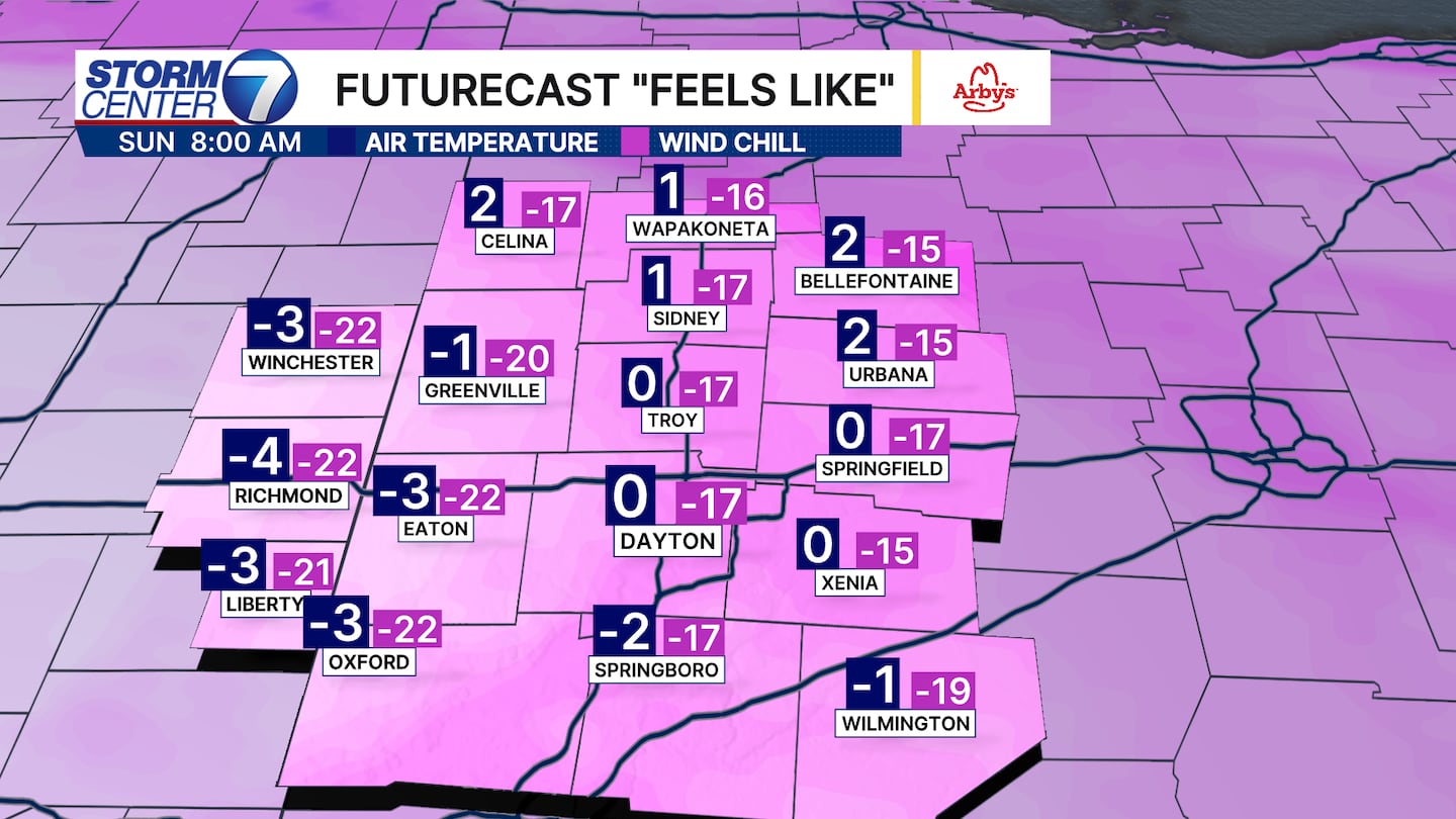
The cold will be a serious problem for us. Snowpack and a clearing sky will combine to produce a bitterly cold night. Low temperatures will fall to near zero Sunday morning.
It stays windy, which will push the wind chills as low as -15. Avoid time outside if you can on Sunday morning. We’ll only rebound to the low teens for high temperatures on Sunday afternoon.