MIAMI VALLEY — This winter season has been the void of much wintry weather, up until now that is.
>>TRACK THE CONDITIONS: Live Doppler 7 Radar
A strong storm system has its sights set on the Miami Valley and could be the biggest storm to hit the region this year. From snow to sleet to freezing rain, this storm will have major impacts on Miami Valley residents.
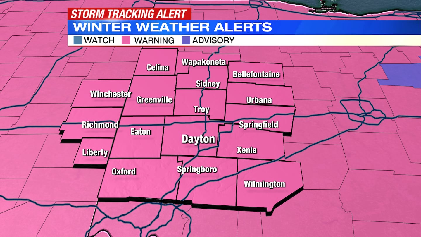
A Winter Storm Warning is now in effect for Auglaize, Champaign, Clark, Darke, Greene, Logan, Mercer, Miami, Montgomery, Preble, Shelby and Wayne and Union counties in Indiana until 7 a.m. Friday.
A Winter Storm Warning goes into effect for Butler, Clinton and Warren counties at 12 a.m Thursday and lasts until 7 a.m. Friday.
WHAT WE KNOW:
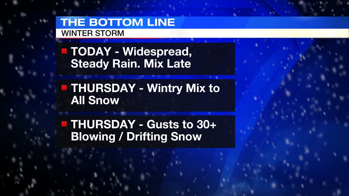
- Steady, widespread rain will move into the Miami Valley Wednesday, some minor flooding is possible
- Rain is beginning to switch to sleet in the northwestern portion of the Miami Valley.
- A switch to freezing rain, sleet, and snow is expected by Thursday morning across the Miami Valley. Areas northwest likely to see snow while the rest of the Miami Valley will be dealing with ice
- All precipitation will switch to snow Thursday into Thursday night.
- Winds gusting up to 40 miles per hour are possible on Thursday. This will cause blowing and drifting snow. Perhaps blizzard like conditions.
- Temperatures will drop quickly into Friday morning
>>AES Ohio preparing for winter storm, offering tips if outages occur
THINGS TO CONSIDER:
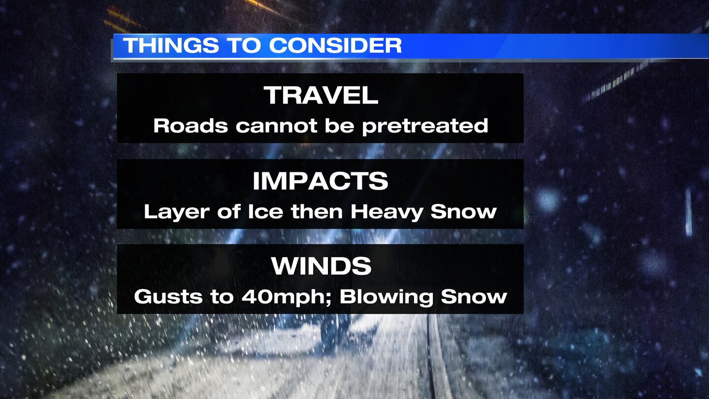
- Rain on Wednesday will keep road crews from being able to pretreat roads ahead of the storm
- Heavy wet snow on Thursday will limit the amount of fluffy snow, but snow totals may still be high
- Ice accumulations may be high enough to create power outages and travel hazards
- Gusty winds may also contribute to power outages and travel hazards
>> ODOT says anticipated rain will impact road preparations ahead of midweek storm
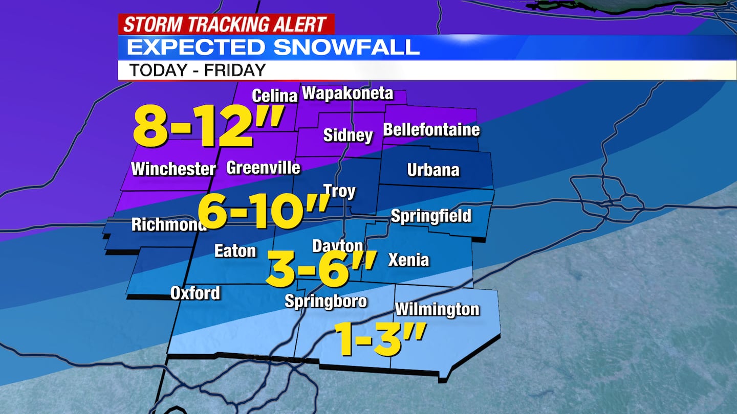
PRELIMINARY SNOW AND ICE TOTALS:
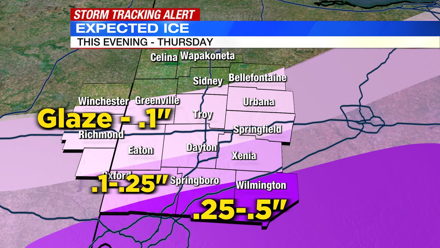
Expected Ice accumulations:
- Areas north of a line from Greenville to Bellefontaine may see a glaze of ice to a tenth of an inch of ice
- From Xenia, to south of Dayton, to Hamilton, a tenth of an inch of ice to .25 inch
- Wilmington to Lebanon and points south: .25 inch to .5 inch of ice
Expected Snow totals:
- Richmond to Bellefontaine and north: 8-12 inches with some localized higher totals
- Eaton to Springfield: 6-10 inches
- Hamilton to south of Xenia: 3-6 inches
- Springboro to Wilmington: 1-3 inches
©2022 Cox Media Group


