QUICK-LOOK FORECAST:
- Flurries possible early Wednesday
- Passing showers Thursday
- A chance for snow Friday evening and Friday night
>> TRACK THE LATEST CONDITIONS: Live Doppler 7 Radar
DETAILED FORECAST:
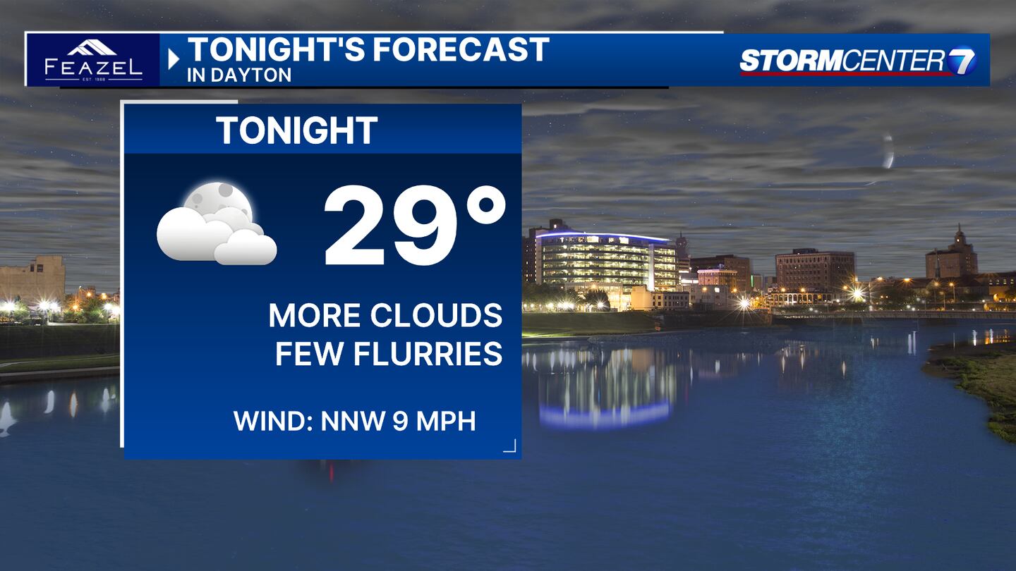
TUESDAY: Clouds increase tonight, according to Storm Center 7 Chief Meteorologist Austin Chaney. By early Wednesday morning, a few flurries or passing light snow showers are possible. Little to no accumulation is expected. Overnight lows in the upper 20s.
WEDNESDAY (VALENTINE’S DAY): Mostly cloudy early with a few flurries or light snow showers possible to begin the day. Little to no snow accumulation expected. Gradually clearing into the afternoon. Highs in the mid-40s.

THURSDAY: Partly to mostly cloudy with a few rain showers passing through during the afternoon. Not a washout. Thursday will be the warmest day of the week with a high of 50 degrees.
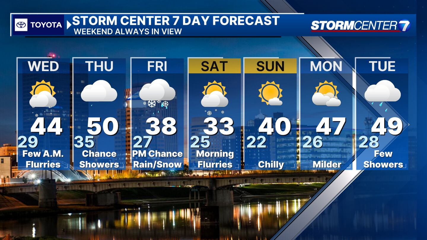
FRIDAY: Cloud will be increasing with a chance for rain or snow arriving late in the day. Highs in the upper 30s. Precipitation may change to all snow before ending Friday night. We’re still a few days out, and considerable differences still exist in the potential storm track, so the chance for snow is written in pencil as of now.
SATURDAY: Flurries are possible on Saturday morning. Gradually becoming sunny. Cold with highs only in the lower 30s.
SUNDAY: Mostly sunny and chilly with highs in the upper 30s to near 40.
MONDAY: Partly cloudy. Warming it up with highs in the mid-40s.
TUESDAY: Mostly cloudy with a few rain showers around. Highs in the upper 40s.
©2024 Cox Media Group