QUICK-LOOK FORECAST:
- Generally cloudy, breaking up a bit on Wednesday
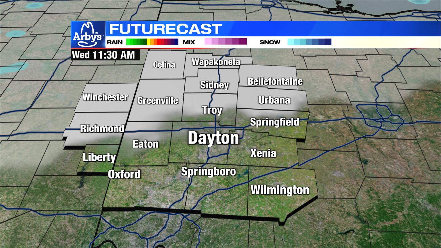
- Passing flurry p.m. Wednesday
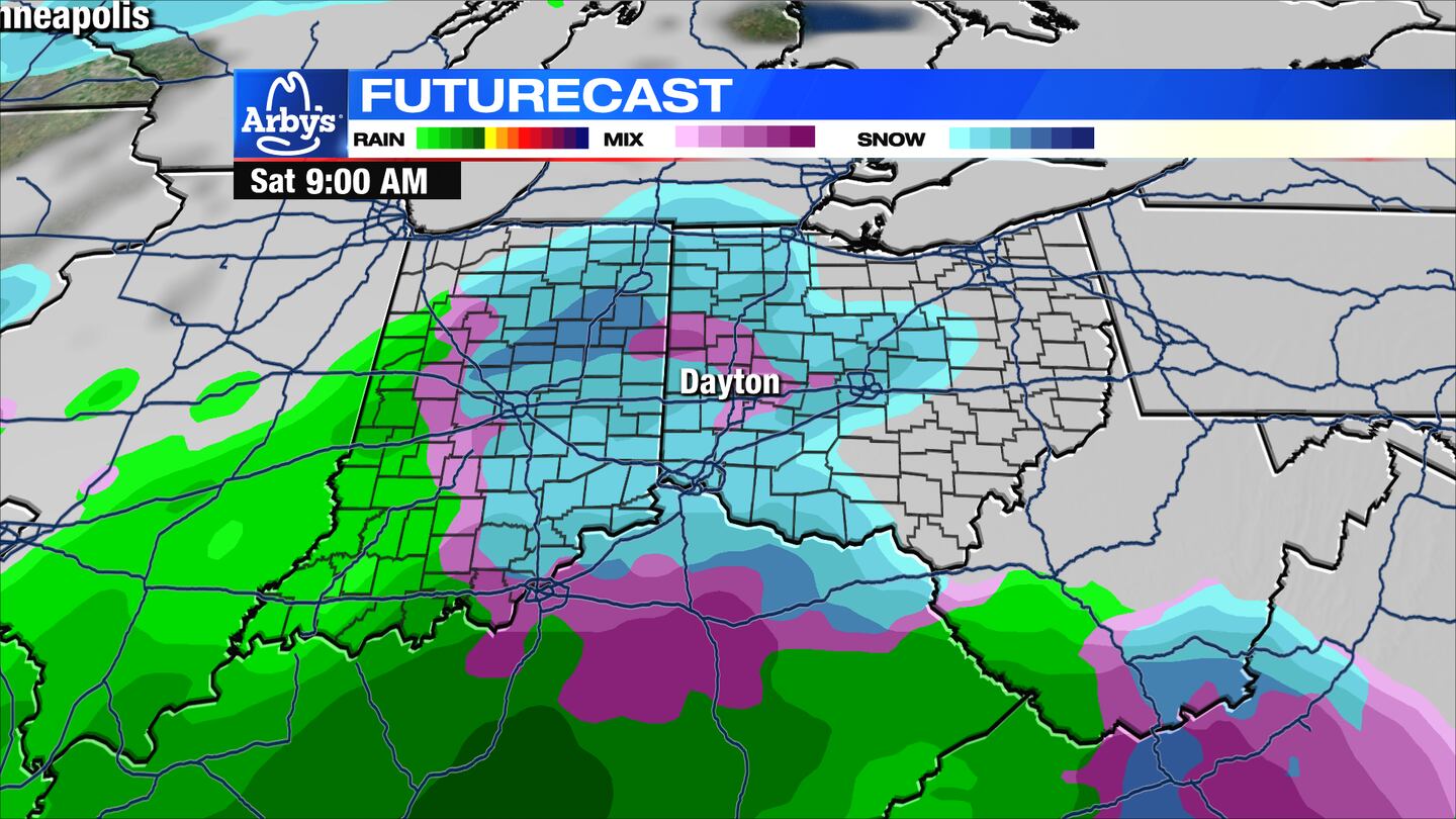
- Monitoring rain or snow potential this weekend
>> TRACK THE LATEST CONDITIONS: Live Doppler 7 Radar
DETAILED FORECAST:
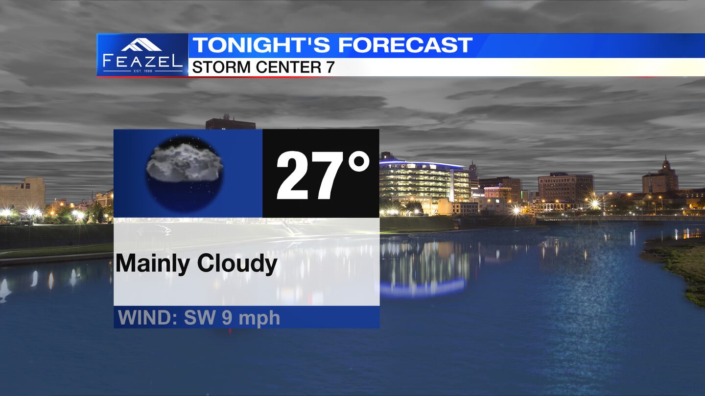
TUESDAY: Mainly cloudy and cold with lows in the upper 20s, according to Storm Center 7 Meteorologist Robert Gauthreaux.
WEDNESDAY: Mix of clouds and sunshine. Passing p.m. flurry possible. Highs in the lower 40s.
THURSDAY: Mix of sun and clouds. Turning colder with high temps in the middle 30s
FRIDAY: Increasing clouds and seasonable with highs near 40.
SATURDAY: Several days away, but a good chance at this time we will see rain and some snow. Intensity and precipitation type are still questionable. Better chance of snow if the system comes later on Saturday. Temperatures are more or less seasonable.
SUNDAY: Low confidence here, but a few lingering snow showers are possible early depending on how Saturday shakes out. For now, will call it cloudy with highs in the upper 30s.
MONDAY: Mostly cloudy and seasonably mild with highs in the lower 40s.
TUESDAY: Chance of showers and milder with highs in the upper 40s.
©2024 Cox Media Group